Showing posts with label coke ovens. Show all posts

Thursday, October 12, 2017

Pennsville and Moyer

 Welcome back, folks. 

   The basic purpose of this article is to take a step back and cover, once again,  a region of smaller, simpler places. These are to be found under the heading of Hamlets. While these type of posts may not be as prominent in importance or of quite as serious an interest for the majority of visitors, they are picturesque and nostalgic while offering a clear path into the average community in times past as well as our modern age. Such realms exist as the true heart of a bygone American culture and its special traditions. These villages took on a very insular yet meaningful existence worth learning about and remembering. Those that often spent most of their precious lives growing up, getting married and raising their children in a rather special, cloaked, rural environment are sometimes here recalled to memory.

   Although it may be only a minor issue, I had planned to include more research material, but needed to get the new Fayete/Westmoreland Forgotten History post uploaded. In other words,"it is what it is."  It is to be hoped the subject will still be of some enjoyment helping lead to an educational experience. Thanks for your understanding and continued support!


PENNSVILLE

      Pennsville, the oldest village of Bullskin Township going back toward the late 1700's,  is situated on the Mount Pleasant Road, sometimes called 'old 119.' There were lots sold off years ago from the Cochran and Strickler farms and it is still a small village of a few dozen or so houses and a handful of stores near Crossroads. Like many an old mining community, there was once a post office kept by David Shallenberger, while it had its a general store or two and the odd tavern and an inn kept by Adam Frazer, which served as the office of the bustling stagecoaches.

     In the earliest days the first store was run by John Strickler, in what was called the "present Miller stand." Other merchants included: the Overholt's, Bougher's, Newcomer's, Rice Boyd and John Campbell. 

Old Pennsville
                                                      

      According to most information which is admittedly somewhat limited, the Pennsville Mine was located near the exit of Rt. 119 in Pennsville and west of Everson. As far as can be discovered, and as would be expected, the coke ovens were near the railroad and some were none too distant from Sherrick Rd. Photos are scarce, (particularly at this time of year for any coke oven remnants). According to G. D. Albert, in 1881, along with other properties, the Tintsman's bought the Pennsville Coke-Works and owned them for some time. In 1890, the mines were run  by J. D. Sherrick with J. F. Dillinger, who was one of its superintendents. Near the turn of the last century, the Pennsville Coke Company had nearly 100 beehive coke ovens. In the late 1800's and early 20th Century, all through this strip of land existed many groups of mines and coke ovens accessed by the railroads.


      On the map above are added highlights giving a basic representation of the loss and changing of a few Pennsville road ways from the 1800's. This is especially the case from the creation of Route 119 which is shown in yellow: The road between Valley View Drive and the Mount East Road which has not existed for some time is referenced in more detail with extra information on a link below.


Possible mine locality near Rt. 119.


Everson Rt. 118 overpass in Pennsville.


Pennsville looking to the west.

                                                                
     The houses of reverent worship included Pennsville United Methodist Church, from 1895, once the "Little church on the hill." It was remodeled somewhat with better brickwork in the mid-1940's and again later with white siding. Further toward east on the border with Upper Tyrone was the Pennsville Mennonite Church. Ground was broken for a log meetinghouse ministered to by Abraham Stauffer with a burial ground in the mid-1790's while there was also a schoolhouse. By 1903, a later brick church was removed and all that was left to examine for posterity is the Alte Menist cemetery. I referred to the site some time ago on a post researching the Lost Cemetery on the Braddock Road.

    Finally, last but not least, is the Pennsville Baptist Church across the Richey Road from the Methodist going back to the forgotten era of the very early 1800's. The name then was the 'White Meeting House'. More on that further on. It is said there are over 700 people who attend the church in modern times.

       
In the Pennsville Mine region.
                           
                                                           
The coke ovens to the west of the railroad became few in number.

                                                                   
Looking south on the Mount Pleasant Road
                                                                         
This stretch of Richey Road approached a once populated locality of the village.

                                                                  
The modern 'end' of Richey Road.

     Interesting Footnote to Pennsville 

     All the information I've gathered concerns the claim that Bushrod Washington had purchased land said to of once belonged to one 'George Washington'. Or, so his name was attached to a property by tradition, in Pennsville, within the confines of Bullskin Township, Fayette County, Pa.

    Early on, plots originated from land sold off from the Cochrane and fairly extensive Strickler farms. If, indeed,  he actually lived there and for how long, is debatable, even doubtful, for all that. Nevertheless, a snippet of "Fayette County Survey of Boroughs and Unincorporated Townships" stated that this nephew of George Washington put up a house near the Disciple's Meeting House in Pennsville, near the later Baptist Church  in 1848 as did Henry Shallenbarger; although the details appear unlikely, unless we are dealing with a relative or a murky recollection.

   Bushrod was noted to of passed on by 1828. The idea may be an interesting one, yet hasn't been researched extensively as far as I am aware. On one hand, while it is true that Supreme Court Associate Justice, Bushrod Washington, the inheritor of the famed Mount Vernon estate in Virginia, who was known to have lived much of his later life in Philadelphia, Pennsylvania - it is indeed a novel concept as as assertion of fact on supposedly good authority that he actually lived anywhere close to the area in question for any amount of time, especially at this late date. It is feasible the main claim originates with historian Franklin Ellis, at the old White Meeting House among such attendees as Jacob Lobengier, Christian Shank and Andrew Rees and his wife, was none other than Bushrod Washington! I thought some of you might find that a fascinating consideration, as did I, especially under the circumstances.


 MOYER


      Moyer is a small community roughly 2 miles south of Connellsville not very far from the boundary line between Upper Tyrone and Bullskin townships. There was once the Progressive Coal Co. among others, and are still  a few other businesses like Snyder's Automobile Garage and the U-Haul establishment that I myself used when moving almost four years ago.

    The village of Moyer held what was in some respects a larger operation than that at Pennsville, since in 1880 feasibly near its peak, Mt. Pleasant's native, John Moyer, built up the Grace works which had over 400 coke ovens. Moyer also had the Eldorado Coke Works which may be directly related to those previously mentioned. For comparison, this was as many as the Morewood operation and roughly half as many as the very large volume of ovens at the Standard Works in Mount Pleasant to the north. While most of these mines and ovens were no longer functioning by the middle of the last century, some, like Leisenring No. 2 with the H. C. Frick Co. still had 500 coke ovens, while Central maintained 300, and Standard held at 277 by 1956.
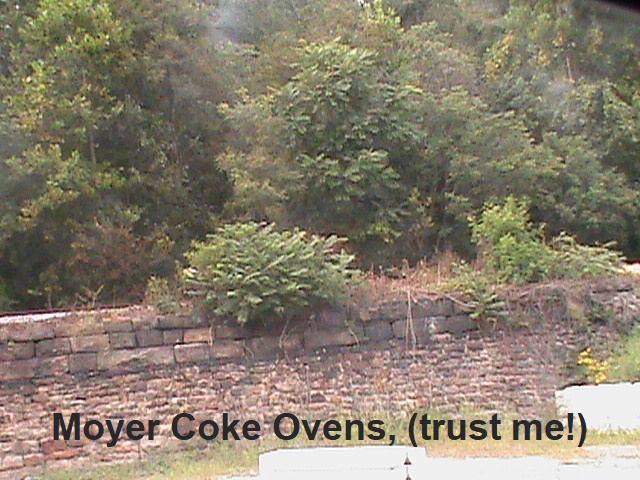


Railroad tracks leading toward the coke ovens.


   On a personal note, I found that my great grandmother, Mary (Miner) Wilson, who at the time resided in a corner of Pleasant Valley up Rt. 982 from the Moyer region. She once owned land near the Kells Schoolhouse where the Bullskin Township Elementary School sits today. This was listed as in Moyer. I believe the property was subsequently sold in the 1940's.

   Beyond this, a relative of mine with a sharp memory for things of this nature has brought to my awareness that my grandpap, Meryl Wilson, who while I was young and for many years previous, resided at Wooddale, said he had a job as a bricklayer, at the once busy Moyer Station. My brother also informs me of the family tradition  that he did most of the work himself. This was undertaken for the price of one cent a brick; this was probably a tidy sum in those days.


   They Soisson Fire Brick Co. was operated at Moyer Station which was the main hub of the area, across from Sheetz. This establishment was on the same side and below the old Blue Ridge Restaurant, now a small, self-serve gas station. The company was also known as "The Southwest Fire-Brick Works" according to Franklin Ellis' in his book, "History of Fayette County, Pennsylvania" and his year for completion is 1871. Seventeen employees were under the supervision of Anthony Sourd. With 4 ovens, they had the capacity of producing eight thousand fire-bricks daily; quite enough to build a good house!

    Moyer itself is just below the hills which are blocked in by what was the Southwestern Pennsylvania Railroad, now operated by Conrail. The location lies along the four lane of Rt. 119, by Irishman's Run. Of the many small, quaint railroad stations nearby were, Broadford, Tintsman's, Everson, Fountain Mills, (or Scottdale), and West Overton. That is just a few of the closer ones.


     In 1932, the Soisson Brick Yard was up for tax assessment for being delinquent of a whopping $355. It was owned by Joseph Soisson, who, along with Worth Kilpatrick, had built the majority of the works. I'm not positive of whether it was sold at that time, but it seems likely. There were many coke ovens, in fact, many of the old ovens are still there. I have a photo (somewhere), but I hadn't  located this yet, so I took a picture with so many trees that,I'm afraid the view doesn't show any!

    Regardless, fire-brick was manufactured in Fayette County as far back as 1830. Much of the brick was either loaded onto railroad cars or transferred to flat boats and floated down the Yough River to the Pittsburgh area for use in coke ovens, furnaces, and mills.

    There are various compositions the bricks could be used for with two basic types: plastic (or soft) clay of a hard, fine grain, and flinty (or quartz) clay, which is more pliable. The material was placed in metal pans and while rollers were surrounding the clay, streams of water were aimed at it with precision to produce the required consistency. It is then taken out and molded and heat-dried. Afterwards the bricks are burned in kilns up to five days and are ready for market.

              On the above photo of the brick works can also be seen the coke ovens in the background.                                           
                                                                 
Moyer toward the south.
                        

     An a major point of interest concerns both villages with their mines and coke ovens this is the basic thrust of info provided which may not be all that surprising, considering the underlying geography of the Connellsville Coke Seam throughout so much of this region.

     As noted at the beginning of this post, I really wanted to make a better assessment of the mine and coke oven localities in themselves, but the foliage and access is still a bit of a problem.  I do possess a map I had highlighted of a few roads in Pennsville which have been lost or just abandoned and wiped out along with a bunch of old homes and buildings when the Route 119 four lane was laid out, but I haven't yet located the ideal one, so a replacement is used instead. A plan is sort of in the works for an attempt to add this material at a later time, so, feel free to comment and please do,

    CHECK BACK.


And then again, there are what is still exposed of those old paved brick roads...

Tuesday, May 6, 2014

Dunbar City

  DUNBAR

  Looking almost like something out of the Wild West with the unusual shaped architectural buildings, Dunbar, in Fayette County, PA, has seen a good share of excitement in its own way. It may see more once again; so please read on down.

 Once called 'Frogtown', an interesting name, and yet later known as Dunbar City.

                            
courtesy of Google Maps


    The town, and borough, began out of early settlers movements from the south, many from Maryland and the eastern parts of Pennsylvania in the late 1700's, although it didn't officially become a town, until almost 100 years later in 1883 when it was incorporated.
  This is the town and borough after which it received its name from Colonel Thomas Dunbar, of the 48th Irish Regiment who was in charge of the support column for Braddock's failed campaign in 1755 during the French and Indian War. His camp was at Jumonville nearby. He retreated back to Ft. Cumberland on July 22. Dunbar Creek flows through to the west of the town crossed by the Dunbar Bridge, appropriately enough.


coming into Dunbar
   
     The Union Furnace was started up by Isaac Meason, about three hundred yards above where the Dunbar Furnace stood. The ironmaster, as he should be called, accomplished this in 1791. He had other forges here and a rolling mill. In what is Bullskin Township, today he also was busy early on with the Mt. Vernon iron ore furnace which you can see more about here. He died n 1819 and his son Isaac, carried on the business. This was defintely difficult work to of taken part in.

    The first Justices of he Peace had jurisdiction over Bullskin and Tyrone. The earliest of record is Jacob Stewart in 1787.  Connellsville Street has been the Main Street for a very long time. In 1844 Jones and Miller permanently changed the name to Dunbar Furnace. A few more times, it changed hands too, as Mr. Edmund Pechin became the head of the works. The enormous amount of manufacturing here is hard to imagine, as this was a very bustling borough. The 'Dunbar Community Fest' which is held the last Saturday in September, continues the tradition of pride in it's 131st year of official acknowledgement as a borough of Fayette County. With the Knights of Pythias and The Knights of the Golden Eagle, there were some interesting organizations. This was all part of what is named the Connellsville Coke Region and the rich quality of material inherent here led to the unprecedented manufacture of nearly 20,000 coke ovens in Fayette County alone. There were still some to be seen out on Ranch Road according to the Fay-West Discussion Boards, but the story is they are reclaimed, in other words, destroyed. Have they all been gotten rid off?

   Train service here began in the mid 1800's. There was even a funeral held for, can you even guess? The last trolley that served here! That is called taking the loss of an important element of your community very seriously, and you can bet that it was a real change in the way of living in those times. In after times, most owned at least one car or truck to get to where they needed to go. They also weathered some bad floods here, mainly in the early twentieth century, but also as late as 1972.


   There has been various businesses here over the years, including brick works, a sand plant, woolen mills, glass works, quarries, the coke works and, of course, the Dunbar Furnace which was working with a prodigious amount of iron when in it's heyday, and the Company itself dealt in coal and bluestone. The Dunbar Fire Brick and United Fire Brick companies started in 1890 and 1907, respectively. with the Uniondale, Watt and Ferguson ovens in operation. There is also the 'Irishtown' section where many of the citizens worked in the local ore and coal mines. There are those sites that can still be seen if you look closely in the corners of the borough and town. Some of the ovens were said to be of a unique byproduct variety which were first in production. At the time this post began being written, not too long ago, I was looking out the window at the snow flakes and it was not too inviting, but I did want to finally get some photos to upload now that it is looking like spring! If you click on other posts on the blog you might notice the snows of last winter will show themselves. Here, for example.

   But, not here:


old First National Bank

      The 1716 trolley ran through Connellsville Street here and to the left of the old bank was where the B&O Railroad Station use to be by the tracks.


Settlers and Indians

  
   Some of the prominent people that settled here, though long passed away would include:
  John Rodgers, John Christy, Jacob Leet, Thomas Jones, and John Sherrard. If there are any descendants that read this, be sure to put in a comment. Everyone would be interested to hear some of your ancestry.

    There are traditions of Indian burial mounds, as at Fort Hill, (Farm), which use to have the Coke Works of that name when it was the A. J. Hill farm. I'll be honest with you, one of the hardest things to research is in finding concrete facts concerning the Indian presence in local areas. Still, curious relics were said to of been found here. According to one Alexander Martin, there was also a crude graveyard with unmarked stones at the yard of Meason's Union Furnace where they simply buried people when they died of whatever was terminal. There was said to be a Liberty Pole at this furnace during the Whiskey Insurrection that read 'Liberty and No Excise'.

    A man called "Captain Cook", a recluse who lived and died in a cave by Cow Rocks, was said to of came from England enchanted by the stories of Braddock's campaign and spent much of his time lingering around the areas he was known to of visited or marched through.


   Inquiries about all the buildings and bygone attractions can be made to the Dunbar Historical Society, started in 1995. I freely would admit, they are more informed than I, while being very cooperative, possessing many old photos and articles of interest. It is open on Saturdays, too. Ask about the Sheepskin Trail, two miles long which connects up from the Greater Allegheny Passage not far from the Borough as the first part is there of the remaining 32 mile length. It is near adjacent to it. They have the nice mural done by Gerald Metzger also. You can discover from these conscientious locals much about the area's history, such as, the Dunbar House, (torn down), from 1897-1917; the Post Office which began in 1889 on Church Street used by the Historical Society, and the Wesley Methodist and Presbyterian churches. The old B&O is not but, the PA R x R Station, and some buildings may still be extant; and the Bryson home with coke oven is very much here. Look for them on Facebook!


  Though the PA Railroad Station is long gone, there is the Coke Oven Park, a unique, rebuilt beehive oven on display from new material of the old Shamrock & Shoaf Works, on New Salem Road. The Society has some excellent graphics and this piece of work has received over 25,000 visits! There is a good You Tube video of the construction of the coke oven above, courtesy of "Stuff That's Gone". And maybe, last, but not least, a person traveling around the olden town is never far from the East and the West, Railroad Streets.
   By the way, Shady Grove was the old West Penn Railway's Trolley Park here.

    A good Fayette County site with a lot of varied info is here and worth having a cup of coffee or tea and checking out. Locally there is the Dunbar Historical Society, as stated previously.

   Note:

   I may need to make mention, I was very excited to of received a very kind e-mail from Donna Myers of the Dunbar Historical Society, acknowledging the article here and that they approve of the quality. It means a lot to me. Very nice of her and I just want to give a special  *Thank You for that!*

    I still aim to get a photo to upload of the derelict restaurant by the creek that was built from the old bluestone quarry. I heard there was once a mill here. That'll have to be on the next trip over there. The name was the 'Rippling Waters' and it closed about 1970.

    There is an interesting anecdote I have here. One of my relatives was trout fishing years ago, and observed an old man that was fishing near the big boulder behind the restaurant and a copperhead slunk out from under it and struck at the ankle of his hip boot and went back under the rock. Well, he was so intent on his purpose that he never noticed the attempt by the snake to bite him! He just went on fishing...

    UPDATE: I got a photo, here it is


bluestone of the Rippling Waters restaurant


the old abandoned gun powder mill


   There's 'No Trespassing' signs all around here, so this was
     the best I could do


the powder mill from the disused tracks

    The town has the old Swearingen building, the Grocer and dry goods store, built in 1901 or 1902. Also, nearby, to the southwest, the Hill Farm and Coke Works, Tr. 703, there are a few ovens still remaining here. I'm not sure of the condition. This began in 1872 , some say, as early as 1865. There were many coal companies served by a private railroad associated with the Dunbar Iron Co. and mostly the Dunbar Furnace Co. There was a teriffic explosion here in 1890 on June 16, that killed 31 workers. Apparently, they were tragically suffocated, according to the 'Warren Ledger'.


   The Speers Mill was here from back in 1815 on Dunbar Creek, and was once said to have had a distillery there. The Eureka Brick Works were a few miles southwest of the town. Originally named 'Mount Braddock', this was a large operation. 

   On the positive side of things, there are some new job opportunities to open up for this area real soon, by way of the Fay-Penn Economic Development Council. Here's an article from the Tribune about it. It would be good news to another place in Fayette and Westmoreland that has seen better days.

   Cleaner waters


   There have been issues between the fly and bait fishermen and modern mining over the years. I have relatives who work along with the PA Game Commission as they help stocking trout, especially on Laurel Hill Creek, so there is a kernel of wisdom of which I write.

   Chestnut Ridge Trout Unlimited's Eugene Gordon's website for further info. Their involved in fighting hydraulic 'fracking' of open pit mining and some damage also from mountaintop mining. Especially, longwall mining operations by Consol, Atlas and Cabot Energy, for methane gas production, supposed offending parties. This compounded with the burning, or flaring of coal 'fly ash' said to be improperly regulated by the EPA, (considered reusable by some), with toxins from diesel fuel used, including known carcinogens.To be fair, though the EPA has been known to reach settlements from lawsuits dictated by the public concern. I mention this subject as we would hardly want to see the local areas decay as they did since the mining days when the place was described in terms of many red fiery lights and gray smoke across the bleak horizon, an after effect of the pollution some of the industry brought with it. Let's keep our trout fishing from being a forgotten thing of the past. This has been said to be a danger to the ecology of fish, their diet, and the drinking water, with possible neurological, dermatological and gastrointestinal symptoms experienced as health problems. This is claimed by those that live close to these wells and mines, as reported by Reuters news agency toward complaints filed by the PA. Fish and Boating Commission, also. This is through the processes sometimes overlooked, maybe too conveniently, of diverting the water flow according to the 'Center For Public Integrity'. This took place in another way, with the dredging of streams like Mount's Creek passing north through Bullskin Township, causing much damage to the habitat of the fish population there. Caution surely should be the keyword when it comes to the health of animals and our fellow citizens, do you agree?

  There were at least four of these dams functioning here:

remnant of old Dunbar dam

    The Dunbar Creek Project, run by Gary Sherwin, are doing what they can along with help by the Dunbar Sportsman's Club, headed by John Maddas, President, (724-277-4258). about the pollution of many streams in the area, especially from higher places like Glade Run. You see, the acid run-off is an ongoing problem from the coal and coke days and the strip mining done here. So, the Trout Unlimited Chapter of the CRTU, has made inroads in efforts to try to deal with radioactivity as well, with the work of Eugene Gordon. This involves the controversial 'Endangered Species Act.' Many feel this is to be commended, though there are some complaints with coal mining, especially the Marcellus Shale in a larger context. According to them, the Yough is not immune to run off by any polluted tributaries. Well, we all want to keep the waters clean and healthy.
  
 Local directions to Dunbar, located southwest of Connellsville, from Rt. 119 to State route 1053, and with the Arch Bridge Road from West Crawford Avenue. Also, Furnace Hill Road from the south will get you here.

 Remember the 'Pechin's' restaurant and grocery store formed from an old train depot? The place sure was popular when we use to shop there every two weeks as a kid, with my mother and grandmother in the 60's and 70's. You could get a little of everything there without paying too much. It has been transferred to the old Laurel Mall location and still has a beer distributor and sporting goods.

  Will be back soon with another article on our lost and forgotten history!
  

Friday, April 18, 2014

Massacre At Morewood

  This was planned as an update to the Mt. Pleasant article. It made more sense to do a separate Post as there is a fair amount of material already there and some photos here. So, it deserved a separate page. This is about what happened in Morewood in the Connellsville Coke Region' in the year 1891.


            Basic Story


  The story behind the Morewood Mines and the Coke Works in the far southwestern part of East Huntingdon Township, in Westmoreland County partly depends on which side was paid the most attention to. This area is/was near to modern Route 119, on Rt. 981, which has been fleshed out partly through courtesy of the Mt. Pleasant Historical Society and a few other organizations, and some more information comes from the U. S. Geological Survey map of 1902, along with George Dallas Albert's early 1880's era,"History of the County of Westmoreland, Pennsylvania."

  This was a fairly typical coal patch town served by the Southwest branch of the Pennsylvania Railroad, back around the turn of the century and eventually owned, by... you probably guessed it, H. C. Frick, through the early twentieth century. Carnegie, by then, his partner, reluctantly approved his decisions from distant Scotland, where he went to get away for a while.

   The area was experiencing various strikes from the miners and the wage agreement had ended and there were rumors that the workers were to demand a shorter work day and higher wages. Regular clashes with mine bosses wasn't something new. It had been ongoing from the 1840's and was widespread. Also, the talk was mine and coke oven operators were going to insist on a wage cut as the demand for coke, which was used to fire the iron furnaces, was reduced at this time.

  A lockout was threatened, so the workers walked out on Feb. 9th temporarily shutting down the mines. The situation was becoming desperate with the stress of the miners being evicted. This was happening in different degrees all over the region and other states, and things really deteriorated rapidly from there.


a mined out valley at Morewood

  It is really hard to picture this desolate place with the burnt looking fields in a long, quiet valley as ever being else but what you see here now. It really struck me how the Massacre and the aftermath must of played out here. Just about everything appears reclaimed from the old village and the location of most else is largely a matter of conjecture, if not, completely forgotten.


The fact is, there were over 600 beehive ovens operating and many hundreds of people lived here also in their huts and company housing. This was a mining community alright. "The one thousand tons manufactured here daily mean, therefore, sixteen hundred tons of coal mined in the same time. Rogers estimates that one pound of coal applied to the production of mechanical power through the agency of steam will exert a power equal to that obtained from ten hours' continuous labor of a strong man on a tread-mill".


             Disaster  Strikes


   Between the pricing and wage situation with the coal strike, resentment toward non-english speaking workers fresh from eastern Europe, and their unexpected violent reaction in return; added to this, along with Frick's apparent philosophy of production regardless of circumstances, it brewed ill for the miners, in more ways than one:

  The mine bosses worried over the newly formed United Mine Workers Union and were determined not to allow their influence to be brought to bear too strongly on the situation. By March 29, "a detective who had concealed himself in a house...overheard a plot being formulated by some Hungarian strikers to raid the Morewood Coke Works owned and operated by the H. C. Frick Coke Company, and to murder Robert Ramsay, one of the Frick company superindendents,(sic), and to burn his residence..." So, they were out to destroy the Main boss! This led to the general altercation, on April 3rd. "On the morning of the 30th 0f March, shortly after midnight, fully twelve hundred men made an attack upon the Morewood works...it was made by four divisions or separate bodies  of the strikers, each headed by a band of music. Starting out from Alice, Standard, Bridgeport and Bessemer respectively, which were mining villages near Morewood." There was also said to be 150 from Donnelly and Stonerville, maybe part of the force already reported. These works, which were the objective point, lie in a valley. "The men advanced and completely surrounded them and by their shouts and imprecations struck terror to the watching body of deputy sherrifs, for they realized that their smaller force of twenty men, although heavily armed, would be able to make but a feeble resistance..." Regardless, the strikers would not be denied their revenge and commenced to destroying the company's property, attacking whatever was in their path, doors, fences, wheelbarrows, tools, you name it.

  Word had been sent to the Governor at Harrisburg  and there were also Pinkerton detectives brought to bear. This was later criticized as causing a lot of the problem, as it was felt in many quarters, they overreacted. Then the National Guard were sworn in as deputies, maybe not the wisest idea, by one Sherriff Dawson, so that it would seem the force was actually about 50 men, all totaled. Sometimes it appears that no one really knew who should be in charge or take the ultimate responsibility and that could be said for the uprising and insurrection as well.
  "Here a surprise awaited them in the shape of Deputy Sheriff McConnell and Captain Loar..."a great many of whom afterwards declared that they were forced from their beds and compelled to join their ranks...the cry arose, "To Morewood! To Morewood!"
   They first cut the telegraph wires leading out of Standard so that no warning would come ahead of them. It was stated in, 'The Riot In the Coke Region' of the New York Times, no less, that the lines were quickly repaired and the warning did get through.
  The claim was made that some of the rioters fired weapons toward the guards, almost assuring a like response. They felt their numbers would bring success. They ignored warnings to halt and continued to shout threats.
   The result was that rounds were fire into the mob and six were killed and three more were wounded, fatally so. It was claimed that upwards of 40 were wounded.

So that, though the main group was, on the 2nd of April 1891 over 400 miners from round about here that began marching, mostly from the Standard Shaft area up town and out toward Morewood, there were many more from other mines as well. In confronting the Mine leaders and Pinkerton Agents and special police, the results were in seven of them being gunned down and more wounded. This may of became an even worse scenario if it would of gotten further out of hand. They were buried in St. John's Cemetery in Scottdale. There were many mourners in the rainy crowds that day. Frick's policy was to consider it something that would have 'a good effect' ! This was a rough time for people with troubles concerning the unions and workers in different places as is well known. Many of the public in the nearby towns were actually said not to be very sympathetic to the violence began by the strikers either.

 The court decision was, "Captain Loar and the deputy sheriffs who had been indicted for shooting the rioters at Morewood, were tried at the May term", and, convicted? sentenced? warned and fined maybe? Not so, "...at the May term of the Westmoreland county courts and acquitted. Some fifteen of the rioters were tried at the same term of court and convicted...the deputy sheriffs were tried ...and were acquitted..and thus ended the strike in the Connellsville coke region." Captain Loar himself vanished fast from the area, knowing full well the danger he was now in. Sheriff McConnel, stated that it was Loar, not himself that gave the order to fire, no one obviously willing to take responsibility, of course.


Morewood Memorial


      The after effects were still felt and retaliation from more miners was dreaded through the small towns nearby. "The opinion of the operators seemed to be that the withdrawal of the troops would tend to prolong the strike...meanwhile the evictions were steadily going on, which led to considerable rioting, owing to the strong resistance made by the Huns and Poles who were forced to leave the companies' houses...so the troops were kept on duty at the Mt. Pleasant Armory just in case of another violent episode occurred.
  Just to give an idea of the panic that still ensued..." the water-tank at the Kyle works was blown up this morning. At Leith today a striker who was arrested, was rescued by from the deputies by a crowd of about two hundred and fifty strikers... and the statement by a disillusioned sheriff was added too, "At Leisenring today, my deputies were driven off by a mob, and the men who were at work were driven off by the strikers, and, owing to the dangerous and turbulent character of the rioters, I am unable to secure a posse adequate to the exigencies of the moment, (suppose this is one way to put it),  and I consider the power of the county exhausted." Well there you have it. Then the Governor caused General Wm. McCelland to contact the captain of Company C, 10th regiment at Uniontown to, "immediately put his command under arms and report with it to the sheriff, which was promptly done."

     By all means, the troubles were not over, and this was a condition of a larger sphere, as Morewood was a microcosm in the whole crisis that was coming about with out any easy answers.
    "At the close of the week ending April 18, there were 3,600 coke ovens operating in the district, and it was estimated that there were 2,500 men at work, but the strikers who wished to hold out were trying by every means in their power to intimidate the men who were willing to work and to keep them from working", it goes on almost relentlessly, "on the night of April 17, a number of dynamite bombs were exploded in close proximity to the Scottdale works..." Apparently they also 'feared' that they were bringing in Italian workers into the region to take their place. You might surmise that a new form of racism was growing out of this and was complicating the situation, on top of everything else.

  Well, the report does go on to admit, "The operators themselves were not blameless in this matter. Desire for cheap labor seems to  has influenced them in employing men utterly unacquainted with our laws or customs," but it goes on to say, " unfitted in many respects to be associates of the better class of citizens, and, who, in time, acquired a knowledge that led them to be breeders of discontent and trouble...this affair clearly shows that there are considerations besides cheapness of labor in employing men-the peace of society, the safety of human life and property, which cannot easily be overlooked." It does seem there were points on both sides of the issue and the 'foreign laborers' didn't feel they had much to lose under the circumstances.

    Here's a 1939 overhead photo from close to the area, of the NE division of the Dept. Of Agriculture:

courtesy of Penn Pilot


     Furthermore, from a Tribune Review article, dated Sept. 28, 2000, a Memorial was also dedicated for the deceased miners in St. John's Cemetery and at Morewood, by the Pennsylvania History and Museum Commission.

    This was preceded by the huge tragedy of another type with the Mammoth Mine explosion on Jan. 27, 1891 where 109 miners lost their lives.

     Thanks for reading through the article. I especially appreciate those of you that keep watch for updates.

 Quotes from, 'Report by the Pennsylvania Bureau of Industrial Statistics', pages, 2, 5-7, 9-12. Courtesy, Google Books.

Wednesday, March 12, 2014

Snowy Stroll Through Scottdale, Pennsylvania


   An Honorable Mention


  Folks, this is going out to the 'Grand Army Of The Republic' Post 209 of the Civil War Era and named well, after the old Colonel. Ellsworth Park started in May of 1881. This is where genealogical material originated for my great, great, grandfather who participated in 20 battles and I am told, like many local veterans, was involved in the re-enactments staged here well into the 1900's and these proved very popular. Now wouldn't it be something if the community could muster such a spectacle once again. How many would love to be a part of that? Frankly, I'm still searching for more information on this special time and place. Sadly, the Park is long gone the way of many good things, having served it's purpose.

   I haven't got round to a photo close to there yet, but did want to upload this particular post before spring arrived! Every time I travel into town I somehow manage to forget my camera or, I am just plain distracted by something else.  Well, it would be proper to add here that any further input would be greatly appreciated.

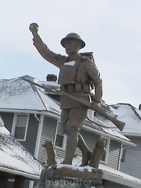
   And how about this dough boy's story ?


 Historic District


 What eventually became the borough of Scottdale was named after the industrialist and railroader, Col. Thomas A. Scott, President of the Pennsylvania Railroad and an Assistant Secretary of the War Department for the United States. The year was 1874. Previously it was known as 'Fountain Mills'.


   In Scottdale, in East Huntingdon township, 35 Miles south of Pittsburgh, (according to some, as much as 48 miles!). It is 12 miles south of the county seat of Greensburg. There were settlements here as early as the late 1700's, many of them of Scotch-Irish ancestry and eventually a fairly large German population. This is called the Allegheny Plateau region of the Laurel Highlands; hope that makes things clear.

  By the mid-1800's the community began to develop with the selling of lots from the farmer Peter Loucks' descendants. An earlier settler, John Sterrett, acquired a lot of land and by 1786 was said to be visited south of here by none other than, Daniel Boone! Also, a tract was owned  by one Mr. Galloway prior to 1801 much of this related according to the Scottdale Historical Society. They do have a Facebook page.

   This foresight of the Loucks family lead to layouts of the early part of the town. The Jacob Loucks house on the corner of South Chestnut and Market Street, circa 1853, is considered the oldest house there. There are other Loucks houses in the neighborhood as well.

     
Jacob Loucks house


    The Lawrence Keister house at 1005 Loucks Ave is a brick prairie dwelling built in 1895. The Church of Christ at 513 is of Queen Anne /Colonial revival style with stained glass beveled windows and the main façade originates from 1895. At 602, the W. E. Stauffer house with fluted columns and rusticated lintels is from that year. The A. K. Stauffer Queen Anne house at 701 with interesting corner towers and outbuilding, hails from 1880. The house at 804 has it's original windows, a bit of a rarity.

Wednesday, February 19, 2014

The Prospect of Dawson

   Dawson


   The town's Main Street is arrived at from the north off of the Dawson Scottdale Road, (Route 819), near the Lower Tyrone Fairgrounds in Fayette County. The Post Office is on Railroad St. and near Cochran St.  As Dickerson Run skirts around it to the south, the Dawson Bridge over the Youghiogheny River divides it from Vanderbilt, close by, which had a few great places for swimming near the beach when we were younger.

   There is the Historic District, (listed with the National Register of Historic places 1997), with the James Cochran House built in 1890.

   Originally called 'Prospect', in Fayette County, PA.  Dawson had some settlement by the 1780's and was started by the Smilie family, (John served in Congress), and then in the mid-1800's the part which became the main district was sold to one George Dawson through marriage to Sarah Huston, (Dawson), by which the borough acquired the name it is best known for these many years.

   As the Washington Coal and Coke was developed by the Cochran family in the latter part of the nineteenth century, this lead to the nearby staple of Star Junction in Perry Township.

   Dawson was first laid out in 1866. It became an industrious and busy place for many years. There were flat boat building, brick making and saw mills. With the close proximity of the 'Yough' river, economic growth was expanded.


Many prominent mining connections were established here, among other industries and companies.

   Like other areas of Fayette county, the coal and coke production were reduced through the newer process of steel manufacture and the area experienced decline in the early 1900's.

 Some information was garnered from the 1889, 'Biographical and Portrait Cyclopedia of Fayette County, Pennsylvania'. (Wiley, Samuel T.  Chicago: John M. Gresham and Company).


explorepahistory, credit, Library of Congress
 
             
   A Story Of Disaster

   This horror took place back in Dec. 23, 1903, near Laurel Run, right before the Christmas holiday. A Duquesne Limited train from Pittsburgh with 150 passengers on board, rounding a curve, struck a pile of logs that inadvertently came off of a freight train shortly before 7:45 p. m. The engineer of the B&O branch train, William Homely of Hazelwood, was killed instantly. The Chief of the B&O in Connellsville, M. K. Smith was also killed. The passenger car became airborne and landed on the locomotive filling the rail car with scalding steam and the rest of the travelers were asphyxiated. One car landed in the Youghiogheny River. Oddly, no women perished.

   One hero was the baggage master, Thomas Dom who, though injured, ran down the track and set his coat on fire and waving it frantically to warn the next oncoming train for a warning to stop quickly or there would be another tragedy. Rescuers did the best they could under the circumstances. The morgue and undertakers were overwhelmed with the 65 persons killed and 59 injured in one of the worst train wrecks seen in this region.

   Remember, this blog welcomes your ideas and memories.

   A Few Nearby Coke Ovens

 Way out toward Hickman Run, west of the borough in the township border of Lower Tyrone on Hickman Road, there were the Jackson Mines and the coke ovens associated with the names, Cochran and Brown & Keister. Quite a few were cited on an old map, which gave the idea to check and observe what became of them. Some, I have found to be in good shape and are a nice example of what they use to appear like.


Hickman Rd. coke ovens

Monday, January 27, 2014

Meandering in MT. PLEASANT


 Mount Pleasant

   Well, back up here with a newer Post for all you folks out there.

  There are many cultural sights in Mt. Pleasant as well as the township of the same name. We might only get to the most interesting here, but, more could be added. Just imagine all those horses and wagons in the Diamond, and women in their finery; the wooden buildings and hitching posts. A brief, but succinct history lesson would probably be appropriate, so we'll manage to attempt just that.

   Mount Pleasant is located near north of PA Rt. 819, not far from Route 119. When you come to the Doughboy, you are in the heart of the town. For some photos near the heart of the borough please check out the Mt. Pleasant Downtown post!

  Some Dates


    The borough of Mount Pleasant, one of the oldest places around here, was incorporated in 1828 and first settled by those of German descent. This was also the oldest borough in Westmoreland County. In 1798 East Huntington was slice off from the township which is off to the northwest, just to give some perspective to the early size of the place. By the way, Westmoreland County history takes us close to the dim past when it was still a part of Bedford County, and was formed in 1773.

   Now technically, the town began in 1797 when it was laid out by Andrew McCready. This was in those old days when there were some odd laws on the books, (at least in certain parts of the country), such as, at times Catholics were not allowed to own land or build a church and in some places, only given half a vote! The Old Presbyterian Church of the very early 1800's was purchased by the Church of God in 1870. The denomination dates back to 1774. The United Brethren church added the tower in 1874 and in 1890 the rather famous and expensive clock was placed within it.

  Let's hope you don't mind a few numbers, it really is necessary to get an idea of things.

 Well, those involved with the 'tract' finally got the opportunity and paid out for the patent with the amazing sum of $8.37. Talk about inflation ! The price became higher later going for $18 an acre. T he township itself also has some associations with the Whiskey Rebellion. And there is also the Bunker Hill area, which was annexed in 1885.

  The borough also had the 1907 L. E. Smith Glass Company, famous for it's work with colored types of finely worked glass and there is Lennox Crystal, with quality textured material, originally of the Bryce Brothers from 1896, with hand blown glass. The lack of this kind of productivity the place once shared has had a dramatic impact, though the sturdy nature of our surrounding townships lend themselves to adaptions and are managing fairly well. In the 50's there was Permali, Durasteel and Screw and Bolt, all within the township. Levin Furniture are still here on Main Street.

    The area was bypassed early, (some say spitefully), by the railroads until the Mount Pleasant and Broadford Railroad, and eventually others came to the rescue. Then there was the West Penn trolley that served the area well from 1906 to 1952.

   The Mount Pleasant Memorial Hospital was opened on January 1, 1904 from a private fund of Jacob Justice.
    
    The area called 'Dutch Town' was the hole in the wall, a place where they say people went to wet their whistle in Prohibition days. Quite a place to live near, a few would probably be thinking!

   Braddock's Road was authoritatively stated to of passed directly through the borough traveling up Eagle treet and out the Braddock Road to Sand Hill and passing over old 119 to the north and to what was known as Jacob's Cabins. This is an area I will revisit sometime. I would also like to gently point you in the direction of the Braddock Road Chapter, the National Society of The Daughters of the American Revolution for something of this aspect directly related with that era. They own the Warden Mansion where they have their meetings and also various promotions and contests and even their own library, so check it out. Sometimes we don't know what is in our own neighborhood! We can follow the Braddock Road signs around to get a better idea of the route the army took on their fateful way toward Braddock's Field.

    It's also a good idea to hike around when you have time and check out some of the Coal and Coke trails between here and Scottdale.

    Interestingly, there was also once a Grand Opera House that graced Main Street and there was a jail here too, until the late date of 1968. l will attempt to do some checking into this further. (Other information, whether historical, or just your take on things here, would be appreciated by any of you that want to contribute. A private e-mail is another alternative).

    Standard Shaft


    This coal patch called the 'Shaft' by locals, was very busy. A large amount of you will still remember the dust, smoke, and the bustle down there. Though first known as Spring Garden before 1873, it really got going as a coal and coke area in 1890, the streets were laid out in 1916 with the old Union Supply Company store on the corner of Diamond and High streets. Standard was said to have nearly 10,000 coke ovens, though maybe that's 1,000, though that would be rather low. Still, one of the largest  in the U.S. When the no. 2 and 3 mines were combined it was known as Standard Shaft. It was begun by A.A. Hutchinson and Brothers and then built up by H. C. Frick under Robert Ramsey's able supervision and still contains some old company houses. Is anyone else interested in this too ? Well, there is further information available to those more curious folks here and here, as to the houses, baking ovens and the mines themselves. 
  

  Here would be a nice place for a few of those stray anecdotes rather impetuously planned for the site.


  For one thing, Samuel Clemens, Mark Twain himself was claimed to of come through the Mt. Pleasant area on business.
   There was Jess Stairs state representative from 1977 to 2007. He came from here and  resides in Acme.

   Other House representatives include Eugene Saloom and back further, Isaac Kine. More recently, Jess Stairs who lives in the heights of Acme and, as a friend pointed out, once taught a 9th grade class here, was a Republican representative served from 1977 to 2007 for the state.

    A really great anecdote is sbout Al Capone, yes him, who also made his way here once on business heading toward Masontown. Unfortunately, there seems to be little, if any, other information available. Well, maybe that is just as well!

    By 1925, the authorities had to put their foot down and prohibit the practice of cattle driving through the streets. The farmers and ranchers would lose out in this, but one should assume it led to a quieter and safer environment for a growing community.

   We have a more honorable and regional mention up next, with John White Geary 1819-1873, who was a local son of Scotch-Irish immigrants, and once lived at Church Street. He was a highly decorated Civil War General and Governor of Pennsylvania with  his very own Historical Marker right by S. Diamond Street too. Geary Park is, of course, named after this man. He sure had a colorful career! In 1856 he was Governor of Kansas and he fought in The Spanish American War in Mexico, as well as becoming the Mayor of San Francisco. Involved in various battles in the Civil War, including, Gettysburg, while providing undaunted bravery at Culp's Hill; he eventually ended up out west and finally came to be military Governor of Savannah.
   
  Moving further down Main Street, making a right at the light at the tavern and hotel, R x R Station, (without commentary, at least for now, of the ghostly stories associated with it's history, which is covered pretty thoroughly on other sites),
                      
RxR Station as seen from the back


making a left behind the Fire Hall there, you will be on route that was said to contain the street car trolley. This old road went all the way to Iron Bridge. The condition is alright for a mile or so, though there are speed bumps, and then deteriorates fairly quick.

             
behind Mt.Pleasant Fire Hall

    Those Road Names...

   Also, there are some curious road names as most residents should be aware of, like 'Misty Meadow'. Sounds nice, but watch out for the road leading to it- 'Pole Cat Road'! Up North Diamond off of Depot is the 'Helltown Brewing' Co. Over by St. Pius X Cemetery is Braddock Street and there's a Washington Street too, the one with the cabins, then we have Liberty Street more southerly. The Coal and Coke Trail heads past the Baseball field on to Bridgeport. You also have FRONT Street, and what would it be without BACK Street; then Fry Hollow, Simpson Hollow and Brook Hollow Roads, all in the same area. But this is moving out of town a bit, so let's look at College Street, a long road, coming off of S. Church from the South side and Morewood Street to the southwest famous for the 'massacre'.
 
    Finally, near the northwest side there is High Street and...Low Street as well. That about concludes this segment.

    Let's not forget, though most probably have the area to the south west called Texas! You might have to look it up on an old map, like here:


Contact Form

Name

Email *

Message *