Showing posts with label Turkey Foot Road. Show all posts

Sunday, August 11, 2019

Old Cabin in the Woods

 Introduction

 Hello fellow history buffs. I know, this is only the 2nd article for 2019. Please continue to stop by, you never know when I will get to a few other long planned on posts. Whether you are new to this blog or you are an old loyal follower who have been impatiently hoping for more insight on Fayette/Westmoreland Forgotten History, I hope you are all fine and in good health.

   Although these photos go back quite some years hence, this was a draft that hadn't seen the light of day. One reason for that: a difficulty in discovering exactly who owned the site as it changed hands since many years ago when, even then, little was known of it. I'm not providing GPS coordinates as much because of the murky condition as concerns any  recent land owners and all that. The post is finally uploaded in the name of research and historical interest.

  All the info I have available is it is quite old, but how old, I do not know, and it was in the 'Rhodes', or 'Rhoads', family for many years. When I and my brothers were little greenhorns an old lady and before that, an old man lived there, deep in the woods on Walnut Hill in Upper Tyrone Township. There use to be a larger lane down into the woods where every so often the old couple had groceries and other items delivered to their area. Well, unfortunately that is about the extent of my boyhood memories of the place.

  Any aware of further information, be sure to contact me.


  I was just feeling cooped up, so I took a corner of an afternoon to check the Walnut Hill area referred to in a previous Histbuffer post. Briefly, this primarily concerned the Braddock Road and the Turkey Foot Road, dwelling at some length on the historic and fascinating likelihood they may of actually crossed on or near Walnut Hill in Upper Tyrone and bordering Bullskin township.

 Touch of Fieldwork


  To give a little explanation, I strode off the road for a bit of fieldwork and felt immediately better to be out in nature. Whether you are hunting, hiking or just taking a stroll, there's something about the solitude and simplicity of going it alone in the woods that can really lend toward an advancement of your peace of mind. And I don't mean scanning pages of woods and snow online to grab a nice screensaver, occasionally spacing out and sighing now and then. No, sorry, that doesn't count!

  I started on the top of the hill, (an obvious beginning or ending, depends on how you look at it), where there is a remnant of the path leding from it's joining to the modern Kingview Road. To the east, this old route appeared to make a connection on a few maps, modern overhead photos, as well as 1939 aerial photos, to join the Kingview Road again from a few hundred yards downhill toward the paved main road on the way to Rt. 119. I had plans to eventually finish with this region in a future article. There use to be a much clearer pathway, wider in size, but you will have to take my word on that. Please, do keep in mind, not many know of the route, excepting a few that lived here a fairly long time ago.


The path near the guard rail to the east at the top of the hill

   Soon I worked my way down into...thorn bushes. HUNDREDS of them! Pesky, innumerable, from all angles, and...sharp. So, I took it slow and hesitantly, followed the trail through there. It appears to branch, then is more difficult to perceive. Later, in a rise toward the south there are a few roads that are were probably mine or farm roads.

After approximately 40 yards the road appears to split

   I would suggest no one actually attempting to duplicate my trek, let alone bothering to go through the trees and thorns from Beauty and the Beast's enchanted castle and simply go by what is shown here. Heck, some might just get lost in there. After a few weeks they will probably find their way back out. Maybe they will of learned about wilderness survival and camping, even though they are a quarter mile from a main road! If you are an experienced woodsman, or woods woman, you might be alright, otherwise, even with a compass (that wasn't part of my few items), it is a bit of a maze. Anyway, a warning, as unless mountain climbing is one of your serious hobbies, no one should attempt heading in there at the pole line to the north of where I did as the descent is extremely steep and surely much worse with the mud and snow of winter. The one advantage was minus the snakes and bugs of warmer months.


A clearer piece of the upper, southward trail

   Specifically, meaning, the path along the high, southern ridge staying in the very thick underbrush, to the point you couldn't get a photo without using a machete, while the lower, more northerly branch heading off eventually toward the old cabin, while further on, a deep hollow that can be a dangerous if not carefully skirted around to the west.


The old cabin hasn't been lived in for many years

 The area I found it in, after so many years of where I was reminded that it was suppose to be, wasn't quite the place I expected to come across it's whereabouts. So, you might say, I was a bit disoriented or whatever, but the case remains it was further up the hill than I had anticipated. No, I'm not perfect, let's put it nicely, shall we? But, I wasn't quite lost either..

 Again, no one I know of seems to be aware who exactly owns the old property these days. No harm was meant. Of course, not all that long ago one could freely hike these woods. No hunting or ulterior purposes were involved. If an objection arises to this post, and will do my best to respect the wishes of the owners as has been done to this point.


  The cabin, last used by an old couple by the name of Rhodes, or Rhoads, was to the last inhabited by the woman until her last days. By the way, if a Mr. Hall(?), or whatever the name is on a few old postings, I didn't see any other until meandering well past the cabin location and am an innocent guy who generally minds his own business, alright? The old landowner around these parts was a friendly man who had no qualms about traversing the hillside. I also saw no other person on my journey through some of the woodlands. Thank you.


   I was rather surprised to see that it did have electricity back in the day!


  The place is very deteriorated. Because the ceiling is fallen, there was no temptation to go inside. There was wood and junk under the floorboards.


  The well was still there, though I was stepping a bit gingerly.


  I followed one pathway until it was difficult to be certain of it's whereabouts.Then I caught pieces of a path or road off and on through to another, more easterly ridge. That's where I saw a few postings. Keep away, you are NOT wanted here! So, I did just that which changed the trajectory of my quest to going in farther down Walnut Hill and walking up in a ways. I noticed what appears to be a scar or trace in the cornfield. This looked interesting. It is easier to perceive and more noticeable in three dimensions from various angles. Here's a photo:


 Later on, I met a man at his residence coming home from work and realizing that I didn't have much daylight left OR permission, I promptly asked him about the road entering the woods back behind the houses. He told me he had only lived there for ten years, doesn't know the ownership situation but pointed out a house where some elderly people live that might have more knowledge. Quickly, it hit me, I know those people! One of them, Dolores Mailik, I had been in the Laurel Art Club with back in the 1990's. Yet, I decided not to bother these folks too much. So I put off any re-acquaintances until maybe a time when I was cleaned up and more presentable to ask if they know if it is alright I check the road down there for a pace or two, as it could be indicative of a clearer perspective of how this road originated.


 What concerned me most is the lack of rutting in the old road in those woods, as much as I could discern anyway. Such is often a feature of the Turkey Foot Road or the Braddock Road remnants amid steep terrain.There are logging or farm roads on the hill as well, but the importance and significance is not known to me.

  Yes, ladies and gentlemen, the jury is still out, and may never convene on how much importance can be gleaned from our limited observations and lack of knowledge, which includes understanding of carpentry and building acumen. In general, these photos and a bit of familiarity with the lay of the overgrown hills and hollows is all I acquired by my rambling camera trek in the heart of February, a lot of years ago. Nevertheless, I felt relieved to of once again seen some of this first hand. In fact, I enjoyed the small excursion for what it was:

 a minor attempt to learn something more of the Turkey Foot Road through this particular region and a chance to get out from a case of cabin fever and check out an old dilapidated  cabin of a different sort. Underlying this, is the real possibility the TFR route went further down toward the northeast around Kingview. The jury hasn't yet been formed to convene on such an alternate course as that, with the basic deduction of very little to go on for now.

  As always, keep the emails and comments coming, they can be the life blood of a good old blog, and are truly appreciated! As for my recent lack of posts, priorities are what they are, so I will leave it at that. Take care, enjoy the rest of the summer, and I'll be back (some day!), for another excursion into our regional history on the next post, folks!
 

Sunday, June 18, 2017

Jeff Hann Interview


     Below, my friend, Jeff Hann, responds enthusiastically to a series of 10 questions posed by me.

     In case anyone does not recall or hasn't read the older posts (shame on you!) back in late 2014, Jeff Hann discovered what is very plausibly portions of the Turkey Foot Road up on Quail Hill and  old Hawk Road. Closely connected to this, Mr. Dietle, Mr. Hann, Kim Brown and myself were interviewed by the editor with the Mt. Pleasant Journal. Jeff Hann, Lannie Dietle, and I were doing fieldwork together a few years ago and located a further portion of this ancient and storied roadbed, while Jeff later found yet another part of the TFR as well. This was a unique historical accomplishment, especially toward our local region.

    I also submitted an article, I believe it was in the spring of 2015, with Jeff's help and Lannie's guidance for the Bullskin Historical Society Newsletter. This apparently proved quite popular which described the more exciting highlights and their various implications.

    If there are any answers, (or questions for that matter), which fans of the blog and this detailed subject are not totally familiar with or aware of, please take a few moments to refer to these links:

      Turkey Foot Road Remnants South Of Quail Hill Near Hawk Road

      The Forgotten Turkey Foot Road in Bullskin Township

 
      Any other comments or inquiries can be made through the blog or send an email to www.histbuffer@outlook.com. Now let's get under way:


                     Interview Questions


1. How have you and your family been doing and what have you been up to lately?

Everyone's good, you know how it is after you get so old ,everything basically stays the same, go to work, come home, eat, sleep, repeat!  HAHAHA!  But seriously, work seems to be the main focus these days, along with just meeting up with friends on weekends and some evenings for dinner and a few drinks.


2. I sure understand where you're coming from. While I was excited to have the experience in late 2014 of walking much of the route with you on two seperate occasions, once in the presence of Lannie Dietle, author of "In Search of the Turkey Foot Road", how does it feel in retrospect of the last few years having discovered a part of the history of the Turkey Foot Road? Does this knowledge still have any major impact on your life?

  I'm still excited about it and still a little taken aback by the whole experience. At first I thought, ahhh no big deal , but when Lannie Dietle actually flew in from Texas to walk several different locations with you and I it kind of hit home that this was a big deal. I take pleasure in the fact that Lannie named me in his book and referred to that part of the TFR as "The Jeff Hann portion of the Turkey Foot Rd." As far as having any impact on my life , not really , other than the fact that I spend a lot of time thinking about where in the hell does that road go after leaving the Shultz property and heading for Dexter to the crossing of Jacobs creek. Hopefully some day somebody will find a reference on an old property deed so it will ease my mind!


3. It was very exciting and intriguing and I agree, historically, it was indeed a big deal; we can only hope more information will some day come to light. 

   As I am aware you do snow removal in the winter and I personally feel we are fortunate to have you in these key positions as an Auditor for Bullskin and Upper Tyrone townships, could you give a basic description of  your duties and have they changed any since you began the job?
  
  I'm no longer an Auditor for Bullskin Twp.  I lost the bid for re-election 2 years ago. But in all honesty, I didn't lose any sleep over not being re-elected. Although it was a pleasure to serve the people of Bullskin for the six years I was Auditor, I just don't enjoy politics and the election process. 

 As far as being road foreman for Upper Tyrone Twp. the duties are a little bit of everything, plowing snow and salting, mowing grass at several locations and along the roads, replacing drain pipes and culverts, minor paving, maintaining  trucks, heavy equipment , and mowing equipment, minor repairs around the buildings and even scraping up roadkill now and again. I'm sure I forgot some things but we try to stay busy and do as much work as possible with the resources we have.  As far as change , I think the job will always be consistent with some minor changes here and there.


4. It sounds like you are still involved with a fairly hefty amount of responsibility to go around! 


   I'd like to ask, in what manner did the familiarity of knowing people and places help with the different aspects of TFR research in Bullskin Township?

  Knowing people and places was a huge help, without that I don't think it would've been possible to do the research that was done. It's so much easier to ask someone for access to their property or to look at their deed if you know them personally. Knowing the area and the terrain was also a huge benefit for the fact that you know they weren't going cut a road  a certain way because of steep hills or big ravines or creek crossings.


5. Is there a specific part of the Turkey Foot route which intrigues you most, particularly concerning the TFR branches from Mick Lilley's on toward Spruce Hollow and northeast of the Shultz property?

 The very last visible part of the TFR  leaving the Shultz property heading north is very intriguing as to why it snakes around the big rock ledge to the east. When looking at the current Breakneck Road it seems that would have been the more logical route especially when both Breakneck Road and the TFR crossed Butler Run at almost the exact same point. But we can only attempt to guess how much the landscape has changed since the TFR was cut through that area.


6. Was working with the GPS and directional coordinates easy, and was this acumen developed naturally (something I was slow to grasp) ?


 Absolutely not , I'm horrible with GPS and directional coordinates although it is a great tool  I'm like you, very slow to grasp . It's much easier for me to relate an area with a landmark or someone's name than it is to try to find it with coordinates.


7. I am curious if you had any recent breakthroughs in the development of the route to Connellsville beyond the likelihood of a connection to Breakneck Road?
 

 I have two different ideas on the road to Connellsville branching off of the TFR although neither have been proven. (1. On the Melish map the road shows a fork at the top of Rich Hill and  if you're heading north on the road, the right part of the fork being the TFR, the center of the fork being the road to Perryopolis which I believe to be part of present day Englishman Hill Rd. and the left being the part to Connellsville by way of an old road bed found below the present day Rich Hill stone quarry which meets up with the present day route of Breakneck Rd. near Polecat Hollow Rd. and then to Connellsville.   

   (2. There is also another road bed branching off of the center part of the fork described in paragraph one, being Englishman Hill Rd. at the sharp S turn at the top of Englishman Hill and heading south west to Connellsville. There are still many parts of that route still used as private driveways and a large portion of it is very visible on google earth .  But again nothing has been proven.


8.  A perceptive answer, Jeff and I could only add that is a meaningful description of the two probable routes involved. 

    Do you think it plausible that Medsgar Road from Rt. 982 to Spaugy Mill consisted, at least to an extent,  in a branch of the TFR?

 No , my personal opinion is that Medsgar Road was a short cut, so to speak, from the Detwieler Mill to the Spaugy Mill. The TFR would have been dryer and shorter to stay the course it was headed on to the Spaugy mill from the known existing part at the end of the Shultz property.  I personally believe the TFR is part of the now existing Breakneck Rd. and on through to the now existing East Keefer Rd. to the Spaugy Mill. I can't prove it, but it makes sense to me. Again hopefully some day we'll find some kind of solid proof to tell us where exactly it does go.


9. For what it's worth, I approve of your educated assessment. In speculating, I sometimes ponder  further about the whole picture as Lannie Dielte has provided in his Addendum some solid evidence for the theory for two branches, possibly more, of the TFR through Bullskin and entering Upper Tyrone, and according to old historians, heading to Dexter and ton to Cherry Hill and Ruffsdale in Westmoreland County.

   In your opinion, is the Hatfield/Lindsey route or branch then, from a later date than the reported Spaugy MIll route?

I think the Hatfield/Lindsey route is later than the Spaugy route for the fact that the portion of the TFR that is now known at the end of the Shultz property would have passed by the Hatfield/Lindsay route. Add to that the knowledge that we already have about where it crossed at the Spaugy mill and headed for Jacobs Creek, I have to believe that the original TFR went to Spaugy Mill first.


10. Fascinating stuff as I've often wondered a lot about that situation.

     Finally, as early on, Lannie Dietle tended to help me to orient the blog better toward deeper historical info, whether or not that was necessarily his actual intention, I have recently reread his hefty book for research purposes. The last question is: have you eventually read it through, and while collaborating with him in the past, especially in consideration of  his intimate input on the subject, what observations did his influence leave you with?

I don't think I ever finished the entire book, there's just so much and to be quite honest I really focused on the section through Fayette County. I still read it now and then just to refresh my mind and to try figure out other portions of the road in the areas that I'm familiar with around Fayette and Somerset counties.  Lannie taught me a lot about old roads, such as the deep trenches they left behind from so much use with horse and buggies and how terrain didn't always deter them the way it would me as far as choice of path. He also taught me something about myself , he said something to the order of , "Jeff has a natural propensity for incisive analysis." Who knew ? HA HA!

      If you don't mind my saying, likewise, I mostly focused on studying Fayette County as the other voluminous southeastern material is so in depth and in regions we are not very knowledgeable about, and am totally in agreement, Lannie Dietle has a way of teaching a person much, sometimes profoundly, and giving new insights into ourselves, as happened with myself too. You've helped in your own way also in my search for historical realities.


      In summing up:
A big thank you to Jeff Hann for your candor and meaningful answers toward my request concerning this post. Your cooperation is much appreciated and will help add to the Turkey Foot Road articles and further interest while enlightening visitors and fans of 'Fayette/Westmoreland Forgotten History', and that certainly is a large part of what is discussed here. Lastly, I can honestly state, I thoroughly enjoyed this most recent collaboration and wish you all the best!


Thursday, March 17, 2016

The Cloverleaf Planned by Pennbot at McClure

  Welcome to another installment to Fayette/Westmoreland Forgotten History as we slowly enter springtime and thaw out from a long winter.


  A half a dozen months ago, I received a head's up and, in a real sense, a wake up call from one Mr. Jay Stern. He hurriedly explained that there was a meeting in Uniontown where those with actual information were invited to present their take on possible historical implication on their planned road work in the next few years between Scottdale and Mt. Pleasant. You can find a mention of it here, but the PennDOT website page with regional offices is found on this link.

   I can imagine some are thinking this Histbuffer just can't seem to leave this area alone! But there is a method and a reason to the madness, if you will. As you can attest by the date of emails below, this doesn't appear an urgent issue time-wise, yet it needs to be addressed. Eventually in later emails Mr. Stern outlined a cogent summation of just what is going on in the planning process to the point he would not mind my referencing his words giving a good added perspective on the whole situation for visitors to the blog without which the story is incomplete for our purposes.

   The Uniontown meeting for PennDOT's presumed plans for District 12 near the northeastern border of Fayette and Westmoreland counties took place on the evening of Aug. 29 of 2015.


  Pertinent Emails

 Below are portions of our email correspondence.

 From Jay Stern:

   Hi Al,

I just ran across a media release from PennDOT about their plans to reconstruct the Rt.119/Kingman and Crossroads Roads interchange.  They’re having an open house and plans display for the proposed reconstruction on August 27th. Besides their ill-advised idea to eliminate turns at the interchange, they state “Anyone with knowledge of historic resources in the project area should attend this meeting.”  I think they mean you.  If you go, I’ll see you there.  I’ll be the guy vigorously and relentlessly opposing the turn restrictions.

   I hope it is alright to mention Jay's interest as I so value his involvement and expertise with being so aware of all this going on!:

   Been here for almost 40 years, ever since I graduated college.  You wanted some of my history.  I'm a pharmacist and owned Burns Drug until I sold it to Rite Aid and CVS several years ago.  I can trace my family in this area to the 1700s... He then explained much of his fascinating historical background which won't be recounted here.


 In response, I wrote the following to Mr. Stern:

  Jay:

  Hi there. While I truly appreciate the heads up on the PennDOT plans and your impression of my regional underpinnings, unfortunately I doubt I will be able to make it tonight. I agree with your efforts about opposing the turn restrictions and you sure have my blessings if that is any consolation.
  From recent research I've done and from certain authors like Norman Baker, it should be basically understood that Braddock's Road traversed over Rt. 119 while heading southerly from Walnut Hill while  the Turkey Foot Road was likely routed toward Dexter from either the Woodale Spaugy Mill, or a branch from what became the Pleasant Valley Country Club. The point is, as you are probably aware, great care should be taken in rearranging these roads in an unnecessary manner for historical purposes, as well as change for changes sake. I am a bit skeptical they will reconsider their decisions from our regional perspective. Best of luck!

  Please, let me know briefly what took place, if you can.

  Kind Regards,

   ~  Al


   This got the ball rolling and we continued corresponding for some time. Jay next wrote with a sure fire compliment perhaps hesitantly accepted:

    I hope you don't mind if I give them your name as a historian and the preeminent local expert on the paths of 18th century roads in the area (live with it!)  I'll definitely let you know what happens.

  Later communications included:

The point is, as you are probably aware, great care should be taken in rearranging these roads in an unnecessary manner for historical purposes, as well as change for changes sake. I am a bit skeptical they will reconsider their decisions from our regional perspective. Best of luck!


  He then told me of his observations of the meeting:

  There was an absolutely great turnout and I had a problem parking close.  The PennDOT plan is to build a new exchange bridging over 119 north of the current exchange (for over $80 million) and closing the current exchange.  I told the engineers giving the presentation that the problem would be eliminated by installing a $80 thousand dollar red light camera at the intersection with appropriate signage.  Being construction engineers, my proposal was poo-pooed, but it was obvious they never thought of it.

I talked to the PennDOT archaeologist who attended the meeting.  He never heard of the Turkey Foot Road (!) and the fact that it crossed Rt. 119 there.  I gave him the address of your website and email address.  I hope you don't mind.  He wants to correspond with you and said he would contact you.  Just in case, his name is Ryan Rowles and email is ryrowles@pa.gov  - and he said another person in his department you should talk with is David Anthony who is the PennDOT poobah of Historical Structures at davanthony@pa.gov

Please keep me updated with your correspondence with them.  Thanks.


  While I find it a sad situation the archaeologist had never heard of the Turkey Foot Road, hopefully he knows more of the Braddock Road and is willing to learn. I did later have contact with Penn dot. I believe I also received email correspondence with Mr. Anthony (please correct me if I am mistaken), but was not contacted by the archaeologist in question unfortunately. I was informed the organization would indeed be soon checking with my blog and the historical info ad research documented there was a priority. We'll have to wait and see if they are in any way influenced by these communications. Only time will tell.

   Since Jay Stern was so helpful in this endeavor and with communicating the facts with my website, I would like to allow more of am insight into how this came about. He also was cooperative in informing me of the entire situation as he understood it:

     Jay Stern:

     PennDOT’s plans are to make a new interchange 1/3 mile north of the Crossroads light, constructing a bridge over 119 for it, and then building an access road west of 119 travelling north and south to Kingview Road and the old Williamshouse plant.  The Crossroads and McClure interchanges would then be completely eliminated and the traffic lights removed.  The new interchange would look a lot like the 119/31 interchange at Mt. Pleasant.  Looking at Google Maps and estimating, I would put it just north of Galley’s Auto on Richey Road/Mt. Pleasant Road, and using the hillsides on either side of Rt. 119 as the bridge base.  I think this places the project area right in the bullseye of the Turkey Foot and Braddock Roads.  Our historical heritage, along with the exorbitant price (now $35M according to the articles in the Trib & Courier), is why I'm still concerned... added to the fact that this doesn't take a great deal of time or effort.

I sent Ryan Rowles a followup email Thursday evening giving him all your contact info, but as yet, I haven’t received a reply... I unfortunately also didn’t cc the Historical Structures guy.  I’ll wait a couple of days and then send him another if I don’t hear anything.  I’m kinda surprised, because he seemed genuinely interested.  I also gave him a personal business card with all my contact info.  I’d suggest both you and Mr. Dietle also contact them, considering the historical aspects of the target area and your knowledge of it.  I also implied you may have some questions for them - a PennDOT roads archaeologist and a PennDOT historical structures expert on a possible 18th century bridge crossing Jacob's Creek at Dexter comes to mind, for one.

    There you have it from a concerned American and informed local resident. If only more people were this protective of our rights and willing to voice their feelings on issues and concerned with policies affecting us in many ways.

   As can be seen, what a debt of gratitude is owed for Mr. Stern's timely and focused concerns and the informational explanation he uniquely took the time to pass on to Fayette/Westmoreland Forgotten History. *Thanks again for your help, Jay!*


    By the way, if people are not familiar with many of the posts here, Mr. Hann it was, who contacted yours truly, taking my interest into he Turkey Foot and Braddock Roads another step or two along. I had then proceeded to pass this fascinating initial information on to the expert Lannie Dietle, co-author with Mike McKenzie of 'In Search of the Turkey Foot Road'. Jeff Hann had successfully detected and uncovered unknown portions of the Turkey Foot Road over a year and a half ago. I felt privileged to walk a few miles of this route myself in late 2014  and that Jeff Hann and I a few weeks later had the experience of finding part of the TFR route to the north of the Breakneck Road in the company of Lannie Dietle himself. This discovery all led to an article in the Mount Pleasant Journal and I also was pleased to be able to submit an article for the Bullskin Historical Society (this initial submission was then graciously accepted and printed) as well as Mr. Dietle adding an important addendum to his voluminous book in its most recent edition.

     This is a copy of the plans sent to me by Mr. Hann. I should mention that his job is an Upper Tyrone and Bullskin township auditor. Notice the classic cloverleaf pattern proposed for the projected McClure interchange compared to the diamond configuration used on Rt. 819 described later:

                  
The township map of the cloverleaf plan


  From the map above it should be noted, the Kendi Road extension from the Kingview Road which appears to circle the village of McClure on north heading to meet up with Porter Avenue. In my view the Kendi Road work is the more troubling.

     Lannie Dietle, no stranger to this blog, graciously tried to track down some authors and experts concerned with the Braddock Road to question them of this region's Braddock Road route with mixed results. He related info that there may not be a serious problem with the traditional Braddock Road location, which is accepted. He also attempted to contact Norman Baker, author of "The Braddock Expedition..."

     Rough Map Included


   With my somewhat limited ability, I drew a schematic map of this region for your convenience. The Barker Map clearly shows the Old Braddock Road route as running through the area of the map below. Whether the schematics are technically accurate or not and staying to the north to Mount Pleasant. I only estimated where the recent Rt. 819 roadwork and the northern part where the projected roadwork will take place as this would of required a larger map format. Hopefully this will help to orient visitors to the region under discussion:


    The Route 819 Roadwork

    For a comparative analogy here are included photos of recent roadwork by Penn DOT. Note that this particular road construction for a bypass with alternate exits has taken a large parcel of the last few years.

      
beginning of older roadwork looking north toward McClure


more Rt. 819 road work looking toward Walmart


Ramp onto Rt 119 heading north, a real mess

                                     
road closed signs

                                     
the southbound ramps are a bit unusual and sprawling in conception


Penn DOT Scottdale exit work

                                       
Penn Dot machinery

                              
a southbound exit which was (FINALLY) opened to traffic


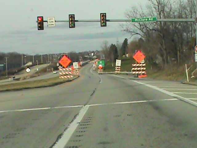
road signs at McClure-there will be much more in the future!


Sherrick Run east of Rt 119 road work

                              
    There were the Emma and Bessemer coke ovens nearby to Sherrick Run and possibly the route of alternate historically important roads. As was normal in this region, there existed various mining operations some of which were owned by the Overholts. I personally know of an Overholt gravestone near here. Even more roadwork would surely make further identification of the paths of either the 'TFR or the Old Braddock Road difficult to discern.

    It is to be admitted, even without the additionally planned road construction for the future identification would be a difficulty, but at the least, a definite possibility. (Please do read the link provided and see for yourself the Barker Map route). There is reason to believe the Turkey Foot Road had a branch running just to the northwest, possibly nearer to Sherrick Run, fairly close to the placement of the Old Braddock Road. The last is very different than the known route Braddock took from near Everson on past Prittstown to Hammondville, then heading north and crossing Jacobs Creek and meandering up through Mt. Pleasant.
               

                    This photo is looking toward the west where Cherry Hill is located roughly 2/3 of a mile away. Backed up traffic above - a regular sight.


Sherrick Run north of Iron Bridge
                           

    The Turkey Path Road: A Connecting Link


 The Turkey Path Road to the northwest
                                  
     This photo shows an area very near the nearly finished Rt. 819 road construction where some believe this old back road superseded the route of the modern one through Scottdale and Mt. Pleasant so being the earliest road to Mt. Pleasant. Keep in mind, the dirt road is well placed in a directional manner indicating a route from and to Cherry Hill where it once had a bridge abutment where it meets the 119 four lane today, crossing Sherrick Run on to join the Old 119 road through Pennsville.

    Interestingly the old road itself has been known since time immemorial as the 'Turkey Path Road'. Is this a possible, even presumable, misnomer referring as much or more to a small piece of the Turkey Foot Road itself instigated by George Washington? The consideration lies in this small, apparently insignificant road local tradition claims was in old time used for the driving of turkeys to market.  Speculation only, as the answer is not known at the present.

   Nevertheless, the relation of the two is an intriguing consideration, is it not? In point of fact, this IS the specific area of placement where it is quite possible, and in my view a fairly probable hypothesis, the Turkey Foot Road was laid by Providence Mounts and his men toward Cherry Hill, once called Alice in its mining heyday.

   Not long ago, Lannie Dietle discovered a tract of land near Cherry Hill which places the Turkey Foot Road routing through there while another tract from an old survey clearly proves it led from there to outside Ruffsdale and headed on to Hunker, meeting up with the Braddock Road. A valuable contribution to the matter at hand, and I would hasten to add, to history in general.

   On top of this research, originating from the south, near the Dexter Road is an enigma of what appears to be a stone road and very old bridge without the use of mortar which indeed still exists. It really needs to be seen to be believed! The total significance of my discovery of this structure is yet to be perfectly understood. Well, deriving an approach which may well of ran in two branches in a basic western and then northern direction - one from the old Spaugy Mill in Wooddale, the other from the Country Club area, both in Bullskin Township, the potential of this area and the worry of the proposed roadwork should speak for itself.

    As for the Braddock Road, I've briefly mentioned something related to it and the 'TFR' in a recent post on Various Inquiries at the start of the year immediately under the header 'Some Upcoming Posts For 2016'. To repeat with more detail and flesh this out, there is an old tradition (certainly favored by the rather eccentric Indian artifact collector Dwaine Fuoss) supporting the notion that the colonial regulars of Braddock's Army crossed the Youghiogheny River above Connellsville at Broadford. They most assuredly were on the march to an ignominious defeat at the hands of the French and Indians. That doesn't fault the amazing ancient roadwork of blazing this wondrous trail through a deep wilderness or discount the little known but great enseavor of creating the Turkey Foot Road some years later. Now, supposedly according to these traditions the crossing was not at Stewart's Crossing to the east as is normally understood by most historians. Instead, this route would have taken them through Owensdale and it is said, the group crossed Jacobs Creek at Stauffer's sawmill near the modern bridge that crosses the stream today on Dexter Road. The remnants of the sawmill can still be seen. The road exits Fayette County there and leads to West Overton Village in East Huntingdon Township in Westmoreland County north of Kingview. Interestingly there is another tradition that the Turkey Foot Road also was routed a mile below the Iron Bridge very near the modern bridge as well. Such considerations allows for thoughtful introspection of these possible routes and differing theories.

    For those visitors that are not aware of the depth of my studies, there is more material on the Braddock Road route located on the post, 'The Braddock and Turkey Foot Roads Near Walnut Hill with added Information.'

   While modern roadwork has been an ongoing and often necessary reality since the days of the railroads and even long before those times, a serious caution needs to be raised against modern 'improvements' under circumstances in special instances. I expect this has been better studied in this post. The inquiry of Penn DOT's historian lends some relief as does show their appreciation over historical matters when it comes to the performance of their duties.

   The danger of the possibility of damaging truly historical parts of our momentous past, particularly in this region as I understand it, is compounded by the apparent route of what was termed 'The Old Braddock Road' on the 1857 Barker Map bordering the Upper Tyrone and Bullskin townships and on to the Mt. Pleasant and Hempfield townships. Coincidentally, this place surrounds Iron Bridge which I have done two articles on to date. Here and here. Although the apparent alternate route of the Old BR does appear to be just to the east of Sherrick Run and near to the Pennsville Mt. Pleasant Road, yet the route of the Turkey Foot Road, if indeed it was through this area, as is likely from various descriptions. In my opinion, it is unknown and not shown any map what exact ground was covered in the process. This is a bit too close for comfort to traditional routes of these two important historic roads in our region to take these chances So, it is agreed with knowledgeable citizens such as Jay Stern for a good example and others, 'we' are slowly but surely destroying any further evidence leading to any additional discoveries in the future. The statement might not need to be made, this is a sad indictment of our society.

   Summation

   We have a call out to all those with a quality background in our history specifically and the many members of our community in general who are interested in our local heritage.

   I realize the humble efforts of a lone stand on this issue must be tempered with the practicality of valuable time and resources available which might appear on the surface to leave at a minimum the amount of cooperation issues like these require for many persons and organizations in the Laurel Highlands, far and wide. Such is to be expected to an extent of course. This is hardly an acceptable or proper excuse for the alternative to simply leave things as they are going; pursuing the regular course of events for the sake of constant progress and expensive costs, however the situation seems justified on a superficial note. It is clearly debatable if the construction is even an actual necessity or wanted on a practical level in such an economically strapped community. Do take a closer look.

    The type of situation documented above should, frankly, be nothing less than a Red Flag to those in charge of our commonwealth near us, especially on the state and local levels, to further their fine cooperation and temporarily set aside for a small time the normal operations of the work they do in many arenas to show a deeper interest in these matters.  

   Let's Get Involved in some manner. How does that sound? Take a moment, do your own research before it may be too late to take any action. Decide if this issue is important. Find out what can be done and become more educated about the loss of our historical roots. Decide for yourselves to learn more of the significant amount of substantial gems and features of our landscape that have been already preserved and protected. Please follow the links provided and read up on some of the intriguing discoveries and recent studies that shine a brighter light on the ancient roadways, buildings and personages of our past. You may contact PENN DOT and voice your own concerns, as well as join in with the local historical societies and tourism boards. Give your opinions, undertake meaningful discussions and help garner support.

  As for the historical realities and suppositions I recounted in this article, it was an enjoyable experience and well worth it to go back over much material dealt with in the past few years that although well tread, has shown surprising new research considerations and exciting vistas to connect the past to our present times.

Thank you for your patronage of this blog and the move to conserve more of our unique historical associations in this region !

 Have a blessed and Happy Easter everyone!~ histbuffer


Monday, April 27, 2015

A Scoop on the Old Braddock Road in Westmoreland County

 Pondering The Turkey Foot and Braddock Routes


  Occasionally, I find myself spending an inordinate amount of a day or two around about my cluttered little nook in the sun porch looking at old maps. Any of you get into serious map reading? It is an occupation-slash-hobby that can become very time consuming. Well, I find myself spending a lot of free time staring somewhat blankly at and going back over and over them 'til the wee hours of the night, again and again and pondering... yet again.Then one is required to check the area on the ground to gain a better perspective or little more is to be learned.

  Now, to get right to the point, I noticed something more than remotely unusual on a particular old map. We'll get to that soon and you can decide for yourselves. I had already observed what may well be a 'TFR' (Turkey Foot Road) remnant and where the Braddock Road may well of crossed this antique road at Walnut Hill in Upper Tyrone Township of Fayette County, PA. The decision was made for a future presentation concerning the route of Braddock's Road southeast of Prittstown as well as a projected route from observations of the TFR from Wooddale toward Kingview and Dexter Road to the northwest, consequently, for all intents and purposes, crisscrossing from the other direction. With the notice of this peculiarly marked map, thereby I found myself planning a brand new post, doubly exciting.

  Hopefully, we can make more sense of the whole situation, which as far as I am aware, has never been properly documented. There are quite a few links to help fill the knowledge base of this subject. I add those for that very purpose, and though this may seem a distraction, they are necessary to get the full picture. You can take the time to click these now. On the other hand, if this appears a little too much to grasp at one time, please come back to the site later and check these links after reading the main post when there is more free time.

  A Word On Further Research:

  Once we are brought forward to this update in what I theorize was a 'high ground', fairly direct route of the Turkey Foot Road near Upper Tyrone to Mt. Pleasant and East Huntingdon Township, the plausible insinuation that alternate routes were developed and others partly abandoned, soon there appears a complication in referring to the routes of the Braddock Road and the Turkey Foot Road in this region. One aspect that might be a significant factor is there are indications the 'BR' was used longer and more frequently south of Jumonville and Mt. Braddock as the forerunner of the National Road to Brownsville and thus led to the popular route past the Monongahela river, thereby, as I am led to understand it, the remnants north in Fayette and Westmoreland counties were less used and more quickly abandoned and forgotten. This should be kept in mind. Consequently, we are in need of  fresh documentation in our modern age of this locality. The internet is as good a place as any to be found.  As an example, this has been succinctly noted, although in book form, in "A Hidden History Of The Laurel Highlands", with the observation there is a patchwork research  requiring further investigation in archeological field work. I would enthusiastically echo the suggestion that property deeds are in urgent need of examination to attempt to clarify the more exact routes of these important historic roads.

 Other Influences

  Soon after this, I stumbled upon other info altogether while checking on Norman Baker's dedicated book on the Braddock Road and various historical descriptions. This took place while trying to follow up on research supplemented by the precise author, Lannie Dietle. If you recall, it was he that provided relevant material for the Iron Bridge article last May and earlier in February of 2014, a guest blog post on the Turkey Foot Road and also providing an in depth interview segment in September. A few others chimed in with e-mails and some thoughts of their own as well.

  During our search late last year for an antecedent of the Turkey Foot Road with Jeff Hann, Mr. Dielte made the reassuring statement that, to a point, the idea of the Turkey Foot and Braddock roads crossing in this region is a "plausible theory" of mine. Frankly, this provides me with a hint of being on firmer ground and this cautious researcher's vote of confidence was a real shot in the arm. My friend and colleague, Mr. Dietle, also recently reminded me of Franklin Ellis' book, "History Of Fayette County, Pennsylvania" where there is a reference to a 1788 petition for a 'Road from Zachariah Connell's to Isaac Meason's, on Jacob's Creek'. It appears plausible this was concerned with the 'great road' from Connellsville to Greensburg, later often called the Mount Pleasant road, and rather misnamed 'old 119' traversing what became known as the Iron Bridge and its small community. There was also a 1783 petition. This does add a depth of further perplexity considering why the Braddock and Turkey Foot routes did not travel the more direct route through Pennsville, specifically the Iron Bridge crossing on the Mount Pleasant Road, but would allow for a better explanation as to why the old famous roads were soon abandoned.

   Secondly, I would also like to include a minor, though important contribution of my brother Scott, who helped orient me somewhat early on as to the positioning of the terrain and geography of the region. The truth is, though he doesn't really use the computer and may never see this, a hearty thanks for some credit is due for his input in this area with helping me get a tighter grasp on things.

  Quite possibly, the laborious efforts undertaken in the mid to late eighteenth century by these military men of note to find the best way to cross Jacob's Creek and avoid as much of the old 'Great Swamp' may well of had the effect of creating different usages of three roads through this key place. Added to this is the estimated minor branches of the traditional Indian Catawba Path that is said to run near Rt. 982 in Bullskin township from the Stewart Crossing at Connellsville toward Laurelville. And yet, there is rumored a branch of the Catwaba Path that ran near Everson to the Walnut Hill region followed by George Washington and Edward Braddock's army in the French and Indian War and cut and cleared by them. This hasn't been proven. This much of a claim toward Indian paths still allows some indications within the realm of reason that might of first led to the round about routes being advanced near the townships of Upper Tyrone, East Huntingdon and Bullskin. At the present, the exact details involved in the actual roads through Walnut Hill, Prittstown and on near to Mt. Pleasant are in many ways unknown with only basic reports and descriptions, like Orme's journal and a few maps acknowledging Braddock's traditional route and research on the Turkey Foot Road in Fayette County providing some evidence. Oh, some books have been written and Laycock once fleshed out a good deal of Braddock's route, especially to the south, but much has yet to be decisively understood and proven.

   I will highlight the route bordering these townships below based on this old enigmatic map. Hopefully, Lannie won't mind my referencing here for background purposes his projected route from the best sources and research, courtesy of his book "In Search of the Turkey Foot Road" which adds much knowledge of the 'TFR', mostly further to the southeast of this region. Here pay heed to the northernmost portion of the map:


   What is noteworthy, for this post we are dealing soley with the region a few miles to the NORTH of Iron Bridge and a mile to the southwest.

 The Mystery of the Barker Map's Braddock Road Route


Basic Orientation of the Area

In previous posts attention has been paid to various references to the TFR heading around Iron Bridge one mile to the southwest, therefore constituting a crossing of Jacobs Creek at Dexter in the northeastern tip of Upper Tyrone township. It is an odd situation that the more direct route of the Iron Bridge road was not used, for whatever reason, for the routes of the Braddock or Turkey Foot roads. Here I've included a photo there where the B&O railroad and later the Chessie System tracks can be seen:

   A photo looking east at Dexter:


 So, in essence, I honed in on various maps, and a few choice books, modern and old, whatever I could get my hands on, admittedly obsessed with the subject. I have already done some research in East Huntingdon about the lost toll houses of Route 31 which coincides in a round about way. That investigation produced little in the way of historical satisfaction.

 Here is a look at the old Scottdale Branch of the Pennsylvania Railroad bed close to Sherrick Run from Iron Bridge to Turkey Path to the east of West Overton:


old railroad and Sherrick Run, north of Iron Bridge

Iron Bridge from the south and the Jacob's Creek crossing

  This is now a private road following the old rail bed and a likely route of the TFR and possibly an unknown branch of the Braddock Road, which will be shown later by the Barker Map of 1858. The next photo illustrated is looking southward toward Iron Bridge from Turkey Path.

GPS coordinates are 40.117990, -79.554969

               
Location where Turkey Path Road bridged Sherrick Run to the Mt. Pleasant Rd

  Courtesy of Google Maps, the above mapping marks the exact spot close to the old PA railroad spur where the Turkey Path Road was bridged crossing what is known as Sherrick Run to the Mt. Pleasant Road, (sometimes called the Pennsville Road and further to the south, the Richey Road). It is hardly a coincidence the railroad used this old route. Unfortunately, to history buffs like myself, the old bridge has since been removed. The Mt. Pleasant Road use to pass through Connellsville before the Interstate Rt. 119 four lane was built in the 1960's. It now ends near the Greenridge Cemetery where it use to continue into Moyer.


Wednesday, December 17, 2014

Turkey Foot Road Remnants South Of Quail Hill Near Hawk Road

  INTRO  and A Newspaper Article


   This is a further travelogue of Jeff Hann's fieldwork of the Turkey Foot Road in Bullskin township of Fayette County, PA. This would be a strong candidate for an antecedent route, an earlier road that was a part of the modern Hawk Road and the region to the south of the area covered in detail in the preceding post.

   First up, I need to relate the fact that there is going to be a milestone newspaper    article about Lannie Dietle's book coming out THIS WEEK on this very subject! Jeff Hann, Kim Brown of the Bullskin Historical Society, and I were also interviewed by A. J. Panian, the editor of the Mount Pleasant Journal for our perspective on the Turkey Foot Road and the aspect of our involvement and relationship to each other. In part, this concerns how we initially met and got together and became colleagues. While the bulk of the article is Lannie's explanation of the origin of the 'TFR' itself here in this branch of fascinating research. Mr. Panian was very intuitive and perceptive to this whole situation.

   My position was a little more peripheral in that I was invited to participate and so get involved in walking the routes. In this relationship, I offered to write a post on this material to further the interest in what is a very fresh discovery of historical significance. So, you really should check the newspaper for yourselves. The article can be accessed online on Wednesday the 17th of December at 9:00 p. m. The Newspaper will hit the stands on Thursday the 18th. Here is the online website, http://triblive.com/news/. Click on 'Neighborhoods' and then pick out 'Mt. Pleasant' and click the icon. There you will find the article.

  
 The Hawk Road Evidence

   Here is some of Mr. Hann's photos and descriptions of what he has discovered further to the south of the alternate, or short cut route he discovered to the north that began at latitude 40.052507°, longitude - 79.501598°. That segment of the blog post which also connects to the route below the Spruce Hollow and Breakneck intersection thus maintains a course near Breakneck and bends to the north. As mentioned above, that segment of the TFR is already documented elsewhere, specifically on the last post.

   This is a graphic depiction of the route Jeff walked, approximately a half mile, near Hawk Road.


highlighted overhead photo of this route of the TFR, courtesy of Verizon


   1. Here is where Mr. Hann first encountered an apparent route of the Turkey Foot Road from Hawk Road:

According to Jeff Hann, this would be
looking southeast toward Hawk Road


  This is southeast toward Hawk Road. Coordinates are 40.049866, -79.499577. Anyone can check with modern maps to observe this route closer with the interaction of the modern road. Satellite imagery can help give confirmation as well.  Jeff states that one of these may be a logging road, but the other surely should be a connection to the TFR.

    Here is how Jeff describes the following photos:


"I walked the road between Quail Hill Rd. and Hawk Rd. this evening and I don't think there is any doubt that it is the Turkey Foot Road. Although I didn't get to walk the whole thing I did walk it to to the just a little beyond the 'Y'. I did do a path track but my phone went dead before I saved it and I lost the path but I still managed some pics and some coordinates. So these two pics are of the more western part of the 'y' just as it breaks over the ridge and before it runs into the high wall of the stone quarry. The first pic is looking east toward Hawk Road and the other pic is looking west toward Lilley hollow. You can clearly see the typical deep rut probably about 4 to 5 feet deep". 

 2.  Latitude and longitude for the approximate location on the photo below is 40.046058, -79.498645.


   3.  Next, this is a stone wall Jeff found near the road at 40.046058, -79.498645:


   4.  This photo is at 40.049288, -79.499394 and is looking northwest toward Quail Hill Road:


Jeff Hann's photo looking northwest toward Quail Hill

   5.  This photo is heading southeast toward Hawk Road at 40.048741, -79.498450. Here he observes "you can see the Turkey Foot route on the left side of the photo, the other may be an ATV trail or logging road":


    6.  This photo below is at the 'Y' in the road "starting at the left side of the pic is looking east toward Hawk Rd. and to the right is looking west toward Lilley hollow."


    7.


The end of the Hawk Rd. route at latitude 40.058391, -79.518253

  Summation

    As Lannie Dietle observes, the Turkey Foot Road crossed through what was the 1796 Vought property and as an early form of the Quail Hill Road route across the old 1794 Peter Smith and James Smith property surveys. I certainly agree that some of the gradual descent of 'riding the ridges' witnessed on these routes would lend credence that they were clearly used by wagons. Of course, this entails the arrival of settlers and the further activity of farmers, drovers, mail and coaches for travelers and business in the region's early days. What a great, but fleeting glimpse through a window to the past we have here. There is the distinct possibility some of the Turkey Foot routes in Bullskin were originally related to various Indian paths and were very likely original pack horse routes, changing over time with weather conditions and heavy usage and convenience of access.

    I find myself thrilled by these discoveries. Nothing less would explain my reactions. Surely, I echo the sentiments of my colleagues I have recently so frequently collaborated with, when I state the importance of the additional insight we gain from having more evidence of these old routes of the Turkey Foot Road.

    Jeff Hann is a man determined to add to the known route of the Turkey Foot Road. With his efforts and in sharing these photos and descriptions along with the GPS coordinates, he has succeeded. Subsequently, everyone can convert these online and check the areas for themselves and be a part of this too.

  Further Investigations

   Jeff Hann has pointed out that he is not totally decided on the interpretation of the evidence from the three way 'split' that shows up on the 1816-1821 Melish-Whiteside Map.  He specifically wants to check further into the stone quarry area and gather more information on the exact relation to each other of these split routes.

   Jeff states that "because the southern most part of the split up there turns pretty hard toward the south and I found another old road just recently...that comes out onto Breakneck Rd. at the old Breakneck furnace. What I'm saying is I think there were three roads coming down the chestnut ridge...". He clarifies this in relating the routes near Mick Lilley's, Lilley's Hollow area and one coming down the ridge at Rich Hill. He feels this route has much the same appearance as the road I walked with him for the first Bullskin post on his discovery north of Quail Hill, thus, the Rich HIll route is a good candidate for a continuation of that route. So saying, you can grasp that more investigation will likely take place. I report here that any extenuating research he can add to this, already fairly considerable body of material, will be promptly included here as an update. If this does not seem to suffice, then it will be documented in a future post.

  In summing up, regional history of all layers and types are what the blog is all about. Fresh research, which has been so prominent in the recent months, is a more urgent and pressing matter for us to study. Here the chance has nicely presented itself for our interest, and, yes, for our entertainment. More information was needed and has been provided here. I hope visitors have been half as caught up in the uncovering of this ongoing eye opening material, as I have been. Then, my part of the job is accomplished and well worth the time.

   Historical research owes a palpable debt of gratitude to Jeff Hann for his recent findings and evaluation of these intriguing routes in Bullskin Township. As does the extra input from Lannie Dietle, stemming from his five year quest and absorption of voluminous contributions in this field.  Do you not agree with my assessment? Actually, it is spot on! *

     ~  Histbuffer

Contact Form

Name

Email *

Message *