Showing posts with label Washington. Show all posts

Thursday, February 20, 2020

Washington Miniseries: A Partial Review


    As many of you know by now, this week, beginning last Sunday, Presidents Day Eve, no less, Feb. 16, 17, and 18th, at 8 p. m. ran a three part miniseries documentary aptly named, "WASHINGTON." Although I wasn't able to watch much more than part of the first installment, for the damnable reason of having to take on a bunch of O/T on another shift. Actually, don't worry, but I have been none too well lately with a couple of pesky health conditions, too. So I may need to tread cautiously in stepping out of the woodwork, so to speak.

      Nevertheless, here's my brief take on it:

     Early on, the show appeared fairly accurate and freshly focused. Good so far, though not without a few minor problems of which we will only examine one or two.

      I am rather sure, George Washington met the Half-King earlier on his trip from the future Loyalist, Lieutenant Governor of the Virginia Colony, Robert Dimwitty, er, ah, Dinwiddie, ahem, to a bold expedition north past Nemacolin's Trail up the old "Forks of the Ohio" where Pittsburgh would later be founded, then on to Erie to meet with the French leaders to discuss abandoning their claims to the region. Of course, this attempt was a failure.. Point being, they portray their meeting in a meadow, whereas it is traditionally reported and thereby generally accepted it should of took place at Half-Kings Rocks. Also, the impression is implicitly implied in which they hardly knew each other beforehand. Not so, as there is more to the story. At least this is what I believe was intended by the portion observed the other evening.

    But, ...perhaps this is merely a bit of quibbling; yet accuracy is to be expected here, is it not? After all, there are a few proper historians of note here - J. Ellis, Alan Taylor, and particularly derived from one as well respected as Doris Kearns Godwin. Otherwise, with the History Channel one does expect a pretty sharp presentation, and on that it is basically successful. 

     To me, the only main faults that appeared obvious, so far, would include a reminder much of the "Ohio Country" is centered in western Pennsylvania. This is the region the Ohio Company were lustily bound for in surveying so much land.

    I would seriously question why a British actor, technically hailing from Edinburgh, Scotland, would be chosen for the spotlight in the docudrama to play the lofty Colonel/General//President, George Washington. Nicholas Rowe has only really appeared in a handful of TV shows and movies. Most noted is his lack of looking anything , and I do mean anyhting like Washington. C'mon, even his noticeable lack of prominent jaw and dignified demeanor, let alone the overall body shape is totally wrong. George was also known to have a bit of paunch around the middle, especially in later life. Rowe is tall...OK...

    While Colin Powell is a rather welcome levelheaded figure, our (other?) impeached President, Bill Clinton, even though a scholar, is hardly the choice you would think of for commentary on our first Pres., clearly of dubious character and not exactly a fount of moral integrity, if only given a smidgen of thought by the producers. And his ignominious wife will not be regaled here. Ah, yes. You do not have to be a Republican to see the poorly chosen contrast. Period.

     We aren't necessarily required to go to the lengths of Coe's book, "You Never Forget Your First:A Biography Of George Washington", reviewed by the New York Post, Feb. 15th, 2020 at 3:00 p. m., which concerns, among other controversial matters, how badly he treated his slaves. I for one am not convinced if this was as bad as it is portrayed at times. Although definitely a shame if true, they must consider the fact they were slaves after all, in the middle of a difficult process of a more barbaric age of such cruelties. Furthermore, many Virginians like himself owned a disproportionate amount of land, most of these interlopers, ignorant though they claimed to be, to the fact this was in actuality Pennsylvanian lands before the Mason-Dixon Line ended their egregious pipe dreams once and for all. For when soon the Penn's, et all, declared slave ownership wrong and needing to be curbed in this state, the Virginians and some Marylander settlers were aghast and quickly hightailed themselves and thier goods south and west onward to Kentucky.

       Oh, Washington did have his slaves freed on the death of his wife, Martha.

      Another issue concerns Tanacharison, the Seneca leader, who being well bolstered by Wasington's enthusiasm to activity in the nearby above mentioned Jumonville Glen, is harshly judged. The idea of a proper "massacre" that took place there, though the Half-King did make it a formidable attack, this his much lessened by the capture of twenty-one French soldiers out of a total of thirty-one.

      So then, Washington's intercession may likely of been a large factor in this leniency of violent surprise attack and swings the case more in his favor than against his cause. These French claimed they were on a diplomatic mission when all hell broke loose, scalping their leader, directly heading on to a broadly fought world war. Yet, to be fair, a suspicious condition of their position cannot be denied where they were well hidden with their campfire below the Jumonville Glen ridge and oddly well placed near to where Half-King held his regular headquarters in the large boulders above. This indicates they may well of been spies under cover of diplomacy as a second cover.

       Another point mentioned was that not everyone appreciated Washington's behavior, especially so during his presidency, since even John Adams, the vice-president and next Executive commander of the United States, basically stated that he "was too illiterate for his station." Jefferson sure made himself a thorn in the side of Washington for years as a part of his Cabinet too. Still, there are always difficulties and disagreements in every political office, particularly so with the job of the being first in his line of office and he wasn't quite as polished as he could of been.

     Indeed Washington was an ambitious colonial man, (he did marry 'up' into wealth with Martha Washington), who had made certain  miscalculations. No he wasn't perfect either as proved by his loss at Fort Necessity. On the other hand, he was a brave soul, for instance he saved what he could of the disastrous march of General Braddock, and did learn from his errors well enough to become a great man of ingenious vision and admirable dedication. Personally, I still like to picture him on his knees at Valley Forge, deep in prayer. I guess that's just me. Maybe you too! He was deserving of praise for many things. He still deserves our respect. For all his supposed pomp, this tremendous 'Father of our Country' refused to become another crowned king. That says volumes.

     Well folks, I plan to see about a recording by Friday, (more overtime AGAIN though), if I manage it, or grab it online as I wouldn't mind catching the whole thing soon. Well, let's hope the rest I missed gives a fair and accurate telling of his time in an alarming war against superior odds and his presidency's tough decisions.

        Whatever our opinions it is a good return to form for the History Channel.

     As always in the past, please post your comments and pass on your thoughts of this three part miniseries. Do you feel these points are valid? What could of made the documentary just that much better?

      Keep in touch and let me know in the section below!
     

     .

Saturday, April 1, 2017

Fort of Necessity: Histbuffer's Photo Blog

    In what will be termed Part One, the background history of the Fort Necessity National Battlefield site  was covered. This included information in creating the reconstructed fort and correlating a smattering of old photos.

   The second segment documents a first hand experience on a blustery Veteran's Day not too many months ago.  Actually, time really flies and this was late last autumn. A particularly special day was chosen, and you will soon discover why.

   I was out and about near Farmington on Route 40, the National Road in Wharton township, Fayette County, Pennsylvania. I was in the process of a personal jaunt to buy a few books and chat to the rangers while getting some candid photos to show for F/WFH.

  Maybe the sights will encourage you to take a trip to Fort Necessity for yourselves. Remember, Braddock's Grave and Jumonville and the Washington Tavern are close by! Sit back, take a few minutes from a busy day and as I certainly did, revel in the history of the place.


Heading up the Summit


Anyone for the Fort Necessity National Battlefield?


The new Visitor Center of the National Park Service  opened in 2005


A photo inside the Visitor Center at the Fort Necessity Battlefield
               
    The site was named a National Battlefield by Congress on March 4, 1931 and later transferred to the National Park Service. On October 15, 1966 the battlefield was listed on The National Register of Historic Places, and by


A quiet bench to recall and ponder the fact that George Washington himself, a Colonel in the British army while fighting this sadly losing effort, owned the land for many years.


A dapper fellow indeed


           Yes, these photos were taken on Veteran's Day.                             


A Veteran's Day gathering of reenactors


     This early battle of the French and Indian War was lost by the British forces.


A close up of the 1970's reconstruction of Fort Necessity


Making a chilly camp in wartime.


All major war eras were represented by these patriotic fellows


A well provided visitor map of the grounds.


Histbuffer pondering...what else? HISTORY


The pathway leading to Ft. Necessity


A tempest was brewing above the meadow


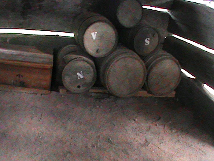
Supplies of rum, flour and gunpowder inside the fort's storehouse


Outer redoubt


Small canon


Indian Run

     The Indian tribes in collusion with France were comprised of the Huron, (or Wyandot), Nipissing, Odawa (or Ottawa), the Abenaki and Shawnee. Most of these lived near the Ontario region of what is now Canada.
                                             

The surrounding woods rang with the skirmish of July 3, 1754.


Ye ole bridge


     And finally...


Taking a moment scaring a few children

     (Um, just kidding about terrorizing any kids; for the record. Fortunately there weren't any around at the moment!)


     Well this was a part of the trip long overdue, specifically undertaken to a justly famed location. Here's hoping folks got some enjoyment from the experience mixed with rich educational underpinnings.

      To sum up, for a touch of edification , I included a couple of photos for the trip back north, the last two as part of the official National Battlefield: :

                       
The historic Stone House

                                      
A slightly earlier story in the life of George Washington


Wednesday, February 22, 2017

Fort of Necessity


   Right at the start, I want to get it in that I am in the process of celebrating...

 WASHINGTON'S BIRTHDAY! God bless him.

   Now, I hope you are at least aware of the holiday for what still matters to some people. The story of Fort Necessity fits the occasion almost down to a tee.

   All the visitors to the site are sincerely appreciated and I hope you are all doing fine.

    
   As is natural, we have broadened out over the years in to various area of interest. But, since we have gone some months without a new post specifically concerning those events in old Westmoreland and Fayette counties of southwestern Pennsylvania which originally brought the blog to your attention, I am aware of a certain impression a fair percentage of visitors are anxious to read more of our own locality. With that thought in mind, starting today, the next few posts should, with one minor exception, lead directly in that familiar and cherished territory.

   On another note, further historical information of a general sort (that wasn't meant as a pun) can easily be found on an early blog posting entitled, "French and Indian War Overview." Actually, I did this one in December of 2013, that's how old it is, but hopefully not completely forgotten!

   One point I continue to make is, never lose faith! 'Fayette/Westmoreland Forgotten History' does eventually get around to most of the promises and claims it makes in one fashion or another. You know what I say, it does take some time.


  Some Background

 This week, we are concentrating on Fort Necessity and Washington's role in it's creation, the battle fought here, and his love of the region in purchasing the property, kept in his possession until his death.


  This special reconstruction is located east of Uniontown, Wharton Township, at the Great Meadows. Go south on Route 40, you won't miss it. This is the history of the fort, as well as a commentary of how it was rebuilt and the prominent Sons of The Revolution who were instrumental in the exciting process.

  In early years, Fourth of July celebrations were held there, also at the Old Orchard Camp of Braddock's Road, according to pages 11-13 of 'Fort Necessity And Historic Shrines Of The Redstone Country', which I am fortunate to own an old copy of in reasonable condition. Some of the photos included are from this vintage book.

   Some historical underpinnings are required to better explain aspects of this cherished and unique structure, how the original came to exist in the past, and again in the future of this state and country.

  The New Fort

  The cornerstone for a monument was first laid in 1854.

  In attempt to accomplish this project various bills were introduced in the Pennsylvania Legislature, only to die in committee for one reason or another, mainly for a sad lack of interest.

   The author of 'Historical Highways', the famous Dr. Archer Hulbert, visited the locality in 1905 finding the structue's elusive fourth side , unearthing a part of the bark believed to be from the original stockade and therefore helped to lay out the probable shape of the fort. The fort's actual position was confirmed by Rueben Gold Thwaites.

  Key members of the Pennsylvania Society of the Sons Of The American Revolution of Uniontown proceeded by a joint resolution of Congress, created the George Washington Bicentennial Commission on December 2, 1924 when they initially met to iron out all the details. Present were luminaries such as J. E. Hustead, who became the first President, J. C. Whaley, and others. Once the application for a Charter was made and presented, the Uniontown Country Club was secured for the Benefit and first Banquet on La Fayette's birthday, September 6, 1926. This was soon granted and approved on Lincoln's birthday, Febuary 12, 1927. Thus the Chapter was formed on the same day as the Banquet with many toasts all around.

                       
Early photo of the Ft. Necessity battlefield site

 
  The first Vice-President was Harry J. Bell, he Secretary, J. C. Whaley Sr., with the Treasurer, Homer Hess. Many other prominent officials were involved, such as the National Geographic Director, Rulef C. Schanck.

  Once this took place, later the Chapter was incorporated on December 16 of the year 1930. It soon acquired 23 acres of prime real estate for the Braddock Memorial Park Association and donated a bronze tablet and $1,000 toward the restoration. Obvious it is, how urgent and important our historical data, restoration and preservation was in these heady glory days.

  Interestingly, to myself, although I haven't any proof these were relatives or ancestors, original chapter members included the likes of Clarence L. Wilson and L.L. Minor, as well as Judge Hudson Allen Beeson a descendant of Henry Beeson and James Veech himself. Who knows, an ancestor may be in the mix somewhere. Possibly one of YOURS!

   .The National Society of the Sons of the Revolution was called 'The Minuteman'.

  Through the project's efforts  they sent Dick Sherrick among others to purchase the farm of Walter Fazen Baker for the sum of $25,000. This had a large area of 234 acres for a National ans State Shrine and Park. Compatriot President Hoover signed a bill to forward this reality on March 4, 1931. On the 200th Anniversary of George Washington's birth, they successfully passed the resolution.

   Altogether, the members raised a whopping $4, 550. A pretty sum back then.

    The magnificent land was finally deeded to the country and especially the great State of Pennsylvania on March 21, 1932., which disbanded and dissolved the Braddock Park Memorial Commission through this endeavor.

   The Great Meadows also had and still has a DAR Chapter that help look after the grounds in various ways.

                                      
Fort Necessity monument


   On July Fourth it was once a tradition to hold old celebrations at the grove behind the Fayette Springs Hotel. By the way, the Old Orchard Cap was called Braddock Park, near where General Braddock was hastily buried and later re-buried.


  A Report On The Battle of Fort Necessity

    While the French had made their claim on the Ohio River Valley region as their own and preceded to influence many of the Indian tribes and drive out English traders, a young George Washington had already been engaged in midwinter of 1753-1754, in a futile effort which supported the plans from a large land grant for the Ohio Company centered in Wills Creek, Cumberland, Maryland, as emissary to the northern french forts. The warning was, of course, unsuccessful. The efforts to build a fort at what would become Pittsburgh at the forks of the Ohio found the small Virginian force outnumbered and driven away. Fort Duquesne was built in its place. Clearly, they were here to stay.

    After Colonel Washington and the Half-King Tanacharison's infamous Battle of Jumonville that began the French and Indian War against likely spies, the stakes were set for the next engagement of what is known as the French and Indian War, (and in Europe, the Seven Years' War). The only battle lost by Washington, his lone surrender, and this took place on July 3, in the year, 1754. More can be learned at the Fort Necessity website of the National Park Service.

     By all accounts this was a circular palisaded stockade of seven foot upright logs covered with bark and hides surrounding a small hut for ammo and various provisions made ready by early June, altogether his men came to nearly 400, while most of the Indian support had left the field. Unfortunately, the provisioning was hardly adequate. The French had as many as 700 men including their Indian allies which positioned themselves in the woods; Washington's forces remained in the drenched entrenchments with wet ammunition and meager supplies; not a situation in which to court victory.

                                               
An engraving of Washington in Council, from the Darlington Collection


     The number of the enemy was said to be at 700, which doesn't necessarily include all the Indians on the side of the French, while with the 100 of Captain Mackay's regiment there said to be as many as were 400. The toll of the dead was thought to be 30 dead and many wounded on the British side, and as many as 300 dead for the French. This would help explain why the French were so eager to parley with the new Lieutenant-Colonel Washington for negotiations.

    After the surrender, the negotiations led to a mistake in that his interpreter apparently didn't read french properly, Washington certainly could not, and the translated statement of 'killing" of Jumonville was taken to read "assassination", which Washington strongly denied. Such a condition may of been partly arranged by the leader of the french contingent and Jumonville's  older brother, Louis Coulon de Villiers seeking revenge. The fort was quickly emptied. What a blow this must have been to young George, the future general and Commander in Chief! We can rest assured he never forgot any of the experience. The Fort of Necessity was then burned on July, 4.

    De Villers went on to make an exciting attack on Fort Granville in the summer of 1756. He died the next year, in November, of small pox.

    The next year for the colonists was to see the building of Braddock's Road and the defeat of his forces at Baaddock's Field. That would not be the last word written on the subject, not by a whole lot.

   Mount Washington, the name given to the site of the battle and fort by Washington himself, was purchased by him in 1770 for the price of 35 pounds, 55 shillings. Our great general and first President owned the land until his solemn death on December 14, 1799. The Great Meadows were said by Theodore Tilton to be 'the Fountain Head of American Independence.' Who, then, would we be to argue with this bold, patriotic statement?


  As of late, the habit converges on two-parters. Since that seems to works well and I haven't heard any real complaints, there is no reason it can't continue a while longer. You shouldn't have much of a problem with the subject in question because the next installment does contain a certain surprise factor. That, and the fact that the graphically intensive photo opportunities are better suited to something less than a very long post. And, hey, everything just loads quicker too. So, wait and see!

 More To Come... 


Tuesday, October 13, 2015

Lingering at Fort Ligonier

    We will be addressing the important historical story surrounding Fort Ligonier. The subject is literally chock full of regional interest, involving as it does some significant places and quite a few well known and famous characters from our past.

   And what a story it is!

    I decided it well and proper to include a glimpse of the modern area and relate some choice details of the environs, for added interest. Here's hoping you find it enjoyable.


  The Township and Borough of Ligonier

    Ligonier is fifty miles east of Pittsburgh and can be reached on Route 30. The road itself is historically part of the 'Lincoln Highway', (the map of the official site is there to click on for your convenience), and runs right through the borough. With the notoriety of being the first transcontinental highway in the United States, the area was also served by the Ligonier Valley Railroad, going back to 1853.
 
   In the older historical matter both were basically carved out and formed in the 1760's. Ligonier is a borough, surrounded by the township which is a separate municipality, just so we have that straight! Ligonier encompasses the villages of Waterford, Darlington, Wilpen and Laughlintown. They are served by U. S. Rt. 30 and PA Rt. 711 near to Latrobe in Westmoreland County of this great state. By the way, Latrobe is the home of the David Strickler invention, the 'Banana Split' at Tassel's Drug Store in 1904 with 'Ice Cream Joe'. Thus we are again in the Laurel Highlands of southwestern Pennsylvania.

  Staying properly within the framework of this post, the Borough of Ligonier was incorporated in 1834. Colonel John Ramsey, who's house was later used as a tavern stand, (History of Westmoreland County, Vol. 1, John Newton Boucher, 1906), laid out the town with the distinctive diamond in the Historic District in 1817, somewhat reminiscent of Mt. Pleasant. In the early 1840's meetings were held to determine whether to create the county of Ligonier and the politics that went with that debate were all too evident. For example, similar meeting held in Donegal rejected the concept as "a wild scheme." Added to the National Register of Historic Places in 1994, there are many buildings in the Federal and Late Victorian styles of architecture. The old railroad station is eye catching. Sadly, the Ligonier Valley Railroad closed down in 1952.

  Originally called 'Ramseytown', then 'Wellington', the name of Ligonier was finally settled on . A word on that soon. Near here is Idlewild Park, one of the oldest amusement parks in the state and the country, founded in 1878. Many of us well remember the paddle boating on the lake, the large picnic area with our families, still very much in operation. There have been some interesting changes that space will not quite allow us to go into here. William Darlington gave the privilege of the land over to one Judge Thomas Mellon to use for picnics, campgrounds and fishing rights back in the day. It further contains the Olde Idlewild area brought in by 1931 which, of course, has the oldest rides there. At Idlewild you find the ' Hootin' Holler' western town and the Soak Zone. I think my favorite ride was the Tilt-a-Whirl, but the Caterpillar was nice as well. In 1981 Storybook Forest, 'the land of once upon a time' was included in the park ownership. It was built in 1956 with a rustic, nursery rhyme theme to it. Nearby, off of Route 91 or 110 of the PA Turnpike is the 5,000 acre Seven Springs Mountain Resort, the ski lodge in Fayette and Somerset Counties which started out as originating from a Laurel Highlands farm beginning in 1932, with fishing, hiking, golfing. shooting and many year round events. It has a history of it's own.

   The railroad, which relied on oral orders, not requiring written confirmations, experienced a tragic disaster in July 5, 1912 when a northbound locomotive collided with a southbound freight train. Most of it was shut down in 1952. There are said to be stations still standing, as it ran along the modern Rt. 30 by Loyalhanna Creek. A special note: watch your 'p's and q's' around here as they do have their own police force!


Early Days


  Here, where there was once said to be an Indian Fort of Delaware and Shawnees near what became known as 'the Post at Loyalhanna', Fort Ligonier, at 200 South Market Street, was built in 1758, and  was garrisoned for eight years. The garrison was considered a very important place of communication and also for the supply lines during Pontiac's War. The Catawba Indian Path crossed north-south through the valley. The Glade Path road drew east-west. Listen to a response to Virginia by then Governor Morris, "there is no waggon Road from Carlisle West through the Mountains, but only a Horse Path, by which the Indian traders used to carry their Goods and Skins to and from the Ohio..." The story of the Glade Pike is to be found more fully in a previous post on 'The Origin Of The Counties' from our last Fourth of July.

   Following the Governor's declaration, Colonel James Burd was commissioned with opening and widening of the Path, and that is exactly what he did. It didn't make it to the Great Crossings or the Turkey Foot crossing at Confluence either. Still, with help from Col. John Armstrong of Kittanning fame, and frontiersman George Croghan, the road penetrated into the deep woods of the Allegheny mountains. This was at the same time as the opening of Braddock's Road with the help of one  George Washington. More on him further on.

  
  Technically, the old fort on the 'Great Western Turnpike Road' was under attack twice and later decommissioned in 1766. Supposedly capable of holding as many as 5,000 troops, the fort was attacked by the French in October 12, 1758, of the same year. The modern fort is a reconstruction, very similar to the type of frontier fort of the 1700's as represented with the museum which retains period artillery pieces and rare paintings.

    By the way, a great place to visit is the fine Fort Bedford Museum of Bedford County.

   Laughlintown is said to be the oldest village in the Valley, laid out in 1797 on the old state road. A bustling place from the days of the stage coaches and wagon trains until the coming of the railroads passed it by. Boucher, (quoted above), claimed Daniel Webster passed through the area and Zachary Taylor graced it with his presence in 1848 for a reception, as well as at Ligonier House, built by Thomas Seaton, while Taylor was running for the presidency. I might also point out that the township once boasted of 22 schools. Henry Reed, one of the older settlers, owned the Freeman Farm nearby that was said to be occupied frequently, for a time, by Indians.

Earl of Ligonier

   Interestingly enough, Fort Ligonier was named after one Sir John, 1st Earl of Ligonier in 1766 and he then became Field Marshal. Ligonier lived from1680 to1770, dying at 91 years of age. A  French-born soldier for the British side in the wars of Queen Anne, he soon succeeded in becoming a Field Marshal under the then Prime Minister, the Duke of Newcastle, Thomas Pelham-Holles and Secretary of War William Pitt, of Pittsburgh fame. More on that to follow. He was a distinguished officer of Her Majesty's Privy Council and a member of the order of Knighthood known as the Most Honorable Order of the Bath, knighted by King George II, and was Commander-in-Chief Of the Forces, from 1757-1759, (of the British Army), under George the third.


Sir John Ligonier, circa –1770, wiki commons

    An interesting footnote of irony must be added here. Per: The History Of Westmoreland County by Boucher, pg. 593, Sir John's nephew, one Edward Ligonier, who himself had a fairly distinguished career including winning a duel against an Italian poet whom he felt, (and soon divorced afterwards), was making sentimental advances toward his wife, a daughter of the Lord Chancellor, came to America as a colonel of the Cold-stream Guards soon after the start of the Revolutionary War. "In 1783 he died in America, without children, and so the lordly line of Ligoniers died with him."


 A Description of the Fort

    The palisades of the fortifications for Fort Ligonier were over 500 feet long. This includes the officer's quarters, along with the soldier's cabins outside. The stockade had mounted cannon. There was a covered way leading to the spring on the east side for the ease of access to fresh water. A logged gate was held together with iron hinges.


Fort Ligonier barracks, courtesy of Wilson 44691


   There was said to be a smaller fort that was built by the local settlers near the creek bank sometime later, called Fort Preservation.  Nothing much appears to be known of it.

   Battle of Fort Ligonier


   The skirmish was sometimes called 'The battle of Loyalhanna', which occurred during the years of the French and Indian War, taking place in 1758 on October 12. Way back when we were still a British nation of colonies. This was a few years after the losses of the large scale Braddock Expedition and it's heralded failure to take Fort Duquesne on July 9, 1755 back from the French at the 'Battle of the Monongahela'. This was the second military attempt Washington was directly involved in. He was then at the ripe age of 23, though not as commander, but as aide-de-camp. The Battle of Jumonville Glen was, technically, his first battle and in that skirmish he was successful.

    The attack made on our fort in mid October the 12, at 11:00 a. m. in 1758, was ultimately unsuccessful. The French and Indians were repulsed from their positions within a few hours of fighting the British in total frustration on their part. A force of about 1500 under de Vitri approached from the southwest, against approximately 2200 occupying the fort area. Forbes' large army was yet to arrive there. The firing went on for approximately four hours. As Bouquet was absent near Stoyestown, James Burd was in high command. He deserved congratulations for keeping a cool head. In the evening, Burd threw mortar shells into the woods among them in answer of the Indian music played to them, and the French and their Indian allies retreated. The loss to the British was sixty three, but the loss to the Indians was said to be much greater, though the number was not recorded. The 50 days it took Forbes to reach the fort in very difficult terrain left the men exhausted and himself even sicker in his condition.


    From here, Forbes with Washington at the head and with Armstrong, the Kittaning hero, marched 12 days to reach Fort Pitt.
   

  Fort Pitt and Henry Bouquet

    Perhaps, now would be a good time to elucidate briefly on this Fort in Allegheny County as to being so closely tied to Ligonier. Captain William Trent's Fort being established early in 1754 and then a block house dating from 1764 at the forks of the Ohio River and the confluence of the Allegheny and Monongahela. This was a large remote supply post straddling the territory opening up the Western frontier. There is further intruiging material related in the 'Minutes of the Fort Pitt Society, DAR  of Allegheny County, Pa', from the late 1950's to the early 60's, and info on Daniel Brodhead, Hugh Mercer, and Lord Dunmore himself, though beyond the scope of this article. After the capture of what would become Fort Pitt, at the old Indian 'Shannopin's town', Henry Bouquet took on the provisioning and logistics of the new fort as well as building Erie and Waterford up north. The time: July of 1760 in what was really the molding of a true hero in his own right; a courageous, perceptive and level headed soldier, if ever there was one.

  With the situation favoring the British and the French abandoning their forts and territory, the Indians beefed up their defenses and returned to the offensive, By 1763 Pontiac's War had begun in earnest and on August 5 and 6, Bouquet then faced off a large force near Jeannette at the dire, as well as strategically meaningful, "Battle of Bushy Run", and you can find the exciting results of that fateful encounter at the link above. Thus, no siege of Fort Pitt was attempted ever after and troops were being withdrawn by the early 1770's, though during the mid 1770's it was refortified and temporarily renamed Fort Dunmore in the dispute with Pennsylvania and Virginia, but renamed Fort Pitt once again when the state lines were decided on permanently in favor of Pennsylvania. There is more to be seen on the 'Disputed Land' section of this post.

  Eventually, Fort Pitt was to be decommissioned militarily and replaced by the temporary Fort Fayette, at Ninth Street and Penn Avenue, in 1792. The nearby Fort Pitt Museum from 1969, cited elsewhere, is at Point State Park in Pittsburgh. Check out the Senator John Heinz History Center for more details surrounding the exhibits and highlights with video included.

  Later, on October 3 in 1764, Bouquet headed a force into the Ohio country to fight the Indians, the Delaware, (from the east), the Shawnee, (from the south),  and the Seneca's, (from the north). This was aborted by the attempt of the Indians to wisely sue for a delegation of peace and with a prisoner exchange, by the decision of the Indian Representative Sir Samuel Johnson. There was then no need for war after all. He then returned to Pittsburgh and had become a hero in Pennsylvania, without any fighting in this campaign. I t would suggest his reputation had preceded him! Unfortunately, he died from what was said to be yellow fever in Florida in the year of our Lord, 1765. He truly proved himself, under the able command of General Forbes, time and again, as a professional soldier of the realm.
    
   Rediscovering Basic History: Washington in Danger

   An interesting part of the colonial history of the fort is a narrative concerning Colonel Washington, who when out with a successful scouting party nearby, was mistaken for the enemy by the very man   that was sent to assist him, Colonel Mercer. Shots and volleys were fired and there were Virginians killed in the dim light of a questionable action. George Washington later made the statement that he was as close to being shot here and in more mortal danger, than he ever knew of being involved in!

  Indeed, during this time Lieutenant-Colonel Mercer got embroiled with a party of some French and  mostly Indians, a few miles from camp. Seeing the conflict was dire, Washington marched a group of volunteers near to them in the dark and they proceeded to attack each other. In the wild confusion Mercer, believing their party another deployment of the French, was involved in causing havoc and death to some. Washington appears to of made claims he deflected rounds with his sword. This was believed to of taken place,( according to the book, 'The Old and New Westmoreland, Vol. 1', on page 65), "where the Forbes Road crosses the Four Mile Run, about two miles south of Idlewild picnic grounds."

   Where did the enemy come from this time? From Ft. Duquesne, of course!
 
    The Fort was under the temporary command of James Burd, (1725-1793), of Redstone fame, while helping to build Fort Burd there in 1759. This was on what was an old Indian mound in Brownsville in the French and Indian War while the expedition of Forbes and Bouquet were underway. A story fascinating enoug to plan a future article on the subject. 

   Burd himself was from near Edinburgh, Scotland. He had arrived here about 1748, and lived at Lancaster County, (named after Lancaster in England), and he became the Justice there. He first commanded at Fort Augusta near Sunbury and was eventually promoted to Colonel in 1758. He resigned in 1776 from active military duty complaining of lack of respect and having issues with his rank apparently as well. ( This comes from Cubbison, Douglas. The British Defeat of the French in Pennsylvania 1758). His son, Edward Burd was a Revolutionary War Major of the mobile and fast moving, 'flying camp' battalions. Edward later became involved with the Supreme Court. He worked out of Reading Pennsylvania. He had the humbling experience of being taken prisoner at 'The Battle of Long Island' and was later released.


 Forbes and his Road


John Forbes, (1707-1759), was from Fife, Scotland. His firt rank of note was as a lieutenant in 1735 with old the Scotch Greys, a regiment of the Royal North British Dragoons. They were known to fight with muskets and bayonets. He had fought in the war of the Austrian Succession and the Jacobite Uprising in Europe. They rode on grey, (or gray), horses, possibly originating with the Dutch Horse Guards, hence the name. Fresh from battles in Nova Scotia, he was promoted to brigadier general.

 Here in Colonial America, his march to the west with an army of roughly 6,000 made him justly famous, with the accompaniment of Lt. Colonel George Washington and his second in command, Colonel Henry Bouquet, of Swiss nationality, with the Royal American regiment. This took in the added situation of possibly foolhardiness concerning the casualties of Major Grant's forces.

  Bouquet, originally from Switzerland, was from a well to do aristocratic family.  Forbes, the brigadier general, was not at all well, in fact, he was slowly dying and the journey was the last important experience of his tragically shortened life. This goes to show just how heroic his outlook was and the feelings this engendered in his troops with such a tenacious sense of duty to the country. His invalid state certainly caused Henry Bouquet to take on a starring role, as he was actually  forced to take care of much of the orders given by Forbes in the supervision throughout the long campaign. The more than 200 miles of road connected Philadelphia and Pittsburgh. Early on, he had a low opinion of the Pennsylvanians and their dislike of fighting wars on his entry in the state in 1756, although he managed fairly well, in spite of this. Like many of the old famous military figures, John Forbes has monuments of  a sort named after him. For instance, the Forbe's State Forest District #3, which encompasses the area of Ligonier and is centered in Laughlintown, also extending into Somerset and Fayette counties. For a more detailed look at his history, please click here for a description from the PA Museum And Historical Commission.

   Washington was well known to be vocally against the Bedford route, strongly favoring the southerly Braddock Road from Cumberland. He wrote in a letter, (according to 'The Old and New Westmoreland,' Vol. 1'), "I am just returning from a conference with Colonel Bouquet. I find him unalterably fixed to lead you a new way to the Ohio, through a road, every inch of which is to be cut at this advanced season, when we have scarce time left to tread the beaten track, universally confessed to be the best passage through the mountains. If Colonel Bouquet succeeds in this point with the general, all is lost, indeed- our enterprise will be ruined and we shall be stopped at the Laurel Hill this winter; but not to gather laurels, except the kind that covers the mountains." The Father of our Country appears to of been rarely inclined to some degree of exaggeration, at least in this instance.

   On the other hand, Bouquet wrote in a letter from late November 1758 "I have been long of the opinion of equipping numbers of our men like the savages, and I fancy Colonel Burd, of Virginia, has most of his men equipped in that manner. In this country we must learn our art of war from the Indians, or anyone else who has carried it on here." I will try to extend further this very brief relation to the politics between some of the Virginians and Pennsylvanians as a more thorough explanation in another post, if you don't mind.


    Traveling from the outpost of Carlisle, PA, he and his men, through rugged, tree covered mountains, built the 300 mile long Forbes Road, through the mid-section of the Appalachian Mountains of the Eastern Continental Divide, specifically, the Allegheny Mountain area. Breaking off from the Kittanning Path, partly follwong the 'The Raystown Path' or 'Old Trading Path' near that branch of the Juniata River. This path connected the Ohio and Susquehanna rivers from old Historic Bedford, named for the powerful Duke of Bedford of England. Near the northern parts of Will's Mountain you will discover the natural scenery in an area of extreme beauty, at least, this is my own opinion. With large forests and steep cliffs, and numerous picturesque streams gurgling through peaceful meadows, and yes, a real taste of deep wilderness still survives.


  Based mainly on old Indian and packer trails to the top of the Allegheny mountains,with the help of part of the unfinished Burd Road,  an ailing Forbes captured Fort Duquesne without a fight of any kind on Nov. 25, 1758 with 6,000 troops. This was caused by the strategic help from the abandonment of much of the Indian forces. Before this was the failed 'Battle of Fort Duquesne' involving Major James Grant of the First Highland Regiment. Later elected to the Parliament in Scotland,  he was an outspoken critic of the American cause to the point of using insults. Despite a successful career with the British, one could safely say, in this war, the last laugh would be on him. The French decided to have the fort burned. Later settlers came east through the road, much the same route followed modern Route 22 and Route 30, many going as far distant Kentucky and West Virginia, places that became future adjacent states. Some of the other paths connected the West Branch and the upper Allegheny as well and leading on to Native American villages in the interior the North west territory and of Ohio proper where the braver traders and hardy settlers came to build their log cabins. And soon the military were to follow the path of smoking ruins and bloody warfare with the Indians before the great migrations were long from settled.

   Forbes Field and Forbes Avenue in Pittsburgh were named in his honor.


Partial information from, (Writings of General John Cabot Forbes Relating to his Service in North America 1948)
                      
1562 Spanish map


  The Ligonier Highland Games take place at Altoona, off Forrest Street, near Lakemont Park every September and at Idlewild Park. They really prove very popular, like the 'Fort Ligonier Days' in the 2nd weekend of October every year. An exciting way to spend a day, with re-enactments, booths, music, redcoats, french troop, Indians and parade, yes! parades.

  Fort Ligonier has been totally reconstructed on eight acres of ground with an outer retrenchment of 1,600 feet surrounding the small 200 foot inner fort. A representation of Forbes' hut is right outside, along with a mill, ovens, and a forge. Inside are the basic gated bastions,


(angular fortifications structured on outward projecting walls of which there are several types), containing the officer's quarters, the mess, guard room, barracks, etc. There are manikins used simulating different military personnel at their posts involved in various functions. The 'Regulars' were for the most part, (properly called the King's Regulars), enlisted from abroad. The provincials and local militia were recruits from the colonies themselves. A fascinating glimpse into the frontier world in a historically significant area is to be gained from this unique place. Recommended highly and, very much, worth a visit.

More information can be gleaned from the Laurel Highlands Convention and Visitor's Center at 120 East Main St. and the Fort Ligonier website itself.

 I hope you enjoyed the article, maybe especially all the amazing prominent military characters being so closely associated with this particular region. This makes a man, and of course, a woman, very proud of their uniquely important historical past!

  Please continue to check in for more Fayette/Westmoreland Forgotten History' with yours truly, Histbuffer

Friday, July 3, 2015

Origins of the Counties of Southwestern PA

    Wishing you a Happy Fourth of July and Independence Day!

  And what better way to set off the celebrations and fireworks, than by recounting a past history of the counties of our wonderful and significant region.


General  Introduction


   This includes basic information gearing attention toward the formation of the surrounding counties of southwestern Pennsylvania, touching on the main highways, prominent figures and key happenings along the way. Hopefully the designation of this post is sufficient to the task. What I will not be doing is specifying much in the way of township histories, such is well beyond our immediate scope.

   Would anyone care to venture where the germ of this idea came from? Yes, there are those of you  checking the blog out more closely! It began , naturally enough with my write up of "Whiskey Mania in Southwest Pennsylvania" here. Of course, in writing on an expansive canvas with such a broad brush, this research led me further into the unique story behind the creation of our counties and their seats of government, with some historical anecdotes and photos to share added interest. So, let's make this an enjoyable experience as there are details I have learned along the way, "up around the bend."

   Before you know it, we can regain and incorporate much of our misplaced knowledge through  unique insights lending to reminding ourselves just where this all began. Polishing off old forgotten library books, turning them into a living, breathing source of regional, state and national pride. We will have also acquired a pocketful of shiny old treasure of a sort that cannot be stolen, but that can be handed out and passed on to younger generations for their future. When given away freely, the interest from this dividend continues to accumulate for a rainy day! Thereby, bit by bit, putting together the pieces of a fascinating historical puzzle to indulge in being a part of the panorama as it ever continues to unfold.

   Included in our survey are the following:

  Bedford, Somerset, Westmoreland, Fayette, Allegheny, Greene and Washington.

  I have decided not to allocate space for the make up of the old Ohio, Monongalia, Yohogania and District of West Augusta claims of Virginia in the dispute with Pennsylvania. This was favorably resolved in the interests of the northern state in the 1780's. The issue was addressed to some extent in the article linked above. Perhaps, this could be discussed with further detail in the near future.

   I allow room for a small disclaimer here that this is partly a learning experience for yours truly, and am not making definitive claims as an expert on everything about the surrounding counties. So, please do not expect this designation as originating at my expense. The data was taken from the basic sources and is believed to be ascertained as factual.

  Now that we have settled this important observation, without further ado, let's begin the exciting journey wrapped up in the intriguing southwest Pennsylvania region!


The first county to be reviewed is ... (drum roll please)... Bedford.


    Bedford  County

  With references from the Old Glade Road, 1941 by William H. Coleman, Bedford County was originally formed from old Cumberland County, a part of the territorial dispute of Maryland, on March 9, 1771. In 1772, in a July Term of Court, the Brothers Valley inhabitants petitioned for a road, and everyone would like to expect their government provide at least one of these means of travel. "The petition asked that the road begin at Bedford and run through the Glades of Yough and Stoney Creek and by Sewekely to the River." (Thomas Kenton was one of those six viewers). They later stated, "To the thirty one mile tree from Fort Pitt on General Braddock's Road where the same crosses Sewekely Creek being in the whole sixty seven miles, which road as it is above described and laid out..." This was then cut and cleared and is the creation of what was the old 'Glade's Road'.


  Bedford is a very historic borough and the county seat of the same name, originating from the military Fort Bedford near Raystown. This was under the able command of Henry Bouquet for the Forbes campaign during the French and Indian War era. Bedford was intially laid out in 1766 and incorporated on March 13, 1795. Near a strategic spot on the Juniata River, it was named in honor of the Duke of Bedford who was a prestigious member of the peerage of England. Bedford was heavily involved with the Black Boys Rebellion.


   The Espy House was known famously as the headquarters of President George Washington in 1794 during the infamous Whiskey Rebellion. Much of this centered on Jean Bonnet's Tavern erected and established sometime before 1779 and purchased by Indian trader Robert Callender, it is a justly well known landmark on U. S. Highway 30, listed on the National Register of Historic Places. The Bonnet family of West Virginia are direct descendants.

         
Bonnet Tavern, from the Library of Congress

   President James Buchanan made the Bedford Springs Hotel his "summer White House" for the supposed curative properties of the water there. It and the Chalybeate Hotel had seen visits by Presidents Polk, William Henry Harrison, Taylor and Hayes. Benjamin Harrison also visited. The Bedford Historic District is on the National register of Historic Places since 1983 The Lincoln Highway also passes through Bedford.


  A word on the Glades Road, or the Glades Pike, (depending on what is the exact vicinity encountered). Once a prominent Indian Path, it traversed from near Mann's Choice at the intersection of Rt's 31 and 96, then near Roxbury, following part of the Burd Road, possibly passing somewhat north of Somerset near to Allegheny Township, and then Lavansville and Bakersville. Then heading near to (William) Jone's Mill at the west of Laurel Hill, proceeding to Four Mile Run north of Donegal and Acme, then back south toward Laurelville on present Rt. 31 again. From there at the bottom of Chestnut Ridge on through near the dividing line between Fayette and Westmoreland County and Mount Pleasant passing Ruffsdale toward the Sewickely and the West Newton area, used  by Putnam to what became West Newton in 1788, basically said to be following Rt. 31 most of the way to Braddock's Road, then a part of the road ran on to McKeesport. Crossing at the 'thirty-one mile tree' near one mile west of Hunkers. It extended to the west of the Youghiogheny near to Budd's Ferry in Washington County. This is as "are shown on Reading Howell's Map of 1792".


    Somerset  County

   At a dim time early in it's history, the region was inhabited by the agricultural Monongehela people of Native American origin. By the mid-1700's began an influx of Scotch-Irish, English and German immigrants like the Bruner's, Weyand's and Putnam's, bringing a hardy brand of pioneer spirit to the mountains and rivers as they built their cabins and reaped the harvests of early farmland.

  The county of Somerset was created on April 17, 1795 out of a part of Bedford County. It was named after Somerset, a shire in England. As an aside, this is partly where we derive the word sheriff from, a legal figure with responsibility for a regional jurisdiction as a  'reeve', an old English or Anglo-Saxon term comparable to a constable or earlderman going back before feudal times; 'shire' 'reeve', there you have it.

   Somerset borough was first laid out in 1795, as many of the earliest settlers came to Turkey Foot. The first court was held on Christmas Day in 1795 and the first courthouse was built in 1800.  Incorporated in 1804 is the county seat with Quemahoning, Lincoln and Jefferson Townships to the west, and Stoney Creek and Brothers Valley Township to the east. The borough is surrounded by Somerset Township, with the Walter's Mill Bridge of 1840 and the old Georgian Zimmerman mansion as just a few of it's attractions. The courthouse itself, administered by a seven member council near where U. S. Route 219 passes and Rt. 31 going east-west through Patriot Street and the center of the borough. This construction occurred in the very early 1900's on land deeded by Adam Schneider, a veteran of the Revolutionary War and important contributor to the town, in 1795. It is pictured here and is on the National Register of Historic Places since 1980.

   
Somerset County Courthouse, East Union Street, (canadian2006)


There exist the Uptown and Downtown Historic Districts with the Patriot Street School of 1906 and the Old Jail and Sheriff's residence of 1856. Harmond Husband from Coffee Springs Farm near here, of the less radical element of the southern Regulators, famous for his part in the Whiskey Rebellion, lived near here. The Berlin militia was involved in putting down the insurrection. Much foment took place at Webster's Tavern at Brunerstown, which became Somerset, off of exit 110 of I-70 and I-76. John Wells involved with the Melish-Whiteside map, lived east and slightly north of Husband's Mill and factory.

   The Historical and Genealogical Society of Somerset County, established in 1959, uses the Adam Miller house on the grounds, by Dr. Earl Haupt from 1955, it was built in the late 1790's. The Somerset Historical Center itself first dedicated in 1970 and expanded in 1997 and contains structures and various departments of significance. Eber Cockley was the first president of the Laurel Messenger publication, celebrating with the Mountain Craft Days every September with potters, stone masons and black smiths demonstrating their vocation.

   Somerset even has a crater named after it on Mars!


  Greene  County


  Named after the Revolutionary War Major General Nathaniel Greene, 1742-1786,  known for his success against Cornwallis in the Southern Campaign, Greene County is at the extreme south west of Pennsylvania. The county was established back in 1796 and carved out of Westmoreland. It is separated from Fayette by the Monongahela River, on the north by Washington County, and on the west and south by West Virginia. Originally, the area was mostly the hunting grounds of the Iroquois from the north.

  The Major General hailed from Rhode Island, in Warwick, from a somewhat controversial and prominent background. Starting out with  his personal study of books on war, rising from a lowly militia private to one of the most respected and knowledgeable military men of his age. He was banished from the Quakers for his views on war and the defense of liberty.

   The county seat is the borough of Waynesburg, where the County Courthouse and Greene County Jail are located. Named for 'Mad' Anthony Wayne, 1745-1796, a famous General of the War For Independence. The earliest census was in 1870. The Waynesburg and Washington Railway was begun in 1874. Home of historic Hanna Hall built in 1851 and Miller Hall. Wayne was head of the Legion of the United States protected by Pennsylvania Long Rifles and based and specifically  kept at Fort La Fayette, replacing Fort Pitt, in what is now Pittsburgh. Something the tri-state area should be particularly proud of with that honor of the origin of the American Armed Forces. Also it was the embarkation of the preparation point for the famed Lewis and Clark Expedition to the far west. He it was who broke the will of the Natives in their fight to regain control of the Ohio country.
(Some of this information is taken from 'History of Greene County', of 1888).

   Rice's Landing, a small borough on the Monongahela River incorporated in 1903, and mapped out by none other than Benjamin Franklin, is ingrained with the story of Washington's stay nearby. In 1786 John Rice settled here on Enoch's Run, now Pumpkin Run. Am important passage with much trading, shops and taverns where the industry eventually centered around the W. A. Young and Sons Foundry And Machine Shop.


    With the Greene River Bike and Walking Trail and the Historic District and it's quality remnants of old industrial buildings, it is on the National Register Of Historic Places.

   The Fisher Indian Site in Richhill Township on Wheeling Creek in the northwest. Ryerson Station State Park here was in dispute in 1792 with the Indians and Virginia for some years. A significant site of the reputed Monongahela Culture of the Late Woodland era, (believed to be ancestors of the Shawnee indigenous peoples), has seen 1,100 artifacts recovered, not counting what was taken by locals from the 1940's on. Now we must move on to other pastures.

   
Fayette  County
 
   Founded on September 26, 1783 and formed from Westmoreland County, (originally taken from Bedford), with the county seat occupying Uniontown, Fayette County.

 Uniontown

Uniontown once known as Beesontown for founder Henry Beeson and is on the National or Cumberland Road. It was a major area of conflict in the Whiskey Rebellion and as those most interested in our regional history well know, was named in honor of a fascinating figure, a loyal patriot to his country and a hero of the Amercian cause, the Marquis de Lafayette.

   The 'town of Union' was founded on the historical and important date of July 4, 1776. That's correct folks, quite a coincidence.It held a large role in the days of the Underground Railroad. It eventually grew into a main town of steel mills and coal mines, experiencing part of the bituminous coal miners strike of 1894 and the violence included the killing of five miners and the wounding of eight from fifteen heavily armed guards. Although the Downtown Historic District has the honor of being listed on the National register of Historic Places, unfortunately, as with so much of the rest of the county through dreaded deindustrialization, it's influence has steadily declined economically since the late Twentieth Century.

  The first courthouse of East Main Street, (old Elbow Street, for its shape), was built in 1796, the last was in March 1847.

   Lafayette the Patriot


La Fayette as a Lieutenant General, 1791


   'The friend of Washington, and the friend of liberty', as stated by Andrew Jackson, Gilbert du Motier was born at the Chateau du Chavaniac in Avergne in September 6, 1757 and died on May 20, 1834. Of French ancestry and a capable military commander and an aristocrat, he married Adrienne de Noailles in 1774 and had three children. He was made an honorary citizen of the United States, with only six others noted for the privilege, and was made a 'natural born citizen' in 1784, as well as his heirs, by a resolution of the Maryland General Assembly in Annapolis before the ratification of the Constitution. As suggested in the above paragraph, La Fayette, in spite of his impetuous limitations in some areas, was one of Washington's closest friends and confidantes and many places here are named after him, and still is counted as a true hero of the Republic. Jefferson even offered to make him Governor of Louisiana!

   He had voted against the death of the King of France, but was considered a traitor for not attempting to save Mare-Antionette from the guillotine. A prisoner of war in Austria for five years, he lost many of his holdings and stature, though thoroughly compensated in later times. He eventually made his escape, having been mistreated and regaining his health, then made his way to the newly created United States. His second visit was in 1784 and in his last arrival to these shores was for his triumphal tour in 1824, which lasted over a year, as an elderly statesman of France. During the French July Revolution of 1789 he refused the offer of Dictator and was heavily involved in the first Constitution of 1791. As related by a 1919 article of the New York Times, he lies in Vicennes in Picpus Cemetery buried in American soil from Bunker Hill that he took with him on his last voyage.

Washington's Personal Connection with Fayette County

    George Washington traversed the area in the 1750's on his expeditions and in 1754 more thoroughly as a surveyor, traveling also from the Alleghenies to the Monongahela River and at Redstone Old Fort, a prehistoric earthwork and an area concerned with Nemacolin's Trail of the Indian guide and Shawnee Chief which passed ner to Confluenc and held close to the Youghiogheny River. Nemacolin's Castle eventually became Fort Burd used as a trading post in the 1780's.

   In Fayette County, Washington did battle with the French when he was 22 years old at Jumonville Glen, near what was Dunbar's Camp, the famous 'shot heard round the world' of the western counterpart of the Seven Years War, known to us as the French and Indian War. Later, he, along with the presence of the famed frontiersman Daniel Boone, Christopher Gist and other later famed men, helped pave the way for Braddock's Road, connected with the Ohio Company and further constructed in 1751, much of which was in the confines of the county. In the summer of 1754, the outcome was much less fortunate as Lieutentant Colonel Washington held a small 'Fort of Necessity', on the great meadows, a National Battlefield Site near Farmington on the old National Pike. Located on the eastern parts of Rt. 40, ithe fort was said to of been built as much to keep the militia from getting to the stores as to be used as a last ditch defensive effort. I'm not aware of the truth of this supposition. Nearby is Braddock's Grave and historic monument, where he died in 1755 in an area, somewhat controversially considered British soil! This was Washington's only defeat amid lack of supplies and wet powder.

   He owned this land and other areas with parts of Perryopolis and old Bullskin Township. The county was settled by many Scotch-Irish and German immigrants. In the mid to late 1800's it became the center of the rich coal mining and coke production which brought in an element of people from eastern and southern Europe. The steel mill collapse of the late 1960's and 1970's brought large spread decline to the economy of the region.

   Fayette County is surrounded by Westmoreland on the north, Somerset on the east, Greene to the west and parts of West Virginia and Maryland to the south and contains 24 townships, with sites such as Friendship Hill and Fallingwater, 48 historic markers and to some, the most important of all, the birthplace of the Big Mac!

   For more information check with the Fayette County Historical Society, once known as the Uniontown Historical Society.

   By the way, it is stated that the Assateague tribe, a probable sub group of the Naticoke in the 'lower counties' of Pennsylvania more toward the east. They spoke a form of Algonquian. In the mid 1700's many emigrated to the Susqurhanna region who were themselves defeated in 1675 by the Iriquois Confederacy, and on further into Canada.Some Nantikoes, (possibly referring to a part of the Nanticoke tribe),  were known by whites as the Conoy and considered part of the Picsatawy Indians.

   Westmoreland  County

   Westmoreland County, 'the Star of the West' of the Laurel Highlands, established in 1785 as Newtown, appropriately enough, after the burning of Hannastown founded in 1773, the first county seat. Progressing into an incorporated borough in 1799 named Greensburg, named after Nathaniel Greene, a Continental and Revolution Era major general, as was Greene County with explanations given previously. A certain amount of what was written concerning Washington and General Braddock in other posts that can be located on the blog, could be repeated almost verbatim, as they traversed what was narrowed down to the modern day Westmoreland, as well.

   The courthouse originated with an act of assembly of Sept. 13, 1785. This took some time, since the burning of Hannastown which was previously the county seat, which caused enormaous hesitation in relocating it further south, especially as Allegheny had yet to be formed and there was added pressure to locate it there with infighting and finagling. Much positive work was done by Christopher Truby, William Jack and Michael Rugh. They then made land purchases and laid out the lots for what was to be called Newtown, appropriately enough.

  In a report of Simon Drums old tavern stand, it was said that, in 1785, "the devil came to this house, "to dance away wi' the excise-man" !

  More On Greensburg

  In 'Dutchtown' there was an inn kept by John Kuhns. In 'Irishtown' there was an the "Federal Springs" tavern of Frederick Mechlin, of a seemingly non-Irish name. There was the Greensburg and Pittsburgh Hotel and the ' Dublin Hotel', which stood on Green Lane. The public common was "a short distance north of the end of East Ottoman Street" and near the Presbyterian Meeting House, according to "The History Of Westmoreland County, Pennsylvania" on page 502. This is where the first schoolhouse was built, very near to St. Clair Cemetery with the elegant spring. The monument to Major-General Arthur St. Clair is in the southern part of the cemetery and is twenty feet tall. He died August 31, 1818.
 

uploaded by Ichabod, Wiki Creative Commons

   This region has the distinction of being the only county in Pennsylvania west of the Allegheny Mountains in the old days and it was named for the historic county of England. Westmoreland County is surrounded by 8 other counties, those being, Armstrong to the north, the northeast by Indiana, Cambria on the east, Somerset in the southeast, Washington on the southwest, with Fayette on the south, Allegheny on the west and finally, Butler to the northwest. The Westmoreland Historical Society is located off the historic Lincoln Highway on 362 Sand Hill Road.

   Mount Pleasant is the oldest borough in the county, (1828), with Youngstown in 1831, and New Alexandria and Ligonier formed in 1834. With attractions like Seton Hill College, Bushy Run battlefield and the Adam Fisher Homestead.

   Allegheny County

   Referenced as being the home of the possibly mythical Allegewi Indians, and later, the Mingo, Delaware and Shawnee tribes, the Indian traders migrated here early, such as Peter Chartier of the 'Pekowi' or Piqua division of the Shawnee Indian tribe, to Shannopin's Town, who came to side with the French cause. They are known to history somewhat as more of an Ohio based tribe as they moved through here to the western regions. Later, Chartier's Creek became extremely polluted by acid and industrial run off and sewage overflow.

Wikimedia Commons public domain,
   Chartier's Old Town established in 1743

 The county was known far and wide in modern times for the production of steel mills, glass, river port cargo haulage and even oil. Now it relies more on technology, healthcare, Marcellus shale and financial services. Note: Do please keep in mind, this is a condensed version and many details like the highways, public transit, most of the famous buildings, radio stations etc., have been related in prominent fashion, ad infinitum in various sources. This will be, by necessity, dictated only in brief and that might be seen as a relief for this brief rendition.

   Allegheny is divided up into forty two townships with two of those containing Fayette names. The popular professional sports teams centered in Pittsburgh, the county seat, more on that later, are the Pittsburgh Pirates baseball team, the Steelers football team and the Penguins hockey team. They use PNC Park, Heinz Field and the Console Energy Center, respectively. It would be interesting to be able to give a relation of their history, but even a brief Wikipedia type rundown would be well beyond the scope of this article, including the teams of the colleges as Duquesne University and Penn State. To this cause, I am planning articles of the major sports teams on FWFH.

   Allegheny County was settled by the English, thrifty Scots-Irish, industrious German and Welsh immigrants.
  

flag of Pittsburgh

Brief history of Pittsburgh

   Often claimed to be one of the most livable cities in the country, originating in the mid-eighteenth century, Pittsburgh, built on the site of Fort Duquesne, home of the Fort Pitt Museum, is known as the "steel city' and steeped in ethnicity. With 446 bridges with it's convergence at Point State Park, is of course is the cultural, demographic and economic leading city of Appalachia on the Allegheny Plateau and the Ohio Valley region of western Pennsylvania. The only larger city in the state is Philadelphia. It lies at the confluence of the Allegheny and Monongahela rivers and the source of the Ohio. The city was named from the humble beginnings by the Scotsman, General John Forbes after Bouquet's Bushy Run victory in the honor of William Pitt, the British statesman in 1758, and building began here.


Alright, now this was a very old pivotal home to the Mound Builders of the mysterious Adena Culture, the prehistoric Hopewell Culture as well, which are highlgihted by places like McKees Rocks,(where 33 skeletons were found),  and later tribes of Native American Indians. Logstown was approximately eighteen miles down river and to the south of Pittsburgh. The Seneca Shannopin's Town, temporary home of Queen Alliquppa in the 1750's, was on the eastern ban of the Allegheny; Sawkunk or Sawcunk, on the Beaver River housed King Shingas for a time The township was incorporated in 1771 and the borough in 1794. France ceded its territory by the Treaty of Paris in 1763 when Fort Pitt was under a siege for two months when successfully relieved by Henry Bouquet after the French and Indian theatre and extension of the Seven Years War, beating out the Shawnee and Delaware from the area. While, a short time later Britain lost any legal claim to this possession, specifically in 1783, after the War of Independence was won by the United States. 
 Despite much affluence of the largely Scotch-Irish iron and steel mills, and a sort of renaissance in the middle of the 20th Century centered in the Hill District and Eat Liberty, the city experienced serious decline with massive closures and layoffs from stiff foreign competition, hostile management and the effect of the unions by the 1970's and 80's. Much, much more could be related about this great city west of the Alleghenies, and yet, I could hardly be able to keep it brief, ballooning out of all proportion. For example, there are at least 12 universities residing in Pittsburgh.

   Famous People:

  Obviously, from the Golden Triangle on around, there are too many to count, so we'll narrow it down to the most famous and most well known.

   George Westinghouse: Born of German immigrants from Massachusetts in New York on October6, 1846, George Westinghouse Sr. was an inventor. Following in his footsteps, the son became an assistant engineer for the U. S. Navy and also spent time in the New York Cavalry. he made many inventions, and example would be the air brake. Then he began working with the railroads and his own steel works and in 1886 formed the Westinghouse Electric Company and had extensive works near East Pittsburgh. He also got into the production of natural gas and was soon a multimillionaire and he won many awards and accolades.
S. Jarvis Adams, born in 1837 was an industrious man of many inventions himself known for his iron plants.

Henry J. Heinz born October 11, 1844 in Pittsburgh, PA, was brought up in a Presbyterian religious family. He started out as a bookkeeper and a grocer, then working in his father's business of brickyards and with his own company active on many boards and universities. He was a famous Republican as well.

 Andrew Mellon son of a financier and a judge Thomas Mellon: the Scot. They were from Westmoreland County and Andrew bought himself a farm in New Salem. He formed the Mellon National Bank and was a great admirer of Benjamin Franklin.

courtesy of Wiki Commons, public domain

At one time this was also a part of West Augusta, Virginia, until the settling of the Mason Dixon controversy in 1780. It is believed the location was first observed by the white man in 1669 by La Salle's expedition when the Shawnee roamed the area at the bequest of the Iroquois of New York.
 
 Once within the confines of Bedford County, Pittsburgh was within Pitt Township according to a Wikipedia article that can be verified. Under the Penn leadership, one Thomas Viceroy actually laid out the town plots.  The 'Great Fire' began by sparks heating wash water and enveloping a cotton factory, destroyed much of the city in April 10, 1845. After rebuilding it experienced rapid growth with the building of the nearby Pennsylvania Canal system, but within an unequal infrastructure, causing problems later. By the early 1800's with the iron production the was coal dust everywhere and for many years under a pall of black gloom. The place of origin of the Republican Party in 1856, (that's hard to imagine), it then saw the rise of Industrialist Andrew Carnegie's U. S. Steel company and the merging of various neighborhoods.


    Washington  County

 Carved out of Westmoreland County, and not a center of pivotal occurrences within it's southwestern boundaries, what would become Washington County, Pennsylvania was a key part of the dispute between Penn's colonial Charter and Virginia's jurisdictional dispute. The Whiskey Insurrection and the building of the National Road was also prominent to the region, (source-History of Washington County, Pennsylvania, main author, Franklin Ellis, 1882).

 The county seat is Washington, a borough with the distinction of visits by fifteen, count them, 15 presidents of the United States! Later it was settled mostly by Scots and Irish. Originally, it was held by "Catfish", a popular name of the Delaware Chief Tangooqua, near Chartier's Creek in the 1750's. This was a key area of rebellious citizens involved in the Whiskey Rebellion of the early 1790's, and of particular important was the politician and insurrectionist David Bradford, a trustee of Canonsburg and Jefferson colleges. He was finally received a welcome pardon by President John Adams. The borough was incorporated with some lots officially given to George Washington, on Feb. 13, 1810.Don't forget this, it is also the home of the Pennsylvania Trolley Museum, by all accounts a really informative and fun place. It is justly famous for the oldest known ancient Rockshelter archeological site in the New World of Meadowcroft Village, in Jefferson Township, once inhabited by the Monongahela Culture and Peoples.

  Surrounded on the north by Beaver County, on the northeast by Allegheny, on th east by Westmoreland, Fayette, and also Allegheny; on the south by Greene County and on the west, by the state of West Virginia. The main waterway is the Monongahela River which rises in West Virginia and flows through the southeast of Greene County and then flowing northward marks the eastern boundary finally arriving at the confluence of the 'Three Rivers' at Pittsburgh. There are many creeks which flow from the east to the 'Mon'.

   Created in March of 1781, the county was once occupied by bands of the Shawnee, Delaware and Mingos with those representatives of the Six Nations who had, more or less, temporary camps or villages there, such as Catfish. But, according to Ellis' Hisotory of Washington County Penn'...it was the old Delaware, Catfish from Wash. County on the Wissameking creek around 1770, who talked of opening a road to the Allegheny saying " we have found it a very Good Road, and all our (11), Nations will use this Road for the time to come." Interesting quotation, if this is not meant more as an allegorical or figurative statement.  After Dunmore's War the area saw much in the way of incursions and massacres from 1774-1783.

File:WandJCollege-OldMain.JPG
'Old Main' of Washington and Jefferson College

    Canonsburg

     Well known for Budd's Ferry and the Black Horse Tavern, the borough was laid out in the late 1700's by Revolutionary soldier, miller and justice, John Cannon and incorporated in 1802.

          
John Cannon's Mill


  Colonel Cannon may of served on the Provincial Council of Pennsylvania in Philadelphia, although this appears to be unclear. He also constructed the Stone College building and the Canonsburg Academy. He passed on in 1798, an invaluable key figure in the early organization of Washington County. Canonsburg became an area of coal mines and steel districts, with several railroads, while famous male pop singers like Bobby Vinton and Perry Como called it home. With the introduction of the Standard Chemical Company of the early 1900's, it was once called 'the most radioactive town in America'.

    In miniature, this is the origins of our counties. I realize there is much information which could of been included, excepting that the main purpose was to present a brief, inclusive presentation that could meet the need toward a view of the key points of our county history and I feel that is accomplished. If anybody thinks important issues or facts were left out, do make a comment below and I will consider your point.

    Thank you for your abiding mutual interest in our great history. Have yourself a good holiday!
    ~ Histbuffer/Alan Wilson

Contact Form

Name

Email *

Message *