Showing posts with label East Huntingdon. Show all posts

Monday, March 9, 2015

In Like A Lion

 A Foreword On A Published Article


 If there is anything I really love doing, up high on the list, is being able to inform people of our fascinating regional history. A close second is the learning experience acquired through this very research and the people and relatives you get to know along the chosen path. The School of History is an awesome place, have you taken a few courses? The Degree is your own satisfaction of gaining a meaningful understanding of times and locations which may involve some time, but totally worth the endeavor, I promise!

 First, but not necessarily foremost, I want to draw your attention to an article I published for the Bullskin Township Historical Society, Volume 4-Number 1 of the Spring 2015 edition. This is a condensed version with some adjustments of my two in depth posts on the 'TFR', The Forgotten Turkey Foot Road...' and 'Turkey Foot Road Remnants...' I admit to feeling some pride in this accomplishment. In fact, I find it very exciting! Although the material was fairly easy to transfer, narrowing the scope for the most important information into a two page story was a mite more of a challenge and yet a good experience. I thank the Society for allowing me this opportunity for betterment and enlightenment of the regional community. There are GOOD, quality articles in there as well you should find entertaining and intriguing, so for more information you can check this LINK!

 COLD Spell

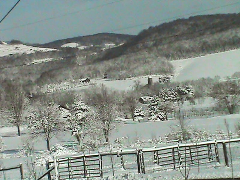
Although our region experienced much cold this winter with some very frozen nights, the white stuff  came in doses of one or two inches. No, we haven't graduated to weather forecasts on FWFH, rather here are a few picturesque views from the large storm from the early March of this year.

   In the old days, and some of us remember a few of those extremes in weather, people had to dig there way out of their homes the best they could to get to the grocer, the post office, or just over the farm lane to the cow pens after a windy night. We don't have it as bad as all that, but getting to and from work and school can still be a harsh reality for many.

  The day after the storm of March 4 was a sunny day, not too chilling and a ride around Upper Tyrone, Bullskin and East Huntingdon was certainly in the cards. So, take a little diversion and hope along with me this is the last snowfall of this caliber, and soon we will be seeing the grass turn greener and the first timid buds of spring arriving!


    The caption from the above photo gives a description of the area where some of these were snapped.


        Ah, blue skies and...snow, plenty of the stuff.


     Can you guess where this is?


A bend in Valley View Drive at South Everson near the Braddock Road


    Above is the South Everson portion of Valley View Drive just north of the St. Joseph Cemetery. Near this stretch was an old trace that could pertain to the Braddock Road that deviated quite close to where the photo was taken.


    This was not actually from part of a wilderness trek, far from it, just a backyard fir tree!


     A path 'around the bend'. Sometimes our course takes us through some chilling places, though often there is beauty along the way.


    This photo is looking east toward the lessening heights of the Chestnut Ridge and the Ore Mine Hill region. In the foreground is a rural scene of Woodale.


    There absolutely HAD to be at least one farm scene  ; )
   
A small wooded area covered in snow in Alverton


B'rrr  !


     Like many of you, I sincerely wish this is our last view of ice on the gutters from the freezing winter of 2014/2015. I'm sick of the cold, to be perfectly blunt. Well, let's keep our fingers crossed. Those with snow mobiles and skis can ignore my rant against the cold. Even those hearty ones must admit SUB ZERO numbing weather is not necessary to experience fun in your travels. The snow itself is a beautiful sight, isn't it really?

   Today on Monday, the temperature reached near the balmy high of 50 degrees. Ah, is that a slight whiff of more pleasant climes and the reawakening of warmth around the corner? Nudging of seedlings deep down and the song of a lone robin on the crisp wind? Just maybe...keep your fingers crossed.

   I'll be back soon with a brand new entry as we thaw out. Keep Checking In!

   ~  Histbuffer


Monday, February 16, 2015

Lost Toll Houses

  Once again, Blogger 'thinks' I published this new post when I first entered part of it into draft form!

  SO folks, here is a proper link to FORGOTTEN TOLL HOUSES OF WESTMORELAND COUNTY. I hope you enjoy it!

  ~  Histbuffer

Sunday, October 5, 2014

Forgotten Toll Houses Of Westmoreland County


  The Toll Gates Of Route 31


 Come on in and make a pit stop on Fayette/Westmoreland Forgotten History and let life slow down for a couple of minutes. Go ahead, sit back, relax a moment with your favorite brew and join us here at my homey site for a scenic discussion where you're always welcome.

Improvements in Historical Awareness and Signs of Neglect


    I feel the need to try do a part, however small, toward bringing attention to these more unique areas enveloped in our local places, hamlets and boroughs. I admit it is limited, yet I have experienced some success. Here our interest is with the townships of Mt. Pleasant and East Huntingdon. There are parts of the southwestern counties that might seem neglected here and I apologize and will try to rectify this oversight as I learn of more distant things.

    Happily, in recent years we have seen improvements in the "coal and coke" walking trails. An example would be the Allegheny Passage; bicycle paths and picnic areas are greatly improved. In many locations signs and routes are easily discoverable and it is a smooth transition to get a hold of good information and keep it at hand. Dunbar has its own reconstructed coke oven for all to observe and admire. Look at some of the developments at West Overton Village. Connellsville has seen the return of the Canteen and railroad museum pieces to their proper place. That reminds me, these two wonderful places and projects will certainly garner a future post! Mount Pleasant has much going for it as well. The website alone of the Society at Bullskin has links to many interesting topics as the Ore Mines, old soldiers, lots of b & w photos, the list of township schools, churches and much more.Though we are hardly in a position to assess their historical society by any means, Scottdale, itself is, well, doing some kind of flower pot arrangements on Pittsburgh Street with brick paved walkways. I confess to being ignorant of the meaning, beyond beautifying the town and an immediate result is restrictive in the sense of a few less places to park a vehicle. So, maybe judgment should be reserved, at least for the time being. We can hope, folks. The historical society is quite partial to house tours, painting and the occasional geocache. There are likely constructive projects in other areas and they have a fairly decent Facebook page.

   These enhancements are only seen and earned through hard work and genuine effort, of which everyone that takes part should be proud. Accolades go to those that put in the extra time and there is an intrinsic trust of the newspapers that do their part in acknowledging them. So, I might add, shouldn't those less inclined to be informed, grab a moment to reminisce on their personal memory lane? If you visit the posts regularly, you probably knew that was coming!

    Preachiness does have its limits and much indeed has been accomplished. So, on the lighter side we have in our midst an impressive renewal of historical societies and organizations. Nobody knows our towns and villages as well as those that live there. Sometimes it seems so much of our cultures and communities are left in the unsure, and sometimes tainted hands of others with differing goals. Though shamefully, funds have been threatened to be "turned off" to many important places of great historical intrigue and import in our state in exchange for more government buildings, offices, raises and what not. Much of the slack is taken up by grassroots movements, charity and books and newsletters. Thankfully, there is the 'little 'guy'...and maybe more frequently, the 'little woman,' as well, and here's to them!

  Yes, it is to be admitted there are regions and cities more prominently displayed and economically sound that might give the onlooker an idea of a more pivotal standing in history than this article addresses, and sometimes, deservedly so. Such appearances do not by any means belie the only reality. The toll houses of Route 31 is a peculiar situation where someone 'out there' may well have photos with more detailed stories to relate, because, frankly the impoverishment has me stumped. The website could certainly use your input here, so, if possible, point in me in the right direction.
  
  We know the toll houses and gates were authorized to the states in 1831. There is a rather remote  chance a few were once rebuilt and renovated, but I doubt that. Near the southern Fayette area there are old descriptions and photos to still document their existence and to an extent in other regions of southwestern Pennsylvania, yet this is a case of those that appear lost to us and apparently forgotten and even unmourned. Some might say, 'well, they were just old buildings'. E gads.To this I would indeed ask, when should one actually mourn and grieve over such keen losses to our regional heritage? Here, I confess to doing just that in a whirl of frustration. (Do an advanced Google search and see what you find for yourselves!) The attachment of any blame clearly refers more to the larger county and state societies. That's the way I see things, anyway. Although these large establishments  share more responsibilities, there is usually better funding and recognition and so better capabilities and resources. Some can breathe a little easier after reading this, but should still be careful guardians of their own backyard treasures.


Brief Description of Historic Toll Houses

  The collection of tolls was discontinued in 1906. It is an interesting observation that many of the toll keepers were known to live at the gates, passing their years and siring children on the premises.

  For instance, in Greensburg, a city where one would consider they would be kept better record of, there were suppose to be five toll gates. Maybe three I have gotten wind of; one on East Pittsburgh St. east of Stark St; another was at the strange name of Mt. Odin Park on Toll Gate Hill Road near Rt. 30. Those from the region should probably recognize the reference. There was one near the northeast corner of the Courthouse. These were a part of the Greensburg-Pittsburgh Turnpike Road Co. and one off Rt. 30 to the west of McDonalds. Oddly enough, I notice some of the GPS coordinates from Wikipedia send me willy nilly to other locations. According to 'The History Of Westmoreland County, Pennsylvania, Volume 1', on page 240, "The name turnpike, as applied to a road, originated from the fact that a pike or pole was placed across the road at a toll house, which prevented the traveler from passing until he paid his toll, when the pike or pole was turned around, and he was allowed to pass through."

   A Few Toll Houses In Pittsburgh

   The very first toll gate was said to be on Federal Street, another was a half mile east of Charles Street and one was past Jake Born's tavern centered at East Street. The famous Joe Keating Tavern was at West View, a popular rendezvous for passengers, sleigh parties and wagoners alike. Others were briefly stated as on the Allegheny and Franklin road, the Butler Plank Road of 1849. There were also tolls on Center Avenue and Brady Street. And then the Pittsburgh and Braddock's Field road came into being, the Temperanceville, Noblesville and Manchester roadways were made, and soon traversed. As many of them lost the toll privilege, things changed again. I don't have access to photos for these places, sorry about that.


Below you see the location of the quaint toll house above Mt. Pleasant.


Limited Information

    So far as I've been able to ascertain, very little information is available to historians or to the public, unless in some library on a musty shelf, rarely visited. Why is this, and just who and what is responsible for such a condition? Is it just the shedding of what was becoming old and rundown in years of progress? That might well be the situation. I will try to address this issue. Whatever the cause, sadly, we might be capable of doing little here to rectify it.

    Well, back when I wrote to the Westmoreland Historical Society, they were very cooperative as far as it goes. Their historian kindly informed me, though there may of been some write up in the past in a newsletter (?) I am welcome to  come up to search the library at Sand Hill, but they have no knowledge of any old photos. Some small good news mingled with the bad. I don't personally blame these people, yet it is a disappointing setback. In fact, they may not be aware of, or have no conception of where this material might be located, or even if it exists. Things do get lost and relegated. Ultimately, someone should take some responsibility. It may lie in the keeping of those that are no longer among us. As this post goes out to the public on the internet, I may be partly at fault as well for NOT discovering more, or maybe not digging deep enough.

   On top of this, I once saw info on the Laurelville toll gate, but, as of late, have not been successful in finding it. When, and if I do, I will be sure to swiftly slide it in as much needed corroboration.

   Journeying up and down the old Glade Pike, (basically, Route 31),  so frequently traveled to New Stanton and on to West Newton from the east and toward Donegal township and Somerset and Bedford counties from the west. There are still one, here or there, to be seen and appreciated, and that's fantastic that they have been preserved and restored.

    At these favored places, we can get a real old fashioned picture postcard. The careful jingling of the shillings or pennies, the impervious attitude of the toll keeper magnates in charge of halting the local traffic, the panorama of bellowing dusty cows and sheep, even turkeys and chickens; the wagon loads of goods and produce; the whinny of impatient horses. The rumbling, romantic stagecoaches of all types and the cowled dashing, long whipped driver and his yells and whistles, amid a constantly renewed day to day trample onward to and from those neighborhood farms and mills. Kids and families would of been closely recognized that were permitted entrance with no fuss or bother, as the law required. Then the welcome sight of the inn or tavern to which many travelers retired for well needed refreshment and sustenance on the long journeys, clearly marked and well known for their quality for miles around through local gossip. Addison, Searight's, these fabulous toll houses have been cared for for future generations to visit and wonder at the historical interest they justly deserve.

   As mentioned elsewhere, these little authoritative buildings shut down in the early 1900's, never to reopen. Of course, in a broader scope, the canals disappeared to the railroads and the toll roads gave way grudgingly and temporarily. The modern effects of the trailer trucks resulted in a usage for the toll roads of today. The same feeling could be evoked concerning those to the southeast of Westmoreland and Fayette Counties as I am to reference on an article about the National Road some day 'around the bend' and in the not too distant future. To be frank, the problem was in not having much of anything to work with for this article. Here along a large parcel of this road, among the grass and gravel, there is not even a hint of a beat up historical marker to remotely show to anyone these places existed at all. What a shame.

  SO, this is clearly a failure to be able to deliver the goods. Yes, I have discovered their basic whereabouts. In this there is small consolation since the maps are easily available. No, I have not located much else to, in any meaningful way, share a good description of their specific historical underpinnings.

 Other References to Toll Houses

  One point of interest comes from the DAR. At this site you see the story and old photos of the Fort Pitt blockhouse. This would be from The Fort Pitt Society of the Pittsburgh Chapter. Though many are aware of this organization, fine tuned toward historic preservation, restoration and educating others for 120 years, with great archives of pivotal American material, I would also direct you to the National Society of the Sons Of The Revolution, descendants of the male line and the requirements of membership, also referring here to the honorable purposes of the Pennsylvania Chapter.  I am slowly approaching the process of pursuing this line of genealogical recognition when time permits.I will keep FWFH, (Fayete/Westmoreland Forgotten History), informed.

Now I do want to point out something about one of the websites connected with the Great Crossings Chapter of the DAR in our region who were responsible for restoring the Addison toll house in Petersburg, which began in 1835. The Iron Toll Gate was made by William Hatfield of Brownsville in 1836. The restoration was done in 1997.

  Apparently, when they innocently list the toll houses and title this as "The Pennsylvania Toll Houses Were:" well, let's say it is a bit deceptive, in the sense this only includes those that were on the National Road, which I do plan to document further in the near future, rest assured. What of the toll houses of the Glade Pike? Are these not surely "Pennsylvania toll houses" as well? Certainly. You tell me what is wrong with this picture. It should be obvious. One would do well to advice specificity guidelines with a proper explanation of region as more helpful, and this would keep those like myself from avoiding unnecessary searches with many of the same results. Otherwise, with the research and restorations, they can hardly be faulted, but, instead are to be congratulated.

   To enumerate, they list Addison, Mt. Washington Tavern, Searight, Bealsville, near Washington, and the one near West Alexander. That is all from the website of the DAR chapter. They do a good service with listing the usage, prices and toll keepers. For instance, you see sheep and hogs at 10 cents each and a coach or chaise with 2 horses and 4 wheels up to 12 cents. Exciting that people kept track of this info. A refusal to pay was the whopping amount of $3.00! That could really break someone, (if they had access to those finances at all). The earliest mentioned is William Condon for 1840. What are we to make of the lack of available material for this region in Westmoreland County? All I can conclude is the fact the National Road grew in popularity and the Pike may of been traveled less frequently, thus the lack of acknowledgement. This is pure speculation on my part.


  Basic Locations

   So these three toll houses once existed on this stretch of a once greatly acclaimed roadway. In general, many of these were removed, or occasionally turned into houses, rarely there was a restoration as far as can be assessed. Most were simply tore down after languishing as an eyesore, probably standing awkwardly in the way of industry and progress in the late nineteenth century to the teens or 1920's of the last century as the trains whizzed past, soon to be replaced for shoppers and visitors, by the trolleys and street cars, and finally, the automobile. You might suppose this was then somewhat more understandable, that these historical buildings had seen their usage and were found wanting as many were given over to another purpose or derelict, abandoned or just plain unwanted and unneeded any longer. Well, there should a limit on how much one can be expected to have a philosophical outlook toward the value of your own history.

  In Laurelville, Pa, the Glade Road led east to the Plank Pike of the Somerset and Mt. Pleasant Road, (or maybe the other way around), said to be one of the finest roads in the whole country.

  Here is a photo of an original piece of old road, much more than a trace or any scar, southeast of Mt. Pleasant near Laurelville and north of Cherry's Mill of what became Route 31:

a glimpse of the original Route 31 Glade Pike Road

   As near as can be ascertained, this toll house was on Rt. 31 close to the bottom of the Three Mile Hill which heads toward Donegal. Possibly, the early location was slightly farther uphill than the place projected here, as I only have a rough estimation. In the environs of Laurelville, on the outskirts of Mount Pleasant and Bullskin Townships, lies a conspicuous intersection by the old feed mill. Technically, I am  unsure if this did not have a somewhat different position. Regardless, this is a reasonable candidate for the vicinity of the old toll house just to the east of the old mill places on Jacob's Creek. In its favor, you can clearly see the closeness of the road between the buildings here on old Route 982 where it may have once been:

The rear of buildings at Laurelville, on the remnant of Old Route 982.
Coordinates, 40.143440, -79.483509


Lobingier's, or Cherry's Mills Toll House on Barker's Westmoreland County Map

On Route 31 at the overpass of Route 119 northwest of Mt. Pleasant, was a quite prominent toll house:

Possible location of the Mt. Pleasant toll house
GPS coordinates are 40.154732, -79.564779

another view of a projected location of
the Mount Pleasant toll house to the south of Rt 31
Route 31 toward the 119 overpass and Mt. Pleasant

Roughly about 5 miles away at Ruffsdale,  close to the old Market area and Post Office, another toll house appears to of been placed right past the little stream called Buffalo Run near the treeline on the next photo:


Probable area of the Ruffsdale Toll House
GPS coordinates approximately 40.171761, -79.608228

  A few sentences and occasional anecdotes are sometimes related off hand in old articles or regional books. Such mentions appear inclined to give a high profile to some prominent person or family in the community of the past, and their industrial, financial standing, religious persuasion and political affiliations as all important at the time. Of course, this is natural to some degree, not only were they always, 'steady and forthright', an absolutely required position to be touted, even for bankers, many times including the amount of children, their grandparents and whether they were masons or Methodists! But, not necessarily the exact location where they resided or the local school they attended. Rarely, does it appear to of been fashionable to be at all considerate, or far sighted enough, to keep a record of many of the old school houses, taverns, wagon stands, stage coaching places, or these toll gates and houses.

  Another area with more information yet available are those railroad stations that lined the little hamlets and groups of town and city tracks, and the rail yards remembered by many today. This is more true of the railroads themselves, and are fairly represented by some well researched websites and books, well beyond the research of this post. The railroads experienced such amazing booms in the late nineteenth and early twentieth centuries, it is difficult for us to conceive of it. By the way, the stations themselves are not properly signed or well known either. Nope. Many people, is spite of much enthusiasm, have hardly a clue where the old stations were with the exception of some of the larger ones, a handful of which are still in existence.

  Back to our subject matter. The toll houses all saw the life blood of the people passing through every day...from cattle drives and wagon trains, to those same prominent citizens passing through to stump somewhere on a soap box, parade or banquet, to the normal flow of travelers and visitors from one place to another. Easily taken for granted and naturally neglected through time in various places in these southwestern counties and townships. That is particularly and oddly apparent if one just does a search. Left to the local hamlet alone in a bit of gossip and stray tradition, and just possibly to be found in a dusty newspaper archive or a library somewhere. Otherwise, zilch.

Old Toll Gate in Ruffsdale past 117 on Rt. 31
with No. 5 schoolhouse to the side


   Above is a small portion of East Huntingdon township on Route 31, from the 1867 Beers Westmoreland Atlas marked with the toll house of  Ruffsdale clearly noted. Does anyone recall the schoolhouse shown next to it? I don't suppose it would pay to make the inquiry if anyone remembers the toll house. Unfortunately, this is the lone reference.

   In "The Western Pennsylvania Historical Magazine, Volumes 1-3" of 1918, courtesy of Google Books, is an excellent start for material bringing good descriptions of how the tiny, powerful toll houses operated and worth checking out. The toll houses on the National Road can be searched as to the prices for how many horses or oxen, and some record of who worked them is available. These were very important landmarks in the 19th century and saw tons of activity. Please to the powers that be, consider the efficiency of those dated places which our trade and commerce depended so highly upon. These are marvelous links to our past. Not to be too harsh or judgmental, but really folks, from this latter day vantage point, the result of this situation over years and decades seems nothing less than deplorable and inexcusable.  The sight of our modern tolls on the Interstate and U. S. routes surely are less attractive and meaningful, only unless you are desperately searching for the right directional lane on a busy day!

   Mapped below is the marked area of the Ruffsdale toll house from an 1858 map:

East Huntingdon Map of 1857 showing Ruffsdale Toll House

   We have an unusual reference in the 'Biographical and Cyclopedia of Westmoreland County, Pennsylvania' in a rare mention of the accomplishment of one of the 'fairer sex', by John F. Grisham on page 300, to a "rather remarkable woman", Mrs. Elizabeth Mellender-"...She was left at fifteen years of age without a home; she began earning a livelihood by sewing and spinning by the week at Mount Pleasant and afterwards worked for some time at Greensburg. By economy, when soon accumulated sufficient money to purchase a farm of one hundred acres at the foot of Chestnut Ridge, for which she paid $500. After living on it for several years, she, on April 1, 1848, moved to the Mount Pleasant toll-gate and became tollkeeper on the turnpike, and afterwards at the bridge across the Youghiogheny river at West Newton from October 1, 1862, to 1884." She was indeed remarkable and gained a living worth $20,000, in those days a huge sum, and even built a parsonage!

 Small Editorial

   This lack of serious attention might be considered all the more unfortunate and disarming, even as much of the time the historical societies feel the intent need to be more often involved with fundraising, membership drives, costumes, tickets and bake sales, however practical and useful. It may appear a cruel endeavor to pass criticism toward this loss and apparent neglect to some extent, as those things, though necessary, do help maintain a proper function in the scheme of various needs of the community. Yet, we should face the truth in this situation that a problem still exists and may be compounded, if much of the 'meat' of our history gets slowly, steadily, pushed aside in the bustle of our times for the 'milk' and those of milder presumptions or delicate, refined dispositions. Not having the time or inclination to search out these pivotal and meaningful places for the benefit of those that still retain some tradition or memory is not an all encompassing excuse. Let's hope research can shine stronger light on the lost toll houses some better day for those younger and impressionable ones we hold dear that would latch on to a slice of the past over our upcoming generations.

   As always, if errors appear, or adjustments should be made, please be so helpful as to point these out with evidence or verification and they will be promptly corrected as much as is possible.

   In this excursion to these old places of great activity, there is a feeling of a small, but substantial piece of the puzzle to a better understanding of this region and one key aspect of our heritage. I enjoyed taking the photos in better weather. Thanks for being an integral part of the website, see you for the next post!

    ~  Histbuffer

Friday, April 18, 2014

Massacre At Morewood

  This was planned as an update to the Mt. Pleasant article. It made more sense to do a separate Post as there is a fair amount of material already there and some photos here. So, it deserved a separate page. This is about what happened in Morewood in the Connellsville Coke Region' in the year 1891.


            Basic Story


  The story behind the Morewood Mines and the Coke Works in the far southwestern part of East Huntingdon Township, in Westmoreland County partly depends on which side was paid the most attention to. This area is/was near to modern Route 119, on Rt. 981, which has been fleshed out partly through courtesy of the Mt. Pleasant Historical Society and a few other organizations, and some more information comes from the U. S. Geological Survey map of 1902, along with George Dallas Albert's early 1880's era,"History of the County of Westmoreland, Pennsylvania."

  This was a fairly typical coal patch town served by the Southwest branch of the Pennsylvania Railroad, back around the turn of the century and eventually owned, by... you probably guessed it, H. C. Frick, through the early twentieth century. Carnegie, by then, his partner, reluctantly approved his decisions from distant Scotland, where he went to get away for a while.

   The area was experiencing various strikes from the miners and the wage agreement had ended and there were rumors that the workers were to demand a shorter work day and higher wages. Regular clashes with mine bosses wasn't something new. It had been ongoing from the 1840's and was widespread. Also, the talk was mine and coke oven operators were going to insist on a wage cut as the demand for coke, which was used to fire the iron furnaces, was reduced at this time.

  A lockout was threatened, so the workers walked out on Feb. 9th temporarily shutting down the mines. The situation was becoming desperate with the stress of the miners being evicted. This was happening in different degrees all over the region and other states, and things really deteriorated rapidly from there.


a mined out valley at Morewood

  It is really hard to picture this desolate place with the burnt looking fields in a long, quiet valley as ever being else but what you see here now. It really struck me how the Massacre and the aftermath must of played out here. Just about everything appears reclaimed from the old village and the location of most else is largely a matter of conjecture, if not, completely forgotten.


The fact is, there were over 600 beehive ovens operating and many hundreds of people lived here also in their huts and company housing. This was a mining community alright. "The one thousand tons manufactured here daily mean, therefore, sixteen hundred tons of coal mined in the same time. Rogers estimates that one pound of coal applied to the production of mechanical power through the agency of steam will exert a power equal to that obtained from ten hours' continuous labor of a strong man on a tread-mill".


             Disaster  Strikes


   Between the pricing and wage situation with the coal strike, resentment toward non-english speaking workers fresh from eastern Europe, and their unexpected violent reaction in return; added to this, along with Frick's apparent philosophy of production regardless of circumstances, it brewed ill for the miners, in more ways than one:

  The mine bosses worried over the newly formed United Mine Workers Union and were determined not to allow their influence to be brought to bear too strongly on the situation. By March 29, "a detective who had concealed himself in a house...overheard a plot being formulated by some Hungarian strikers to raid the Morewood Coke Works owned and operated by the H. C. Frick Coke Company, and to murder Robert Ramsay, one of the Frick company superindendents,(sic), and to burn his residence..." So, they were out to destroy the Main boss! This led to the general altercation, on April 3rd. "On the morning of the 30th 0f March, shortly after midnight, fully twelve hundred men made an attack upon the Morewood works...it was made by four divisions or separate bodies  of the strikers, each headed by a band of music. Starting out from Alice, Standard, Bridgeport and Bessemer respectively, which were mining villages near Morewood." There was also said to be 150 from Donnelly and Stonerville, maybe part of the force already reported. These works, which were the objective point, lie in a valley. "The men advanced and completely surrounded them and by their shouts and imprecations struck terror to the watching body of deputy sherrifs, for they realized that their smaller force of twenty men, although heavily armed, would be able to make but a feeble resistance..." Regardless, the strikers would not be denied their revenge and commenced to destroying the company's property, attacking whatever was in their path, doors, fences, wheelbarrows, tools, you name it.

  Word had been sent to the Governor at Harrisburg  and there were also Pinkerton detectives brought to bear. This was later criticized as causing a lot of the problem, as it was felt in many quarters, they overreacted. Then the National Guard were sworn in as deputies, maybe not the wisest idea, by one Sherriff Dawson, so that it would seem the force was actually about 50 men, all totaled. Sometimes it appears that no one really knew who should be in charge or take the ultimate responsibility and that could be said for the uprising and insurrection as well.
  "Here a surprise awaited them in the shape of Deputy Sheriff McConnell and Captain Loar..."a great many of whom afterwards declared that they were forced from their beds and compelled to join their ranks...the cry arose, "To Morewood! To Morewood!"
   They first cut the telegraph wires leading out of Standard so that no warning would come ahead of them. It was stated in, 'The Riot In the Coke Region' of the New York Times, no less, that the lines were quickly repaired and the warning did get through.
  The claim was made that some of the rioters fired weapons toward the guards, almost assuring a like response. They felt their numbers would bring success. They ignored warnings to halt and continued to shout threats.
   The result was that rounds were fire into the mob and six were killed and three more were wounded, fatally so. It was claimed that upwards of 40 were wounded.

So that, though the main group was, on the 2nd of April 1891 over 400 miners from round about here that began marching, mostly from the Standard Shaft area up town and out toward Morewood, there were many more from other mines as well. In confronting the Mine leaders and Pinkerton Agents and special police, the results were in seven of them being gunned down and more wounded. This may of became an even worse scenario if it would of gotten further out of hand. They were buried in St. John's Cemetery in Scottdale. There were many mourners in the rainy crowds that day. Frick's policy was to consider it something that would have 'a good effect' ! This was a rough time for people with troubles concerning the unions and workers in different places as is well known. Many of the public in the nearby towns were actually said not to be very sympathetic to the violence began by the strikers either.

 The court decision was, "Captain Loar and the deputy sheriffs who had been indicted for shooting the rioters at Morewood, were tried at the May term", and, convicted? sentenced? warned and fined maybe? Not so, "...at the May term of the Westmoreland county courts and acquitted. Some fifteen of the rioters were tried at the same term of court and convicted...the deputy sheriffs were tried ...and were acquitted..and thus ended the strike in the Connellsville coke region." Captain Loar himself vanished fast from the area, knowing full well the danger he was now in. Sheriff McConnel, stated that it was Loar, not himself that gave the order to fire, no one obviously willing to take responsibility, of course.


Morewood Memorial


      The after effects were still felt and retaliation from more miners was dreaded through the small towns nearby. "The opinion of the operators seemed to be that the withdrawal of the troops would tend to prolong the strike...meanwhile the evictions were steadily going on, which led to considerable rioting, owing to the strong resistance made by the Huns and Poles who were forced to leave the companies' houses...so the troops were kept on duty at the Mt. Pleasant Armory just in case of another violent episode occurred.
  Just to give an idea of the panic that still ensued..." the water-tank at the Kyle works was blown up this morning. At Leith today a striker who was arrested, was rescued by from the deputies by a crowd of about two hundred and fifty strikers... and the statement by a disillusioned sheriff was added too, "At Leisenring today, my deputies were driven off by a mob, and the men who were at work were driven off by the strikers, and, owing to the dangerous and turbulent character of the rioters, I am unable to secure a posse adequate to the exigencies of the moment, (suppose this is one way to put it),  and I consider the power of the county exhausted." Well there you have it. Then the Governor caused General Wm. McCelland to contact the captain of Company C, 10th regiment at Uniontown to, "immediately put his command under arms and report with it to the sheriff, which was promptly done."

     By all means, the troubles were not over, and this was a condition of a larger sphere, as Morewood was a microcosm in the whole crisis that was coming about with out any easy answers.
    "At the close of the week ending April 18, there were 3,600 coke ovens operating in the district, and it was estimated that there were 2,500 men at work, but the strikers who wished to hold out were trying by every means in their power to intimidate the men who were willing to work and to keep them from working", it goes on almost relentlessly, "on the night of April 17, a number of dynamite bombs were exploded in close proximity to the Scottdale works..." Apparently they also 'feared' that they were bringing in Italian workers into the region to take their place. You might surmise that a new form of racism was growing out of this and was complicating the situation, on top of everything else.

  Well, the report does go on to admit, "The operators themselves were not blameless in this matter. Desire for cheap labor seems to  has influenced them in employing men utterly unacquainted with our laws or customs," but it goes on to say, " unfitted in many respects to be associates of the better class of citizens, and, who, in time, acquired a knowledge that led them to be breeders of discontent and trouble...this affair clearly shows that there are considerations besides cheapness of labor in employing men-the peace of society, the safety of human life and property, which cannot easily be overlooked." It does seem there were points on both sides of the issue and the 'foreign laborers' didn't feel they had much to lose under the circumstances.

    Here's a 1939 overhead photo from close to the area, of the NE division of the Dept. Of Agriculture:

courtesy of Penn Pilot


     Furthermore, from a Tribune Review article, dated Sept. 28, 2000, a Memorial was also dedicated for the deceased miners in St. John's Cemetery and at Morewood, by the Pennsylvania History and Museum Commission.

    This was preceded by the huge tragedy of another type with the Mammoth Mine explosion on Jan. 27, 1891 where 109 miners lost their lives.

     Thanks for reading through the article. I especially appreciate those of you that keep watch for updates.

 Quotes from, 'Report by the Pennsylvania Bureau of Industrial Statistics', pages, 2, 5-7, 9-12. Courtesy, Google Books.

Wednesday, March 12, 2014

Snowy Stroll Through Scottdale, Pennsylvania


   An Honorable Mention


  Folks, this is going out to the 'Grand Army Of The Republic' Post 209 of the Civil War Era and named well, after the old Colonel. Ellsworth Park started in May of 1881. This is where genealogical material originated for my great, great, grandfather who participated in 20 battles and I am told, like many local veterans, was involved in the re-enactments staged here well into the 1900's and these proved very popular. Now wouldn't it be something if the community could muster such a spectacle once again. How many would love to be a part of that? Frankly, I'm still searching for more information on this special time and place. Sadly, the Park is long gone the way of many good things, having served it's purpose.

   I haven't got round to a photo close to there yet, but did want to upload this particular post before spring arrived! Every time I travel into town I somehow manage to forget my camera or, I am just plain distracted by something else.  Well, it would be proper to add here that any further input would be greatly appreciated.

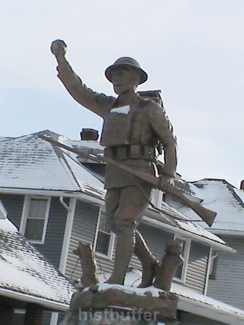
   And how about this dough boy's story ?


 Historic District


 What eventually became the borough of Scottdale was named after the industrialist and railroader, Col. Thomas A. Scott, President of the Pennsylvania Railroad and an Assistant Secretary of the War Department for the United States. The year was 1874. Previously it was known as 'Fountain Mills'.


   In Scottdale, in East Huntingdon township, 35 Miles south of Pittsburgh, (according to some, as much as 48 miles!). It is 12 miles south of the county seat of Greensburg. There were settlements here as early as the late 1700's, many of them of Scotch-Irish ancestry and eventually a fairly large German population. This is called the Allegheny Plateau region of the Laurel Highlands; hope that makes things clear.

  By the mid-1800's the community began to develop with the selling of lots from the farmer Peter Loucks' descendants. An earlier settler, John Sterrett, acquired a lot of land and by 1786 was said to be visited south of here by none other than, Daniel Boone! Also, a tract was owned  by one Mr. Galloway prior to 1801 much of this related according to the Scottdale Historical Society. They do have a Facebook page.

   This foresight of the Loucks family lead to layouts of the early part of the town. The Jacob Loucks house on the corner of South Chestnut and Market Street, circa 1853, is considered the oldest house there. There are other Loucks houses in the neighborhood as well.

     
Jacob Loucks house


    The Lawrence Keister house at 1005 Loucks Ave is a brick prairie dwelling built in 1895. The Church of Christ at 513 is of Queen Anne /Colonial revival style with stained glass beveled windows and the main façade originates from 1895. At 602, the W. E. Stauffer house with fluted columns and rusticated lintels is from that year. The A. K. Stauffer Queen Anne house at 701 with interesting corner towers and outbuilding, hails from 1880. The house at 804 has it's original windows, a bit of a rarity.

Saturday, March 1, 2014

Round and About Near Ruffsdale


Ruffsdale and Central


    Hi all. We're back here with a history Post about a few places in and close to Ruffsdale in East Huntingdon Township on the Westmoreland side right along Route 31. Once known as 'Ruff's Station' because of the relation to the railroad and a connection with William Ruff. 

  There you will find the Ruffsdale Road and Dillinger Drive off of Rt. 31 with Railroad Street leading through Rocktown toward Central. Much strip mining and quarrying took place too.  Buttermore Road also heads north from here leading to Hunker and beyond. Interestingly, according to an old map, it appears there was a Toll Gate on Slate Cir. Rd. Jacob Leighty of 'Leighty Hollow Road', held a school on his farm in 1802. The Samuel Dillinger Distillery can be seen on old maps as being in operation in West Bethany about the mid 1800's before there was a bad fire and then he soon started it up again here. Daniel Dillinger, 1787-1845, started at the farm in Bethany and Samuel Dillnger stared distilling in 1882. he and his kin also had many coke ovens at Pennsville. At Tarrs Station they had 64 coke ovens and 51 at Hawkeye. That was before moving it to the Ruffsdale area where you can see the old building today. He, and his sons were certainly involved heavily with coke ovens and the railroad with more info here. They had connections to the Overholt's and the Louck's. A gist of this concerning their history can be also be gleaned from the 'History of Westmoreland County, Pennsylvania, Volume 2', and 'Old and New Westmoreland, Volume 4', by John N. Boucher
  
   The old Dillinger Whiskey Distillery....

Dillinger Distillery

                                    I hear that it's for sale! That's a lot of windows to replace.

  Now is an appropriate time for a few lines about the area called Central, very near Ruffs Dale and Tarrs. There was much more going on back when there were still coke ovens and this place was being mined in the late 1800's and early 1900's right next to, and basically, including, Tarrs also. You can't hardly miss this one, it's near Central Road. That's it. This bears on to Central Mine Circle and the area of many coal patch houses. There were also coke ovens and, apparently, some mining. And this was also the case past Bethany, coming from the Ruffsdale-Alverton Road and toward the Leighty Hollow Road years ago. There are still said to be some signs of this in the nature of the darkened fields around here, if you look closely. Work must of been hard in those times, but some would say at least there were jobs then! (There are some old photos available on the internet). There was also a company store in Central and it even had it's own ball team too. When driving past there you can get an idea of the lots, though it may seem a little difficult to place everything and it must of given a different appearance then; but, some of the houses are still there.

   A comprehensive site with much in the way of information on the various mines and coke ovens all around here and includes names of many of the miners you'll find linked up from  'In Tarrs'; ( it leads to the fine Roots web site on ancestry.com, so consider giving it a look).

   Of course, this isn't more than a hop and a skip away from the old Chrysler/Volkswagen of America/Sony Technologies plant, (not necessarily going by those exact names in that order), now called the RIDC Westmoreland Technology Building on old Rt. 119. Sitting on 1200 acres, it produced over 1 million vehicles from 1978-1988 and Sony manufactured a prolific amount of televisions from 1990-2008 of various kinds, with a glass plant across the road and a distribution center operated out of the old Wards building. In older history, which is somewhat favored on my site, this area was once a swamp that was seriously considered for a park. With the whiff of industry came the draining of most of the rare swampland that held Jacobs Cabin on the east side by West Tech Drive. Here the Braddock Road went by, as the colonial army passed through on to the north west to a fateful day at Braddock's Field.

   Things went well here for a small time for Chrysler, then with the Americanization of the Rabbit, in particular, there was criticisms, along with the stiff competition from Japanese small cars and other factors, including parts shipped from West Virginia. As well the wild cat strikes, gas pricing, amid charges of discrimination, which all were said to of led to the decline and sale made over to the Sony company. This eventually caused the experience of some of the same like problems; partly concerned with competitors and change overs from the CRT models and flat screens to Plasma products, before finally leaving the area too. A sad event.

   When you think about it, though, there was a tremendous amount of production and quite a lot of jobs here and it has seen quite a few famous people from all walks of life in and out of it's doors, including Pittsburgh sports figures. This was a real boom time for the area.

  RIDC is indeed a large group of buildings, including a C U P, (Central Utilities Plant). They have acquired the Leeds contract, DNP is there, (the old Sony Chemical group), a solar power business that went bankrupt, Aquion Energy that produces batteries, WCCC's Advanced Technologies are upgrading in the southeast side; also, from the old Williamhouse is Cenvio, I believe. The whole place has seen it's share of business over 30 some odd years and still has some operations in the works with other companies on the site. It would be good to see it grow and expand once more, as it certainly appears to be doing.

  As for Ruffsdale, there is a Post Office there as well only about a mile from the one at Tarrs, which is unusual. Be sure to keep an eye out for the traffic around it, as there are a few, somewhat busy roads branching off nearby. The D. L. Ruff homestead is just a ways down Rt. 31 toward Mt. Pleasant. There is more here than some may be aware of, such as a U-Haul Dealer, J L Screen Printing service, Aaron and Associates, Barnhart's, etc.

   And let's not forget to make some mention of old Snydertown near to here: a small area practically within Tarrs near C&C Lumber and the Fire Hall. I do humbly confess to not knowing too much about it really.
                     
road leading to Snydertown
                
     And there is also a small village that was named Feree nearby to Central where many of the coke ovens were.

    As stated, this is all about 3 miles from the borough of Hunker and close to the 'control city' of New Stanton off of I-70 with a lot of conveniences and hotels and fast food shops for a weary traveler, but AGAIN-watch these roads, they're really busy and the place is oddly enough, minus any traffic lights.

   Well, hopefully, we can return here at another time when we have a bit more information. If, by chance, any of you have stories, photos or even rumors of this place then, by all means, feel free to comment or send an e-mail. The little villages are all snuggled up together with various tidbits of history concealed deeply within.

    By the way...does anyone have any idea about 'East' Bethany ? (I didn't really think so; you can disregard that one). We do know West Bethany was up 117 going toward Alverton where the Dillinger's had the early farm and mills.

   There are also a few old fragmented stories of Indians and arrowheads round about these hills , though nothing definite has been related to sink your teeth into. It is known, however, that Capt. Jacobs, (Tewea), the famous Native American chief of the Delaware's who was killed in 1756 in Armstrong's raid on Kittanning, it is seriously claimed that he kept a base right here. There gas been some debate whether this is the same Capt. Jacobs or even his son. This place had extensive swampland before reclamation, as did the Greenlick Dam area of the 'Great Swamp' even more so,  in Bullskin. Well, that wet, dismal place in Ruffsdale was said to be once known as "Captain Jacob's Swamp". Whether there is any stock in it, his father was said to be a French fur tapper too. He died by the hand of Colonel Armstrong in Kittanning, but that is a bit of another story.

part of Capt. Jacob's Swamp
        
    And not to be totally facetious...what exactly didn't happen on the Old Maids Road ? ? ?

Old Maids Road courtesy of Google Maps
     
    Alright, this is another post for you to ponder over for a while.

   I'll remind people once more that, if you live in this area and have information to relate, that would be greatly appreciated.

   ~ Histbuffer
Monday, January 27, 2014

Meandering in MT. PLEASANT


 Mount Pleasant

   Well, back up here with a newer Post for all you folks out there.

  There are many cultural sights in Mt. Pleasant as well as the township of the same name. We might only get to the most interesting here, but, more could be added. Just imagine all those horses and wagons in the Diamond, and women in their finery; the wooden buildings and hitching posts. A brief, but succinct history lesson would probably be appropriate, so we'll manage to attempt just that.

   Mount Pleasant is located near north of PA Rt. 819, not far from Route 119. When you come to the Doughboy, you are in the heart of the town. For some photos near the heart of the borough please check out the Mt. Pleasant Downtown post!

  Some Dates


    The borough of Mount Pleasant, one of the oldest places around here, was incorporated in 1828 and first settled by those of German descent. This was also the oldest borough in Westmoreland County. In 1798 East Huntington was slice off from the township which is off to the northwest, just to give some perspective to the early size of the place. By the way, Westmoreland County history takes us close to the dim past when it was still a part of Bedford County, and was formed in 1773.

   Now technically, the town began in 1797 when it was laid out by Andrew McCready. This was in those old days when there were some odd laws on the books, (at least in certain parts of the country), such as, at times Catholics were not allowed to own land or build a church and in some places, only given half a vote! The Old Presbyterian Church of the very early 1800's was purchased by the Church of God in 1870. The denomination dates back to 1774. The United Brethren church added the tower in 1874 and in 1890 the rather famous and expensive clock was placed within it.

  Let's hope you don't mind a few numbers, it really is necessary to get an idea of things.

 Well, those involved with the 'tract' finally got the opportunity and paid out for the patent with the amazing sum of $8.37. Talk about inflation ! The price became higher later going for $18 an acre. T he township itself also has some associations with the Whiskey Rebellion. And there is also the Bunker Hill area, which was annexed in 1885.

  The borough also had the 1907 L. E. Smith Glass Company, famous for it's work with colored types of finely worked glass and there is Lennox Crystal, with quality textured material, originally of the Bryce Brothers from 1896, with hand blown glass. The lack of this kind of productivity the place once shared has had a dramatic impact, though the sturdy nature of our surrounding townships lend themselves to adaptions and are managing fairly well. In the 50's there was Permali, Durasteel and Screw and Bolt, all within the township. Levin Furniture are still here on Main Street.

    The area was bypassed early, (some say spitefully), by the railroads until the Mount Pleasant and Broadford Railroad, and eventually others came to the rescue. Then there was the West Penn trolley that served the area well from 1906 to 1952.

   The Mount Pleasant Memorial Hospital was opened on January 1, 1904 from a private fund of Jacob Justice.
    
    The area called 'Dutch Town' was the hole in the wall, a place where they say people went to wet their whistle in Prohibition days. Quite a place to live near, a few would probably be thinking!

   Braddock's Road was authoritatively stated to of passed directly through the borough traveling up Eagle treet and out the Braddock Road to Sand Hill and passing over old 119 to the north and to what was known as Jacob's Cabins. This is an area I will revisit sometime. I would also like to gently point you in the direction of the Braddock Road Chapter, the National Society of The Daughters of the American Revolution for something of this aspect directly related with that era. They own the Warden Mansion where they have their meetings and also various promotions and contests and even their own library, so check it out. Sometimes we don't know what is in our own neighborhood! We can follow the Braddock Road signs around to get a better idea of the route the army took on their fateful way toward Braddock's Field.

    It's also a good idea to hike around when you have time and check out some of the Coal and Coke trails between here and Scottdale.

    Interestingly, there was also once a Grand Opera House that graced Main Street and there was a jail here too, until the late date of 1968. l will attempt to do some checking into this further. (Other information, whether historical, or just your take on things here, would be appreciated by any of you that want to contribute. A private e-mail is another alternative).

    Standard Shaft


    This coal patch called the 'Shaft' by locals, was very busy. A large amount of you will still remember the dust, smoke, and the bustle down there. Though first known as Spring Garden before 1873, it really got going as a coal and coke area in 1890, the streets were laid out in 1916 with the old Union Supply Company store on the corner of Diamond and High streets. Standard was said to have nearly 10,000 coke ovens, though maybe that's 1,000, though that would be rather low. Still, one of the largest  in the U.S. When the no. 2 and 3 mines were combined it was known as Standard Shaft. It was begun by A.A. Hutchinson and Brothers and then built up by H. C. Frick under Robert Ramsey's able supervision and still contains some old company houses. Is anyone else interested in this too ? Well, there is further information available to those more curious folks here and here, as to the houses, baking ovens and the mines themselves. 
  

  Here would be a nice place for a few of those stray anecdotes rather impetuously planned for the site.


  For one thing, Samuel Clemens, Mark Twain himself was claimed to of come through the Mt. Pleasant area on business.
   There was Jess Stairs state representative from 1977 to 2007. He came from here and  resides in Acme.

   Other House representatives include Eugene Saloom and back further, Isaac Kine. More recently, Jess Stairs who lives in the heights of Acme and, as a friend pointed out, once taught a 9th grade class here, was a Republican representative served from 1977 to 2007 for the state.

    A really great anecdote is sbout Al Capone, yes him, who also made his way here once on business heading toward Masontown. Unfortunately, there seems to be little, if any, other information available. Well, maybe that is just as well!

    By 1925, the authorities had to put their foot down and prohibit the practice of cattle driving through the streets. The farmers and ranchers would lose out in this, but one should assume it led to a quieter and safer environment for a growing community.

   We have a more honorable and regional mention up next, with John White Geary 1819-1873, who was a local son of Scotch-Irish immigrants, and once lived at Church Street. He was a highly decorated Civil War General and Governor of Pennsylvania with  his very own Historical Marker right by S. Diamond Street too. Geary Park is, of course, named after this man. He sure had a colorful career! In 1856 he was Governor of Kansas and he fought in The Spanish American War in Mexico, as well as becoming the Mayor of San Francisco. Involved in various battles in the Civil War, including, Gettysburg, while providing undaunted bravery at Culp's Hill; he eventually ended up out west and finally came to be military Governor of Savannah.
   
  Moving further down Main Street, making a right at the light at the tavern and hotel, R x R Station, (without commentary, at least for now, of the ghostly stories associated with it's history, which is covered pretty thoroughly on other sites),
                      
RxR Station as seen from the back


making a left behind the Fire Hall there, you will be on route that was said to contain the street car trolley. This old road went all the way to Iron Bridge. The condition is alright for a mile or so, though there are speed bumps, and then deteriorates fairly quick.

             
behind Mt.Pleasant Fire Hall

    Those Road Names...

   Also, there are some curious road names as most residents should be aware of, like 'Misty Meadow'. Sounds nice, but watch out for the road leading to it- 'Pole Cat Road'! Up North Diamond off of Depot is the 'Helltown Brewing' Co. Over by St. Pius X Cemetery is Braddock Street and there's a Washington Street too, the one with the cabins, then we have Liberty Street more southerly. The Coal and Coke Trail heads past the Baseball field on to Bridgeport. You also have FRONT Street, and what would it be without BACK Street; then Fry Hollow, Simpson Hollow and Brook Hollow Roads, all in the same area. But this is moving out of town a bit, so let's look at College Street, a long road, coming off of S. Church from the South side and Morewood Street to the southwest famous for the 'massacre'.
 
    Finally, near the northwest side there is High Street and...Low Street as well. That about concludes this segment.

    Let's not forget, though most probably have the area to the south west called Texas! You might have to look it up on an old map, like here:


Contact Form

Name

Email *

Message *