Showing posts with label Braddock. Show all posts

Monday, October 20, 2014

The Braddock and Turkey Foot Roads Near Walnut Hill with added Information

  I'm back with you here folks, to present an in depth post on the little known Walnut Hill area of Upper Tyrone and Bullskin townships and the historic connections it has to the Braddock Road and, possible associations to the Turkey Foot Road.

  Please read on for some interesting observations and surprising conclusions.

 School, Church and old Cabin


 Part of the Walnut Hill area is in Pennsville of Bullskin Township, the other part in Upper Tyrone Township, and both are in Fayette County, Pennsylvania. This is above where George's Trading Post is near Crossroads. To help give directions for more distant travelers, from the south is the next one to the left past the Rt. 119 Everson exit. From the north, the second turn off to the right, past the Mt. Pleasant exit.

 As the Pennsville area was settled very early, the only place around the region this ancient is probably the borough of Mount Pleasant. Accordingly, Franklin Ellis' book, "The History Of Fayette County" on page 497, claims the Pennsville settlement once had twenty-one families, (at least as many, and maybe more than now). In May of 1837, it was voted on to build the octagon schoolhouse, so this was, apparently considered as coming into their jurisdiction. I don't know just when this school was replaced by others to the west in Kingview and Kifertown and how this was used in conjunction with the school houses round about Pennsville.

 In what was termed the 'First Half District', was the somewhat mysterious 'octagon' schoolhouse and an old United Brethren church where Isaiah Potter and sometimes, Rev. Powers preached. Dr. John R. King, born in Normalville in 1866, (according to the "History Of The Allegheny Conference of the United Brethren Of Christ", by J. S. Fulton), attended the Mt. Pleasant Institute and was converted at the old Walnut Hill church and was united in service for that church. The Everson Evangelical church was said to be an out growth of the Walnut church in the late 1890's.

  Both the old school and church  have long since vanished.

  Here is a schematic cropped photo to delineate the general location of these two buildings:


   On the same page of Ellis' book about the population, we have "This house was on the Tyrone line, west of Pennsville and was a prominent landmark in its day." Which makes it even more interesting as so very precious little information is known concerning it. Sarah Ullery and Henry Ullery, a family name that has lived nearby, may well of been a teacher there, the same might be said of Elijah Yunkin, and possibly even Lulu Longanecker, as she taught for some time at the hamlet of Kingview. In 1900, as well as South Everson and McClure. Francis Hill was a teacher listed at the school.

  According to the Daily Courier, Sept. 26, 1905 pg. 5, the First Institute of the Upper Tyrone Teachers was to be held in October at the Walnut Hill school house with teachers, patrons, and other friends of education invited to attend. This would allow for some evidence of it's prominence.

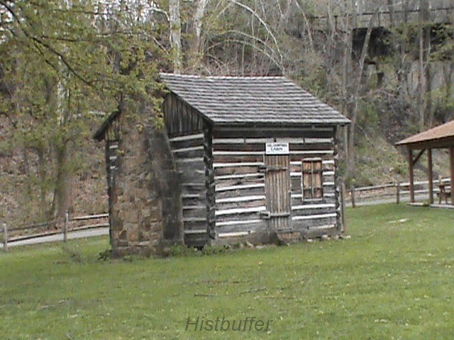
   Here is the old cabin down in the woods approximately 40 to 50 yards, (at a posted location), near the top of Walnut just to the northeast of the Kingview Rd. There is still a ruin there, but may not be much left of it nowadays. My family knew the old Rhodes man and woman who use to live here in the 1950's and into the 1960's. My father, Wayne Wilson, wassaid to be personally acquainted with her son, and there was talk of stray Indian and military relics found near there:

Old cabin near the gas line. GPS coordinates are 40.094355, -79.570578


             My research of these places really began with this old map. You can see here evidence of the old church and octagon school house and the residences of a few, very probable, though distant, relatives:


  Here is an old photo of the schoolhouse generously provided by Kim Brown, President of the Bullskin Historical Society that was thoughtfully bought, and therefore salvaged, from the old offices of The Independent Observer by her son, Tom. The contract was voted to build it in 1837:

  
old Octagon school house on Walnut Hill at the border of Upper Tyrone

 The Basic Route of Braddock's Road 


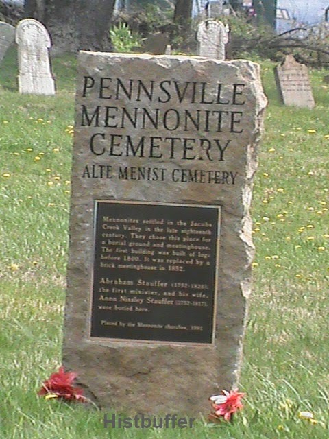
    After the fording of the Youghiogheny River at Stewart's Crossing the Braddock Road headed over the hills through the Narrows along the border of the two township lines through an old road that is broken up for the railroad. It soon travels right past on the west of the Mennonite graveyard, (coordinates, 40.073882, -79.579090), on a branch of the Catawba Path at the intersection of Sherrick and Bradish Roads where once was the Mennonite Meeting house. Here one will have arrived at the location of the old Mennonite Cemetery, a place covered in my last post. From here the Braddock Road segment veered away from Mount East north toward Valley View Drive. You can see on the cropped colored map above, the 'coal lands' might of endangered traces of the BR east of Valley View. What remains is covered as a projected heading for the route to Walnut Hill on what is known as the Kingview Road or the A1035 road, which runs easterly to Pennsville and west to Scottdale.

 Some Orientation

   The Crossroads, to the north of Pennsville, strictly speaking, are to the east of Walnut Hill as well, where the road turns left before turning right, but this relation does not factor into the directional equation because of a more modern origin. The point I'm making here, is the Kingview Road clearly ran unimpeded to the Country Club Road. So, the older road, which I will point out soon, traveled straight down what isWalnut Hill, to where today, is that same road entrance. These beelines can be significant, as when farmland and trees join as a part of a trace linking an old tract. For there, the Braddock Road was plotted by some researchers to turned north, running somewhat close to the Rice School Road and on the northerly part for a way, where there are possible scars still to be observed, but nothing definitive is known. Then it adhered to a rough extent to Rose Road as it traveled more northerly still to Gimlet Hill and the Green Lick Dam. This is my understanding of it. For more information on the 'New Dam', click the underlined link.

 Brief Information on the Turkey Foot Road Route


   Now, what is also interesting, the Turkey Foot Road appears to of followed the Braddock Road from Wooddale in the other direction toward the Rice School Road from the south in an effort to avoid Iron Bridge and the 'Great Swamp' located there. As it may of followed the Braddock Road route, it would then of ascended Walnut Hill and diverting up to the top of the hill where there is an old road trace from a 1939 overhead photo. This is as much as it can be enlarged for the supplied Blog format, so please click on it for a better view.


candidate for a branch of the Turkey Foot Road on Walnut Hill

  Tell me, do you spot the old road trace? Any feedback you can provide will be appreciated! More on this train of thought in a moment.

 As a secondary alternative, I speculate the 'TFR' could of crossed through the small Rankin Creek valley, as it came westerly up what became the Prittstown Road. This would calculate to the advantage of a more direct route, circling on lower ground around the steep elevation of what is locally called Penny Hill, which would necessitate being skirted. For another reason which I will get to in a minute, I favor the plausibility of the Walnut Hill route.

 Here is a schematic that lends a rough estimate of the Braddock Road in blue and the abandoned road, possibly a branch of the Turkey Foot, in green, with a red dotted circle delineating the small area directly across from Valley View Drive to the north with the old United Brethren church and the Octagon schoolhouse. Very little remains:


  I would issue a small word of caution that some of my article is still on the order of estimation, with some proof from map reading, as quite possibly, a part of the Turkey Foot Road used the extension of the Braddock Road. With the route of the Braddock Road near Kingview, we are, admittedly on firmer ground. Consequently, I feel a near surety these two famous routes simply crossed over and through there, navigating around this hill, one down and one up.

  Kingview and Dexter are places I am still looking at and investigating more thoroughly as of this moment, as I find the quality time. I will keep be sure to keep you all posted. Please be patient with research works that are in progress.

  Any discovery of this type is made more difficult as anyone who is familiar with the area knows, with the complications of farming, mining and logging roads that were continually laid in here in their hey day and left their marks and scars to blend with the modern era changes. Even more so, the strip mining that took place from the large Connellsville Coal Bed that under ran the whole region and has done much to deface these historic traces.

  Since the Turkey Foot Road was said to of crossed Jacobs Creek near Dexter and onward toward Mt. Pleasant, possibly using as a part of the old Turkey Path, this needs to be checked out as much as humanly possible in the near future. To further this theory, we have some maps of various ages to help with orientation.

The Backing of an Old Researcher:


  According to my calculations, between the Rice School Road and Walnut Hill, the 'BR' and the 'TFR' would of crossed each other. Though, this statement only holds feasible if the projected research is in the main, correct. This is well within the realm of probability. (As mentioned elsewhere, part of the supposition is not without another, though less likely, alternate route of the Turkey Foot Road, south of McClure).

  Below, you will note what I present as the major factor to favor this route of the Turkey Foot Road.

  I am not privy to the origin of this statement, but, in a dissertation on the main Indian Paths in Fayette County, Pa, a rare distinct claim was made by Rodney D. Mosier, the High School Principal for Uniontown in the 1960's in an article in the Evening Standard for April, 1969. there he is referred to as "one of the district's leading historians":


   Mr. Mosier, a Waynesburg college professor, was a Vice Principal of a Syracuse school in New York and a Supervisor of the schools in the Uniontown area. Also, he was the one time President of the Westmoreland-Fayette Historical Society and his claims should not be taken too lightly.

   Furthermore, if said Turkey Foot Road met with the Braddock Road, a temporary convenience for those that were responsible for it's continuance in Fayette County, as was Providence Mounts, would be to put to good use part of this roadbed already cleared and cut, however the decayed condition years later.  So it stands to reason for them to follow Braddock Road  some distance in the opposite direction around Walnut Hill, steep Penny Hill and Iron Bridge further to the north to the northwest of the old chain bridge. This lends some collaboration toward the Turkey Foot Road in the Kingview and Dexter area. And, again, here appears to be a remnant of the Braddock Road on the 1939 aerial photo as it appears to deviate from roughly one half of the way up Walnut Hill heading east:

Here, from the 1939 photo, is noted the course of the Braddock Road antecedent before modern realignment.

  Above is the old road, probably a part of Braddock's Road, I located from the 1939 black and white photo with locational coordinates where the modern road changes course at 40.090291, -79.560148. Approximately, thirty to forty yards below here is where the newer version of Route 119 bisects the township line north and south. Therefore the new Rt. 119 parallels old 119 of the Pennsville, or Richey Road.

  Again, the only other likelihood to this route or alternative at hand, would be for the TFR heading through an area near Prittstown and subsequently to of entered the hollow of Rankin's Creek just south of Penny Hill and thereby heading to a segment of what would become Dexter Road. This was in the pre-industrial days, before Stauffer's saw and grist mills built on what became their farmland, bought from the original warranty and patent holders. There would still be the required crossing or fording of Jacob's Creek at Dexter which could not be avoided, as pointed out in Veech's book as a mile below the chain bridge, ( at modern Iron Bridge). As Lannie Dietle has calculated, this area is south of West Overton near the Stauffer or Overton Station and saw mill area of the Stauffer coke ovens and part of the Dexter Mine Works near the turn of the last century. Here we find the Jacob Creek Bridge. I would prefer to highlight that place in the future even more clearly.

   Providence Mounts, a captain and major of the militia, was prominent in clearing the TFR in Fayette County, and lived for some years near Connellsville. He was elected a justice of the peace for the area of Westmoreland County, Sept. 15, 1780, per George Dallas Albert, in his book on page 453. This was three years before the separating of Fayette County from Westmoreland after the  Pennsylvania and Virginia land controversy and the resolution of the Mason Dixon Line. He was, of course, a major figurehead here too, along with men like Isaac Meason, the largest landowner around, and George Hogg.

  I could, tentatively speculate toward the inclusion of some relatives of mine, such as Adam Hatfield, John Miner and possibly Adam Flick, (also a Revolutionary War soldier), in capacities as Justice of the Peace, and Overseers of the Poor, and Supervisors of the roads, etc., with the instructions given from General to Colonel, passed on down the chain of command to lay out roads in these areas. This is documented in Washington's journals. I must draw the line right there, having at hand no real evidence of ancestral involvement beyond the efforts of Providence Mounts to sustain such a theory than my conjectures and speculation.

  Thus, in what became Fayette, in the, then, larger township of Bullskin, and once large township of Upper Tyrone and in Dunbar, Isaac Meason, a principal landowner, held offices toward Uniontown, and all these type of men were heavily and directly involved in shaping the region. Much responsibility and territory was associated with his jurisdiction. Notice must be given that Fayette did not become a separate county until 1783.

 Both Old Routes Straddling The Townships

   Finally, to give a clearer understanding of this situation, here is an illustration of what could be the routes taken by the only two ancient roadways near this area:


   For more detailed information of most other regions beyond this, of the Turkey Foot Road route itself, please check with the well documented book, "In Search Of The Turkey Foot Road", by Lannie Dietle and Mike McKenzie, and you will find much detailed research to ponder over and learn of. May I add, the learned gentleman also has expressed a degree of approval, with some added support toward the possibility of these famous roads intersecting each other. It is likely, he will deliver some weight on the issue. As of right now, he may have much on his plate with a letter I forwarded to him of a man with, apparently, convincing evidence of remnants of the Turkey Foot Road near to Quail Road in Bullskin township.

 Summation


   I give this research material out to the public rather tentatively, and in between collecting, photographing, and gathering material for other concentrated posts I am deeply concerned with at this time. I will want to consider including more indirect, though meaningful evidence and/or documentation up 'around the bend'. This will be when I can get a breather!

  So, theoretically, with some fairly substantial documentation, we are confronted with what appear important remnants adjoining the Country Club Road from Walnut Hill, traveling the very area the Braddock Road traversed and quite near to where the Turkey Foot Road of a few years later, would of extended close to. Here I have located an abandoned road on the side of that hill following the contoured incline.This is what I call fascinating stuff, folks. Where am I going with this, you may inquire? Well, we'll see, but I feel as the website gains steam, more perceptive observations ride on it's coattails.

  These signposts of historical relevance need to be noticed and addressed as they light the dim reaches of our forgotten days, finding a serious purpose in your readership to enlighten our path forward and what treasures has been lying right behind us all along.

  In my eagerness to provide some tantalizing clues toward the further discovery of these famous roads of antiquity, I consider this a sister post to the last one on a lost or abandoned road near the Mt. East region of South Everson where Braddock's army crossed through. Please have a look at it too. Coincidentally, this was about an area only a relatively small distance south of the location referred to in this, my most recent post. These articles and their content, literally and figuratively, need to be followed up on soon with more exciting revelations of our past.

  So stay tuned!

Tuesday, October 7, 2014

Lost Cemetery on the Braddock Road

   I want to welcome everyone back to the blog with a post about a mostly forgotten cemetery and an old historic road, including a famous stretch of lost road, to boot.

  There is a tendency here at Fayette/Westmoreland Forgotten History, to leave the more beaten path and some of the mundane concerns of modern industry and packed up businesses for the elevation of older material. I hope this is not detrimental for most visitors. The blog does also cover recent history when required, and it is very interesting as well. This older habit is more intended to bring out the 'origins of things' and to grant a unique niche some added flavor for a larger recipe.

  Although, St. Joseph's Catholic Cemetery was begun near 1913, this article is endeavoring to highlight one much, much older. The Alte Menist Cemetery east of  Owensdale toward the southeast of Everson or to be more formal, South Everson as a more exact description. Technically, it is in Bullskin Township, and very  near the border with Upper Tyrone. Right on the township line. So, by all means, please keep reading and to discover for yourself what I've learned while not sleeping much thinking about all the possibilities. This place is historically significant in triplicate, as you will see for yourself!

   It does appear the cemetery is mostly in Upper Tyrone by a few maps I've looked at, though the township line has seen adjustments. As reported in the "Entering Everson" article, it is looked after by the Scottdale Mennonite organization. Abraham Stauffer, the patriarchal reverend, owned much local land and lived in Kingview, but he bought a large parcel of the region that became Everson very early on. Stauffer kept a grist mill and possibly a distillery, and is prominently buried here. It has been claimed, or more to the point, rumored, there was an Indian burial ground very near here. This wouldn't be a real surprise. Many of these old traditions have a ring of truth to them. More on that further in a minute.

   On a personal note, I am continually learning all the time in continuing investigative research for these posts.

   This is a good place to add a word about Daniel Boone, who occasionally made return visits to his family on trips from the south. He was related to the Sterretts of Fayette County, especially in Owensdale, south of Scottdale. Of course Boone also traversed the Braddock Road with the British army, and was said to of passed through here when he lived in the Carolina's. He first visited some members of his extended family in Pennsylvania in October of 1781. Once again in the winter of 1787, and possibly in later years, although this may not be confirmed. This according to "Daniel Boone: The Life And Legend Of An American Pioneer", by John Mack Faragher. 

   I would like to relate there is a theory and a sort of tradition the colonial militia crossed at Broadford and met up with the Virginia Regulars at either Mt. Pleasant or Sewickley. It appears there is a mystery here. This idea might take on significance on this site as I add further material in blog posts yet to come.

   The story that in the summer of 1755 George Washington, on returning from his sickness in trying to catch up to the main military body under Braddock's command, had a small contingent that supposedly did cross as Broadford instead of Stewart's Crossing. And while this is an intriguing suggestion, it is unsubstantiated to my knowledge. Again, this concerns the report of a division of Braddock's army near New Haven. On the old surveys and maps, the area is listed as Stewart's Crossing only, leaving us much in the dark to the other claims. The mix up could of come from a road on one map that traversed from the traditional crossing location toward Broadford. There is also the fact that later, before the battle at Braddock's Fields, they did cross the Monongahela twiceand, of course, the Yough river was also twice forded. It would be appreciated if a scholar or member of an historical organization will be able to shine more light on this, or point out a topical reference.


   The Mennonite Cemetery and Braddock's Crossing

    Earlier this spring, I took a trip to South Everson to the old Alte Menist Cemetery by way of Mt. East, which I thought was an important subject matter documented here with photos included.

     Every other year on All Saints Day, it was said they have a picnicking celebration, though it is uncertain that is still the situation. It appears this is only done every so many years as of late, according to an informative South Everson resident, Scott Noss. The Scottdale Mennonites have taken over the upkeep. This is the statement according to this informative Daily Courier article which I found long after starting this one.

    So, see for yourself, the cemetery may not be quite so lost, but, in many ways, it is forgotten. There is some interest in the name of the 'Pennsville' Cemetery', the first I actually noticed the description, which could be confusing as to the relation of the Baptist Cemetery and old parsonage in Pennsville proper, across Rt. 119 to the east.

   Braddock's Road crossed smack through this place, this according to many reseachers, including Professor Laycock in the early 1900's. This was further said to be on a branch of the Catawba Path. There is no sign of the old Mennonite meeting house any longer and the story of a possible Indian burial ground on the north side, if there is any substance to that, has long passed away, possibly from any living remembrance. An old map clearly demonstrates the Mennonite Church was on the northwest of the cemetery in question, which does appear plausibe. I haven't located this map for some time and it is not included here.

   As to the legendary Indian fort or burial grounds I've mentioned briefly on other posts, little in the way of evidence is apparently known or the exact place where the small Indian community was, only a few stray clues so far. For now, I won't be quoting information that I am not sure of, or is copyrighted. One idea in particular, is the intriguing old stones without any perceptible inscriptions on the northwest side of the cemetery intersection. There may well be another simple explanation for the stones. Could it be just wishful thinking that these are old Indian grave markers of some kind? A conjecture worth something, although maybe nothing beyond speculation.You can find some general information about the Indians in Fayette and Westmoreland counties here on the subject of 'Sacred Ground'. A plan is in the works to have a good post on Native American places near the borders of Westmoreland and Fayette and at this time in the form of an embyonic kernel of an outline to hopefully grow to fair sized proportions. I want to bring together what basic information there is available and hope that will be helpful. The cemetery is a fairly peaceful place, yet it holds an air of mystery. I decided to highlight it for the article as to its surprising interest, and that will continue to unfold.

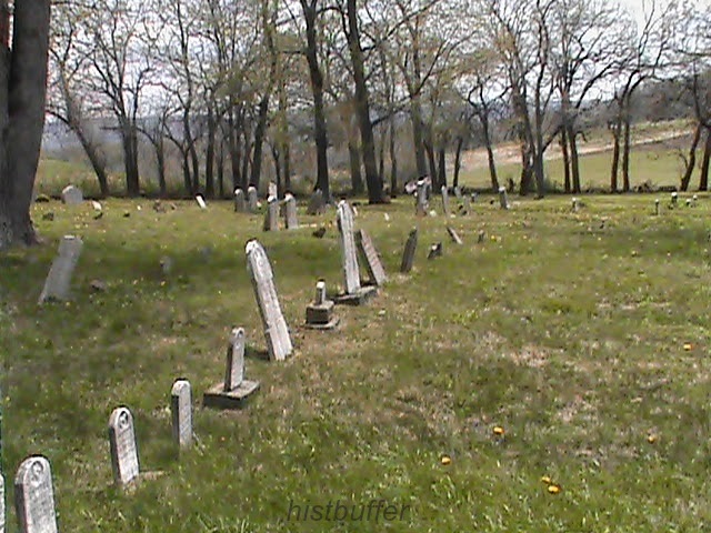
   Here are some views of the old cemetery and further down you will find photos of the surrounding directions:


Braddock's route, Mt. East street, or road, going south

Mt. East Rd. facing toward Owensdale

Tombstones in the Alte Menist or Sherrick Cemetery


  General Braddock, according to Captain Orme's journal and other sources, passed right through here with the large army of Virginia Regulars, volunteers, Indians, women and children, baggage handlers, cooks and guides.


Bradish-Sherrick intersection looking west, Here, tradition
says the Meeting House was located


Abraham Stauffer's newer grave marker

  
A view toward the south

   Pennsville, (and not Everson), was said to be owned by prosperous farmer, John Shallenberger, who bought 426 acres in 1791 near the time when Bullskin was a part of Tyrone Township. This was referred to before, so please excuse the repetition. I would personally have some doubt as to whether he actually possessed all of the hamlet in question. That is not so important here, but his farm took in much of the core of Pennsville, also it was claimed to originated near the cemetery here. (Information courtesy of Rachel Basinger of the Tribune Review).


south of Everson proper, overlooking Pennsville to the east


Pennsville Baptist Cemetery looking east not too far from where
another Indian site may of existed

     Location of the Mennonite Cemetery

    Further into South Everson, the main borough of which I recently did a post about, heading east toward Rt. 119 and across from the old Valley service station were the Valley Works. I am not that familiar with everything concerning this particular location, but from Mt. East Road going south past where the coke ovens were said to be, about a mile and a half is where we find the the quiet place referenced above. The Mennonite Cemetery, 'Alte Menist', is very old, just how old, it is difficult to be completely sure of. It is known to date back to the 1700's. This may well be the area of an old Indian fort mentioned by Veech, east of Pennsville. Then again, maybe it is not. I recall the statement of a mile in another report, again unconfirmed, and possibly a garbled account. Braddock's Road is also described as starting its descent through the Everson Valley about half a mile from the Valley Works. This is clearly accepted to be a corner near old Pennsville, a very old village indeed, perhaps only surpassed by Mount Pleasant. So, we'll just leave it at that for now.

Washington's Importance and his Famed Associates of the Braddock Road March

   To top things off, in a somewhat more steady historical vein,  this was rumored to be, and very likely was, a traditional route traveled by part of the old Catawba Indian Path. A branch was claimed to go toward Laurelville and a small branch may of traveled past Walnut Hill toward Kingview and the Dexter area crossing Jacobs Creek there. This could also coincide with claims made of the old Turkey Foot Road. This leads to some heady speculation. Washington, although of a robust constitution, suffered much from maladies like diphtheria, malaria, smallpox and pneumonia. We know Braddock's Army certainly bustled through here on their way to Braddock's Field with a young Major George Washington at 23 years of age following up the rear, so to speak, because of sickness amid a destiny of bullet holes in his clothing and death surrounding him, where he barely escaped,  except for God's good graces with horses shot out from under him. After the brazen defeat by the French and northern Indians to undertake the ceremony of the General's eulogy near Fort Necessity and to fight another day, entering the realm of our greatest heroes. As mentioned above, Daniel Boone and other men soon to gain fame, was a part of this journey as a wagoner. He ived through it as well to assume a place in the backwoods canon of historical tales and truths. The great army arrived here, and those left after the bloody and confused massacre retreated back the same way of the Narrow's Road area to Mt. East Road, which later cut off the through road by a railroad, roughly half the distance from Stewat's Crossing. The  road deviated toward the Valley View Road near Walnut Hill and then on toward Prittstown to the north.

    This is undertaking an exciting endeavor when we are considering George Washington received so many of his impressions of the countryside of old Bedford County through his travels at various times, conoeing the rivers, fording streams, riding the ridges of Chestnut and Laurel, and in congenial and inclement weather, journeying much of what became the Braddock Road at least four times. His first two war experiences in battle, we might add, came from Fayette County, regardless that the area was connected, indirectly to a part of his homeland, then considered by Virginia as the District of West Augusta, and maybe parts of Maryland. This was the pivotal early history of Pennsylvania, comparing favorably well, especially to most events happening in other states of the Union. This should give us some pause in our daily rounds and toils, a foundational source of great remaining  heritage, locally, statewide and nationally. A boost of well deserved civic and patriotic pride is due.

   Indeed, it must be remembered, he was a loyal Virginian in all matters. Washington was one of the main protagonists of our finely threaded, multi-layered culture and an intelligent strategist, commander, and our first President and the first in many things in so boldly paving the way, when stories of the same ilk are now more scarce. He developed many of his early ideas and received much of his education on the governing of the Army, the state of American affairs. most importantly, much of his own life and attitudes were formed in the region round about this territory in what was Cumberland and Bedford and soon to become Westmoreland and Fayette County, (not to leave the original counties completely out of the equation), and to a lesser extent, with Greene and Allegheny counties.

   From his surveying days, with a keen eye to the land here, certainly in what became Perryopolis. The man passed through the Indian paths and small and large villages, meeting some of the pioneers on the frontier. Scouting with Christopher Gist and George Croghan, gathering land grants, delivering orders, seeing the same views and vistas as we do every day, with less of the trappings of industry and civilization and so much more of the old wilderness. Here, where our mothers gave birth and grandfathers lived, worked, fought and died; sleeping and eating his breakfast and dinner, telling tales, listening to the stories of the Indians, staying at the frontiersman's cabins and eventually plotting courses and events around the fires long into the night. He was experienced at dealing with the traders, like Henry Steward and William Jenkins, Colonel Crawford, Zachariah Connell. His family. His brothers, Valentine and Augustine, and their interests and letters; the wagoners and their craft, meeting with Trent and Dunbar; slowly gaining the trust and confidence of the militia as envoy to the French to the north and as a colonel, major and on up the ranks.

  George Washington truly endured and survived everything in his path; the inglorious defeat of Fort Necessity and retreat at Braddock's Field, sickness and attempts on his life, minor, and major battles of the Revolution. Intrigues and conspiracies were no stranger to his life. He also did not succumb in relations with his Congress. He held his reputation high and with every aspect of the places we have grown so accustom to, steeped in such unique history, the future Commander-In-Chief was an originator so very familiar in many ways, and yet keeping an aloofness and professional quality that was all his own.

   When crossing the Allegheny, he met in councils with King Shingas, the Delaware Chief; Monacatootha ; his half-king friend Tanacharison and Queen Alliquippa There were meetings in the tents with the guides, Jeskakake and White Thunder. (as you read in the 'History of Bedford, Somerset and Futon Counties, Pennsylvania", by Waterman, Watkins and Company in 1884 on page 28, for instance). With dangerous defiles, weak horses, facing hostility and frequent hunger and mired in swamps, wading through the cold and snow, our first president, the victor of the Revolutionary War, explored our region up and down. His story can almost take your breath away.


    The region is clearly lacking in some major areas. In spite of this, our home region is particularly fascinating. Does anyone else agree?

  Abraham Stauffer, the Reverend of the Mennonite Church, (and surely, it is no coincidence, there is a church of that affiliation in Kingview), once owned land here, as did others, through Everson and most all of what became Kifertown and Kingview. He was the patriarch of a clan of distinguished gentlemen and gentle ladies. Apparently, he purchased much of his early tracts from Isaac Meason, who is listed as owning large parcels early on from the 1700's, as did his family members.The original survey for the cemetery property appears to be for Thomas Meason and the warrant  from 1785.

   I also want to add a link to a Tribune article of a local man with knowledge of Indian artifacts around the region, here. I recently was fortunate enough to arrange an interview with him which, when I can get to it, I do have plans to turn into two segments for the sake of the interest it holds. He made the statement to me of his strong belief that the Owensdale area had a number of Native American sites at one time. With his past discoveries, and local knowledge of traditions, this does hold some water. We can also read this in "The History Of Fayette County" and a few other books. I will address the quotes directly when I publish a post more concerned with the Native Americans of this region.

  We need to keep in mind that the Braddock Road did run from the Narrow's further south from Connellsville and came down near the Bullskin and Upper Tyrone township line to Mt. East. Whether this is a slice of the Braddock Road or, simply an antecedent or alternate road of disputable age, here is a 1939 Geo survey black and white photo taken from the Penn Pilot website. The area experienced much mine activity, and some farming, yet this photo appears to clearly show a road veering off from Mt. East north, crossing the modern roadway and railroad to the Valley View Road:

courtesy of Penn Pilot, GPS coordinates 40.081527, -79.57863
 
   The evidence from the Geo Survey photo of 1939 appears substantial, but is this really a likely place for an abandoned road trace? Well, it may not be a meaningful issue for this subject, but I've been looking into it. Let's check one older map here, which, as antique as it is, that depends on whether I am reading it properly. I trust that is so, and with the noticeable connection between Mt. East and Valley View Drive, this just might be some proverbial icing on the cake!


 A Local Mennonite, Ivan Moon

  Lastly, I don't think it at all out of range to add a small tribute to a great artist and a kind, sensitive and religious man, Ivan Moon, past President of the Laurel Art Club, who sadly passed on in 2011. He is interred here. Some of you will recognize the name.

  Back in the early 1990's, (when I somehow became Vice President), there was a real feeling of camaraderie with artists like Helen Alt, Dolores Malik and another past President, Don Randolph of Scottdale, among others. While I knew him, Ivan was a good adviser and friend, and I send a greeting to his family and any and all of the members out there that might read this. He was the best artist I knew personally, considering my somewhat limited abilities and all faucets of the hobby and trade; his use of oils on a large canvas, or delicate watercolors of a quality palette were really something wonderful to observe first hand. He was also a great person to all that knew him. This is where I learned the exactness of hanging a framed canvas to the point  that I still do it automatically. I fondly recall the years with exhibits in places as the Carnegie Library in Connellsville and the Fall Foliage festivals in Scottdale. Then, what eventually led to a lessening involvement, working 12 hour shifts, only being capable of attendance once every two weeks. It wore on me and the practice of painting slowed quite a lot from the late 90's onwards. Some day soon, I hope to rectify the situation. And when and if I do manage to find more time and lift a brush more frequently, it will be in his honor and in his remembrance.


  I am going to leave you for now to ponder this bunch of old assorted, if not mostly  forgotten stories of our exciting regional history. This should be very appropriate in a blog with a name like this one!


Friday, August 1, 2014

Upcoming Posts

    HI ALL,

     I hope you history buffers are having a good summer!


     Rarely do I upload this kind of thing, though a Progress Report might well be due and I'm really in between posts. I figured it might be enlightening to include viewers in the process of what I'm doing, so here's a quick update for upcoming regional and historical articles, starting in a few days.

     Please, read on:


     Firstly, it is rather difficult to believe the website is approaching a year since it's initial inception. I feel it a nice surprise we have seen a steady and healthy growth and this sure means plenty for my expectations. I know, too, there is certainly room for improvement here and there. On that, I could go on and on, (BUT, I won't!). Frankly, this just isn't the type of blog that gets little emotional tidbit entries every couple of days, so I try to incorporate a more factual glut of material and less of the every day side of things on each upload. You probably agree it is, mercifully, absent. Another perception is to be admitted some of the technical areas envisioned in the past are still to be achieved.

     Secondly, I do hope to again get with the Indian artifact collector from Mount Pleasant, Duaine Fuoss, for another and maybe more in depth interview soon. It was also a great experience collaborating on Iron Bridge with the author Lannie Dietle, who helpfully initialized the discussion by sending me information on the area. Something he occasionally does. I feel there has been progress made with more meaningful stuff to pass along as I face challenges through the learning curve.

    I speculated a little foolishly back in February and March  that I may run out of quality ideas for the blog. It could just be the gloom of the cold, cloudy season gave pause for a somewhat hazy period and that can happen to anybody that writes, from time to time. Yet, the feeling was probably related to the first winter I spent without the presence of my parents. We all have to be able to let our cherished loved ones pass on and adjust ourselves to some tragic happenings, and deal with that intense grief, but this was the worst from my side, at least. They meant so much to me and with only a few months separating their deaths, felt devastating. My Dad really meant the world to me. We may of not always seen quite eye to eye, but I respected his war service and many of his religious and practical attitudes. In a world that continually is changing, he was a real man. They both cared for me and my family so much. I was especially close to my Mom too. As I look back, I couldn't say enough about how classy a lady she was and how dutiful and selfless, so deeply concerned with every faucet of my life. As an example, she even traveled a few times with yours truly on trips to Europe and the Bahamas. What vacations those were! So, you can understand the tough situation it was, and is, the adjustment to not having their earthly influence. I do feel they watch, and sometimes guide me from Heaven. Well, as was almost bound to take place sooner or later, somewhere in late spring I became more inspired and had a real brainstorm, (no negative aftereffects, I'm happy to report!), and between doing research and talking to a few distant relatives and acquaintances, it became a prerogative to expand the scope here.

    Of course, if you've been paying attention to recent posts, the Connellsville article is STILL in the computer boardroom, but close to completion. I am also working on the one in front of me which, I'm afraid, may come off to some as a bit of a 'fluff piece' on Latrobe. That is basically finished. It really does have some substantial interest, especially to those of a particular sporting persuasion.

    Eventually, a good coverage concerning World War Two, and possibly other wars and some of the veterans of them would be something to consider. What do YOU think? Let me know if that sounds meaningful enough to many of you for future attention. My Dad spent many years on the railroad before retirement and that is something else that could be used as the nexus of upcoming interest. We'll see.

   The up side to doing your own website is the freedom inherent in making decisions. When to publish and what the subject will contain.

   Yes, you have also probably noted my attempt toward branching out more in the late spring and early summer months, including more information on surrounding townships and counties. Now there are plans to get back to areas closer to home soon, as well, with some good stuff on Everson and West Overton in Upper Tyrone and East Huntington townships, respectively, yet I do enjoy broadening the scope of historical material while gathering more afield in as expansive an erudition as I can manage!

    I also submit articles for a newsletter monthly, (there are those of you that are well aware of that), with limited viewership. Sorry, but it is best to keep it at that level. The main reason to mention this here is the spike in number of hits received on the site are a nice compliment and greatly appreciated. I am in the process of hesitantly and cautiously, doing a few speaking engagements.

   Tackling the important history of Fort Ligonier is a real priority of mine, so that will be coming your way, in time.

    Hopefully, everyone enjoyed the post on the Braddock Crossing at the Yough River Park area. That was an experience that was particularly fun for me too, so it's good the event was covered here with some details on what went on.

    It has been exciting from my stand point to improve my skills as I learn more details about our local history, with a larger knowledge base and meeting like minded people. It is with a wiser dedication to a more efficient mode of writing. in keeping a few articles in the pocket, so to speak, just in case.

    Finally, there's actually much in the early planning stages and, for your sake and mine, this would be unfair to pin myself down to describe anything closer or definite than already stated above. Many concepts haven't been decided on yet, so any explanations that far ahead will have to wait.


     So that's it for now. Keep checking back folks and I'll see you here 'down the road' and 'around the bend' !

     ~ Histbuffer


Sunday, July 6, 2014

The Braddock Road Crossing Reenactment At Connellsville


I hope everyone had a good, patriotic July Fourth!

  On the weekend of June 28 and the 29th, Connellsville held its re-enactment of General Braddock's Crossing festivities of the Yough River here, near Crawford's Cabin. I was glad to be a small part of that.


River Park Crossing area, courtesy of Penn Pilot

   Introduction

   It's doubly interesting, as I have had a post in the works for some time for the city of Connellsville anyway and that's convenient. This was a good opportunity and a meaningful experience all around, one I hadn't had before. The rock and roll music of the Del Sols was nice, they could actually play! Whiling away some time, many of the families tended to gather at booths, displays and the Balsley Pavilion, built in 2011, to beat the heat a little and enjoy some fun. This is as about as soon as this article could be done, since we are so close on the heels of July Fourth celebrations. I would like to add that The Greater Connellsville Chamber will sponsor the main fireworks there.

   Some Broader History

   In brief, during the Seven Years War of Europe, some of which played out here in what became our own unique backyard, so was being 'invaded' by the French, generous to the natives, but with long supply lines from Canada, while attempting control of the waterways and fur trade, goaded by the old claims of explorers LaSalle and Celeron.  While Pennsylvania was naturally inhabited more toward the east by the British, (and Germans, Dutch and Swiss), of the 13 royal colonies of the King of England since the 1600's, by grant of 'Penn's Woods', they were pushing westward for the prospect of more less expensive land. Once, southwestern PA was originally inhabited by the Monongehela and Woodland Cultures, and later, Algonquin, Susquehannock or Conestoga, and then some of the Iroquois from the more northern regions. And though the Seneca were the most powerful on the western corridor, first in rank were the Mohawk and the Onondagas; the Leni Lenape, and sub clans, which held the Munsees; and the Kanhawhas. As well, the nearby areas were visited on the periphery at times by other tribes and sub tribes passing through, such were the Shawnee, Wyandot and Nanticokes, with mixed clans of varying allegiences and agendas, such as the Mingos. As things stood, the provincial situation here in the Ohio Valley west of the Alleghenies was becoming a crucial hotbed and violence and bloodshed was honing in on the surrounding pioneers.

  Now that we have laid some groundwork for the urgency of the route taken and this crossing of the Youghiogheny River, I will leave off to relate the recent adventure of a tamer nature to this very place. (some research gained from 'The Indian Wars of Pennsylvania', C. Hale Sipe).


    My Lone Route

   So, down I went by Route 119, heading to the car park and turning right after a very mild crossing of my own on the Memorial Bridge on the west side of the city. Having  camera in hand, and some beef jerky, with the temperatures hovering in the mid 80's, and in need of a cold drink, I had my eye out for a parking spot. The forecast predicted foreboding thunderstorms and I wondered what treatment that weather would receive by the powers that be, centered around something to do with splashing through a river of water with lightening all around!

                                           The Festival

Yough River Park
    At the Yough River Park area, they had a nice Art on the Yough show, which I didn't really have time to take in. About 12 p.m. the Historical Society began speaking, (and speaking...), and thus began the ceremonials preliminary to the actual crossing itself at 1 o'clock.


A very exciting take on the colorful fording here, I might add! It gets the kids out of the history book mode, away from the video games and bringing to life a pretty fair impression of the reality behind the festival. It may of been marred ever so slightly by so many of the 'rent-a-cops', (no disrespect), and the presence of numerous firemen in the river.


   Add to that, the very long bright yellow rope the whole way across, well it does lose something in the translation. I looked longingly, but failed to find Mr. Braddock or his horse.


   Here you can also see the rafters interfering a bit on their journey down river.

Don't shoot, we're not French!


   But, with the shouting, band playing, splashing and shooting, hot damn, this felt right up my alley. All in all, it was enjoyable, especially the puzzling continual shooting of the muskets by the interestingly attired colonial re-enactors.


musket fire at Braddock's Crossing


Keep that flag held high!

    I'm not sure who was who exactly, but you would suppose this might of been a needed consideration for extra drama; and it does get your attention.


the British are coming


some good reenactors at the festival posing for a photo


       The recreation of Col. Crawford's 1766 cabin:

recreation of Colonel Crawford's Cabin


Crawford at the Carnegie Library

                                  Historical Background

   For the nitty-gritty, historically speaking, linking up to the Greater Allegheny Passage, locally, you can follow the Heritage Trail signs on the west side around a two mile area and ride or walk to take in the sights. The British themselves, were busy following the Nemacolin Indian path and part of the Catawba Trail; the exciting tale of the breaking and forging of Braddock's Road up a mostly, northwesterly route, through Fayette and Westmoreland during the heat of the French and Indian War, in 1755. This truly historic route would become the National Pike, then the future Route 40 and U. S. 68.

   Briefly, one Major General Edward Braddock, (1695- 1755), of the Coldstream Guards:


Major General Edward Braddock, courtesy, Wiki Commons

   He was responsible for launching the Expedition to defeat the French and Indians, (including Seneca, Mingo, Shawnee and some Delaware tribes), and with 21 year old George Washington, recently of Fort Necessity who had scouted the region well for Virginia previously with Christopher Gist, now as aide de camp and a Major, and, at least, part of the way, a young wagoner named Daniel Boone, Colonel Thomas Gage, Captain Horatio Gates, future commander of the continental forces and Indian guides, on the long march to the forks of the Ohio, with roughly, 2,600 troops, baggage, wagons and artillery, was assigned to the colonies for the taking of Fort Duquesne. Widening the road as they moved along, Colonel Dunbar was assigned the control of the artillery and some of the heavier supplies on Chestnut Ridge.

   This led to the fateful encounter in July and surprising ambush at the three hour Battle of the Monongehela, with approaching 900 casualties, the Major General severely and mortally wounded and the hasty, disorganized retreat; Braddock's burial by Colonel George Washington, and quick journey back to Will's Creek, Maryland. Much else can be said of the cutting of the wider road, the unfortunate tactics at the Field of his name, Dunbar's over reaction to the oncoming danger posed by the French, etc. We are here to concentrate our attention to the after affects of the following of Stewart's earlier Crossing here near Colonel Crawford's historic cabin in what was said to be three feet of water at the Yough Park, an area full of historical significance, at the 2014 June Festival at Connellsville, Fayette County, separated in time, hundreds of years later.


The route was also used as part of the Underground Railroad, to help escaping slaves in the 1800's and today is a good place with swimming, biking, hiking and fishing.

   Coming from the area of Mt. Braddock on Laurel Ridge, past Gist's Plantation, and Robinson's Falls at New Haven where the army camped and before the next camp at the Narrows, a mile towards the north, you come to Stewart's Crossing on the Youghiogheny River. More information here. Information on Mt. Braddock and Gist here.


    William Stewart was an early settler on the western side of the Yough River, near Opossum Run and Mount's Creek in what became Connellsville in 1753.

    A tragedy of a different sort involve a Scots-Irishman, Colonel William Crawford, 1732-1782, an early surveyor and soldier with connections to Washington and his Virginia Regiment. Tortured by the Indians and tragically burned at the stake in Sandusky, Ohio. He also fought in the Revolutionary War.


fireplace in Crawford's cabin
    This is done in honor of the work of a man and an army of what were then British soldiers in colonial days of yore. Washington had said of him later, in retrospect, "Thus died a man, whose good and bad qualities were intimately blended. He was brave even to a fault and in regular Service would have done honor to his profession. His attachments were warm, his enmities were strong, and having no disguise about him, both appeared in full force."


     It was a great learning experience for the young and old. We are seriously indebted to the Connellsville borough, Historical Society and the Fayette County Cultural Trust for holding the meaningful and cultural event there, as well as all the other sponsors.

    Any of you that were here this weekend, please go ahead, be proud and leave a comment with a little of what you thought of the event and what all you did.

    Here's some more of the action:

best I could do as it was a bit crowded


Indian hut with Colonial and Indian weapons

.
Native American at the Yough

Not Robin Hood and Little John here!

old days of Pennsylvania fire power

seller of Indian artifacts and Native American goods (I bought some)

animal pelts for the rendezvous

ready for the Narrow's encampment ?

C'mon, hurry back for the BBQ, boys!


   The Connellsville post will be up sometime soon, just don't get impatient. And in the mean time, I do have a few other plans in the pipeline. So, stay tuned and check back!
    - Histbuffer

Contact Form

Name

Email *

Message *