Saturday, July 19, 2014

A Spring Afternoon with Duaine Fuoss - Part One

  (NOTE: It would of been best to of had this post uploaded sooner, but with other material already planned and expected time wise, this was as early as was feasible. Now I can relate this interview to the public at large. Better late than never, so enjoy!-Admin)

    Background

   First, if I may give a brief background on Duaine, partly gleaned from the article from the Tribune Review and most available from his own words when he visited me:

 Duaine Fuoss, 65 and a resident of Mount Pleasant, has been a collector of Pennsylvania Native American artifacts since the 1950's. That would be over fifty years on. As a boy of 6, he found something unique on a farm neighboring his home in Owensdale,  south of Everson and Scottdale while hoeing the soil. It was a side-notched Indian spear said to be 3,000 years old. He quickly showed it to Don Keffer of Dawson, an old collector of Native American artifacts and the empathy of their relationship and his historical passion were sealed forever, as if by fate.

 So began the nucleus his careful collecting while hunting and fishing these hills and dales, soon becoming more and more fascinated by is findings. By the decade of the 1960's he was uncovering Indian sites in southern Westmoreland and areas of north Fayette County here in Pensylvania. He has gathered thousands of beads, implements and spearheads in his time, kept in 40 display cases and going the whole way back to the last ice age and beyond! 


An Invitation and an Acceptance

  On a nice early June morning here, on a tip from Nancy, (connected with the 'Connellsville Canteen' Project, who kindly sent me a link to an article in the Tribune from February of this year). I hastily decided to make the call to him from my little paneled, sun porch hideaway and try to arrange a meeting. Let me explain, this is in reference to hooking up with an intriguing local outdoorsman and collector of Indian artifacts, who was born in Fayette County.  He quickly called me back and said "are you busy"? I immediately replied, "no, not really". "Right, then, I'll meet you in 10 minutes". Great, here we go, I thought luckily, no messing about here with this guy. I believe I just accepted my own invitation to talk to Duaine!

    Meeting Up


   Well, we soon made our greetings and I invited him in, but he elected to stay on the back porch where it is easy to watch the birds and a few squirrels and chipmunks we regularly indulge in feeding here in the late spring sunshine. I drank coffee, as usual, deciding against a wine cooler, while Dwaine politely, but steadily, refused any refreshments as he wasn't thirsty. So began an interview of sorts and in a sense, a take on his version of a history lesson from an exceedingly knowledgeable fellow, living in M. Pleasant. This was literally and figuratively, 'right up my alley', something I could sink my history buffer teeth into. I only hope there isn't much that was missed between recollections and sporadic note taking.


    A Discussion and Interview with Mr. Duaine Fuoss


   Fuoss' first find was a fascinating Indian spear head, of all things, possibly of the Woodland Culture of what is considered Prehistoric Indian ancestors, in nearby Owensdale, where he says there are quite a few areas with remnants of Indian culture, if you knew where to look. Eventually, he began making a habit out of closely searching the various local fields and creeks around these parts where he heard told there were old Native America encampments...

    Duaine did accomplish another unearthing of a different caliber, when finding his Indian roots. An ancestor from Scotland, one James Logan Colbert, moved to Oklahoma in the 1800's, becoming a trader and married a woman of the Chickasaw tribe named Mintahoyo. His descendant, Issac Colbert moved from South Carolina to Liberty, Fayette County, Pennsylvania where he took up the occupation of a blacksmith. That was his great, great grandfather. He is known as 'Meadow Walker' by the Lakota Sioux tribe. He is also related to the Overholts and a few of the other prominent old families around the area.

   We discussed, many things, some a bit off topic, which I won't enumerate in detail, including Braddock's Road at the Stewart's Crossing, versus his theory the crossing took place at nearby Broadford, to the northwest of Connellsville, (where there was a ford that Washington once crossed), even his thoughts on those odd 19th century stories of giant skeletons, even UFO's and bigfoot! So there is nothing wrong with keeping an open mind, going the gamut, and yet avoid gullibility. Speculations with something to prop them up can, and many times do, lead to insights if one, very gingerly, walks the fine line between legend, tradition and facts. Personally, I'm no stranger for unusual ideas, this I do confess without much hesitation. I was glad he seemed to be at home talking to me.

   Mr. Fuoss adamantly asserted he has documentation for many of his views, especially his Native American material and can back them up, as he has been well vetted on previous occasions. I am curious to be privy to some of his valuable research papers if that can be managed some time in the near future. It's not often you get to meet a knowledgeable free thinker as himself.

    He told me that spring is the best time to search for artifacts, but he claims not to dig down amid  the soil and stones because of the chances of doing damage to Indian graves, a thoughtful sentiment entirely. I expressed some skepticism that artifacts could be found in this way in recent times considering how rare such possible findings would be on the land surface. He agreed it would be difficult. We also were in agreement as to the requirement of taking land ownership into consideration being a must, so unless you had express permission, when you think of all the 'No Trespassing' postings there are anymore, searching around many areas is normally off limits.

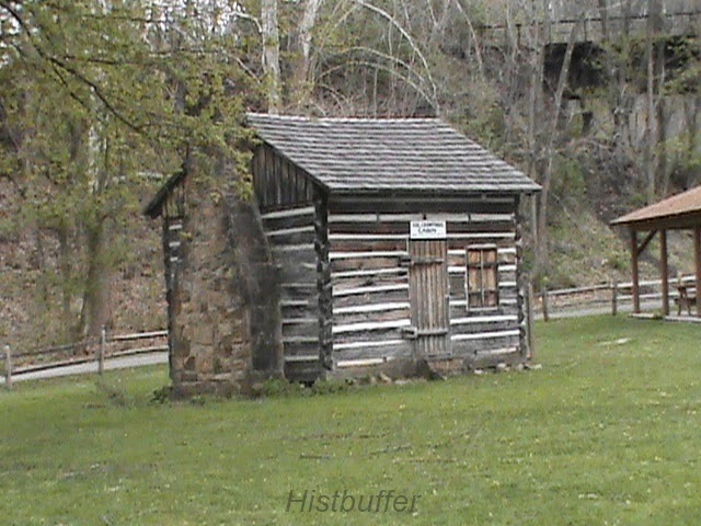
    Apparently, one such site is near the old Sony buildings near Ruffsdale and Mt. Pleasant. I have some info as to the supposed Jacob's Cabin area on the way to Braddock's Road to Hunker, with some documentation, so I am partial to the stories concerning him and the Kittanning Expedition where he was burned in his cabin there by Colonel Armstrong. Duaine is skeptical of the reality of a Captain Jacobs, at least in this area, near northern Fayette and southern Westmoreland counties. On this subject I tend to respectfully disagree, assuming the Captain Jacob's was the same man said to be the Delaware, or possibly Shawnee Indian, responsible for terrorizing raids on Fort Granville and Sideling Hill. Jacobs was said to be active here in the 1700's near Everson, the hamlets of Ruffsdale and Tarrs and northwest of Mount Pleasant and, perhaps mistakenly, near the Greenlick Dam near Hammondville and above Woodale. You can click on the links for more history on those half forgotten places near and dear, referred to in the above paragraph.

Since it felt a bit daunting scribbling rushed note on a tablet while listening to him, I purchased a digital recorder for such a future purpose and can go easy on my ability to read my own notes!

     A Rundown On Indian Information

     Now, this is a good time to elaborate on the bigger picture by giving you a quick rundown of general Indian research before continuing with the discussion about some of his knowledge:

    So, hang in there a minute, as there is need to orient the discussion slightly as to prehistoric and later aspects from to the years of Henry Hudson and the later explorers. Naturally, we won't be able to address many issues too far and get into all the substance of that here: the forms of hierarchical functions of the governance of communities, the seasonal and specific rituals or the different movements of the Indians, or their wars with the projected mortality rates and the settling of the nationalities of white traders and some of their depredations and epidemics. A fair bunch of written material available is based on a large amount of calculations bordering on speculation of many tribes breaking up or being conquered near the approach of European contact. We are assured very little initial contact took place anywhere near this part of the state, only distantly to the  north and southeast, mostly in other state's like Virginia, Connecticut and New York.

   Some relatively unknown or minor tribes of debatable origins were scattered throughout western PA, like the Honniasont, a possibly Siouan language group people, the Wenro, or the Black Mingo's, which according to books like the 'Encyclopedia Of Pennsylvania, Vol. 1', lived south of Lake Erie along with others as the Conestoga's, (known as the Sussquehannock), further northeast and their descent toward Maryland near where the Nanticoke Confederacy of the Delaware had settled.

  In brief, there were certain complex differences of totem clans and lineages of planter-gatherers, fishing, hunting and farming, contrasted between the developmental distinctions and divisions of various cultures as they migrated in and out of these regions. This also involves climatic trends as well as the essential time framing, as interpreted by linguists and archeologists of the early and later periods. This also extends to the interpretations toward those specific classifications regarding the ancient roots of the main stocks; noteworthy are the Algonquians and Iroquoian. Beginning with the Beaver Wars of 1608 to the French and Indian War major changes and conflicts were created and actvely fought. Some of the Indians were soon taken to the designated reservations and much of their former lands ceded to the new country partly to compensate for the part they chose in the American Revolution. This led to further rebellions and establishment of the American Fur Company heading far west with the steady growth of the system. There were those known as the 'half-breeds', mostly north and west of this part of PA made up of part French or Scotch and Irish, sometimes mistaken for pure blooded natives. Meanwhile, the Indians continued to back the losing side as in the War of 1812 for example, and the Indian Removal Act of 1830. So you see, this is an exhaustive focal subject requiring deep study. I, for one, am hardly an expert in this field.

    More Discussion 

     Now, you could say my information collecting is not too up to snuff, but, here is a piecemeal of what was generally related on Native Americans around here. Duaine Fuoss made mention of the Chickawa, Ottawa and Kanhawa Indians near here and the Indian associations of the quarry at Dawson and at Adelaide which is between Dawson and Broadford still in Upper Tyrone, a township of Fayette County. He is particularly noted as covering and walking large tracts of the surrounding townships while searching for Indian remains and valuables. Also, he talked of Indian graves near the old Laurel Mall; Indian remnants and forts at the King farm area of Kingview and a mile north on Dexter Road, near where Abraham Stauffer had a saw mill and where his sons ran the mines and coke ovens; that there was an old cemetery at where 'Busy Beaver', the hardware store at the mall south of Mt. Pleasant; of the finding of what many would feel to be controversial-giants bones near some areas in Fayette County. Furthermore, he is related to the Overholts, an illustrious farming and distilling family that gave rise to Henry Clay Frick with his monopoly on the Coal and Coke industry; the old settlers of Owensdale and the famly of the Sterrett's, related to Daniel Boone. This and much else, had me excited and left me almost gasping... for more!

   He proceeded to tell me of his great grandfather who owned much of the Iron Bridge area, when I mentioned my article 'The Meeting Of The Townships', on the old railroad crossing and home of the very first Iron Truss bridge built in the U. S, ( in conjunction with historical research of Lannie Dietle, published a little while ago). He also confirmed what I'd heard and read about where there once existed an Indian burial ground located on the northwest part of the old Mennonite Cemetery south of Everson which I already planned to include in a future post.


   Reluctant Goodbyes

   Eventually, he had to move along and I reluctantly shook hands and said good bye to quite a character and good speaker on these wonderful and colorful old subjects. I suggested he consider a Presentation for an organization such as the Bullskin Township Historical Society, only seeking their permission. They may well be as rooted to the spot, almost spellbound as I was with a gentleman that is an old treasure all by himself.

  Altogether, I had a very enlightening and fortuitous time spent that day, listening to him for approximately 2 hours with an occasional interjection from myself, now and then. He gave me permission to use his information in an article cart blanche, so here it is in a condensed form. I hope it was half as interesting to others as it was to me.


  I do plan a follow up to continue soon in a Part Two, offering more of his detailed material with photos of some of his prized artifacts, as well. Keep your fingers crossed and thanks for reading.

Sunday, July 6, 2014

The Braddock Road Crossing Reenactment At Connellsville


I hope everyone had a good, patriotic July Fourth!

  On the weekend of June 28 and the 29th, Connellsville held its re-enactment of General Braddock's Crossing festivities of the Yough River here, near Crawford's Cabin. I was glad to be a small part of that.


River Park Crossing area, courtesy of Penn Pilot

   Introduction

   It's doubly interesting, as I have had a post in the works for some time for the city of Connellsville anyway and that's convenient. This was a good opportunity and a meaningful experience all around, one I hadn't had before. The rock and roll music of the Del Sols was nice, they could actually play! Whiling away some time, many of the families tended to gather at booths, displays and the Balsley Pavilion, built in 2011, to beat the heat a little and enjoy some fun. This is as about as soon as this article could be done, since we are so close on the heels of July Fourth celebrations. I would like to add that The Greater Connellsville Chamber will sponsor the main fireworks there.

   Some Broader History

   In brief, during the Seven Years War of Europe, some of which played out here in what became our own unique backyard, so was being 'invaded' by the French, generous to the natives, but with long supply lines from Canada, while attempting control of the waterways and fur trade, goaded by the old claims of explorers LaSalle and Celeron.  While Pennsylvania was naturally inhabited more toward the east by the British, (and Germans, Dutch and Swiss), of the 13 royal colonies of the King of England since the 1600's, by grant of 'Penn's Woods', they were pushing westward for the prospect of more less expensive land. Once, southwestern PA was originally inhabited by the Monongehela and Woodland Cultures, and later, Algonquin, Susquehannock or Conestoga, and then some of the Iroquois from the more northern regions. And though the Seneca were the most powerful on the western corridor, first in rank were the Mohawk and the Onondagas; the Leni Lenape, and sub clans, which held the Munsees; and the Kanhawhas. As well, the nearby areas were visited on the periphery at times by other tribes and sub tribes passing through, such were the Shawnee, Wyandot and Nanticokes, with mixed clans of varying allegiences and agendas, such as the Mingos. As things stood, the provincial situation here in the Ohio Valley west of the Alleghenies was becoming a crucial hotbed and violence and bloodshed was honing in on the surrounding pioneers.

  Now that we have laid some groundwork for the urgency of the route taken and this crossing of the Youghiogheny River, I will leave off to relate the recent adventure of a tamer nature to this very place. (some research gained from 'The Indian Wars of Pennsylvania', C. Hale Sipe).


    My Lone Route

   So, down I went by Route 119, heading to the car park and turning right after a very mild crossing of my own on the Memorial Bridge on the west side of the city. Having  camera in hand, and some beef jerky, with the temperatures hovering in the mid 80's, and in need of a cold drink, I had my eye out for a parking spot. The forecast predicted foreboding thunderstorms and I wondered what treatment that weather would receive by the powers that be, centered around something to do with splashing through a river of water with lightening all around!

                                           The Festival

Yough River Park
    At the Yough River Park area, they had a nice Art on the Yough show, which I didn't really have time to take in. About 12 p.m. the Historical Society began speaking, (and speaking...), and thus began the ceremonials preliminary to the actual crossing itself at 1 o'clock.


A very exciting take on the colorful fording here, I might add! It gets the kids out of the history book mode, away from the video games and bringing to life a pretty fair impression of the reality behind the festival. It may of been marred ever so slightly by so many of the 'rent-a-cops', (no disrespect), and the presence of numerous firemen in the river.


   Add to that, the very long bright yellow rope the whole way across, well it does lose something in the translation. I looked longingly, but failed to find Mr. Braddock or his horse.


   Here you can also see the rafters interfering a bit on their journey down river.

Don't shoot, we're not French!


   But, with the shouting, band playing, splashing and shooting, hot damn, this felt right up my alley. All in all, it was enjoyable, especially the puzzling continual shooting of the muskets by the interestingly attired colonial re-enactors.


musket fire at Braddock's Crossing


Keep that flag held high!

    I'm not sure who was who exactly, but you would suppose this might of been a needed consideration for extra drama; and it does get your attention.


the British are coming


some good reenactors at the festival posing for a photo


       The recreation of Col. Crawford's 1766 cabin:

recreation of Colonel Crawford's Cabin


Crawford at the Carnegie Library

                                  Historical Background

   For the nitty-gritty, historically speaking, linking up to the Greater Allegheny Passage, locally, you can follow the Heritage Trail signs on the west side around a two mile area and ride or walk to take in the sights. The British themselves, were busy following the Nemacolin Indian path and part of the Catawba Trail; the exciting tale of the breaking and forging of Braddock's Road up a mostly, northwesterly route, through Fayette and Westmoreland during the heat of the French and Indian War, in 1755. This truly historic route would become the National Pike, then the future Route 40 and U. S. 68.

   Briefly, one Major General Edward Braddock, (1695- 1755), of the Coldstream Guards:


Major General Edward Braddock, courtesy, Wiki Commons

   He was responsible for launching the Expedition to defeat the French and Indians, (including Seneca, Mingo, Shawnee and some Delaware tribes), and with 21 year old George Washington, recently of Fort Necessity who had scouted the region well for Virginia previously with Christopher Gist, now as aide de camp and a Major, and, at least, part of the way, a young wagoner named Daniel Boone, Colonel Thomas Gage, Captain Horatio Gates, future commander of the continental forces and Indian guides, on the long march to the forks of the Ohio, with roughly, 2,600 troops, baggage, wagons and artillery, was assigned to the colonies for the taking of Fort Duquesne. Widening the road as they moved along, Colonel Dunbar was assigned the control of the artillery and some of the heavier supplies on Chestnut Ridge.

   This led to the fateful encounter in July and surprising ambush at the three hour Battle of the Monongehela, with approaching 900 casualties, the Major General severely and mortally wounded and the hasty, disorganized retreat; Braddock's burial by Colonel George Washington, and quick journey back to Will's Creek, Maryland. Much else can be said of the cutting of the wider road, the unfortunate tactics at the Field of his name, Dunbar's over reaction to the oncoming danger posed by the French, etc. We are here to concentrate our attention to the after affects of the following of Stewart's earlier Crossing here near Colonel Crawford's historic cabin in what was said to be three feet of water at the Yough Park, an area full of historical significance, at the 2014 June Festival at Connellsville, Fayette County, separated in time, hundreds of years later.


The route was also used as part of the Underground Railroad, to help escaping slaves in the 1800's and today is a good place with swimming, biking, hiking and fishing.

   Coming from the area of Mt. Braddock on Laurel Ridge, past Gist's Plantation, and Robinson's Falls at New Haven where the army camped and before the next camp at the Narrows, a mile towards the north, you come to Stewart's Crossing on the Youghiogheny River. More information here. Information on Mt. Braddock and Gist here.


    William Stewart was an early settler on the western side of the Yough River, near Opossum Run and Mount's Creek in what became Connellsville in 1753.

    A tragedy of a different sort involve a Scots-Irishman, Colonel William Crawford, 1732-1782, an early surveyor and soldier with connections to Washington and his Virginia Regiment. Tortured by the Indians and tragically burned at the stake in Sandusky, Ohio. He also fought in the Revolutionary War.


fireplace in Crawford's cabin
    This is done in honor of the work of a man and an army of what were then British soldiers in colonial days of yore. Washington had said of him later, in retrospect, "Thus died a man, whose good and bad qualities were intimately blended. He was brave even to a fault and in regular Service would have done honor to his profession. His attachments were warm, his enmities were strong, and having no disguise about him, both appeared in full force."


     It was a great learning experience for the young and old. We are seriously indebted to the Connellsville borough, Historical Society and the Fayette County Cultural Trust for holding the meaningful and cultural event there, as well as all the other sponsors.

    Any of you that were here this weekend, please go ahead, be proud and leave a comment with a little of what you thought of the event and what all you did.

    Here's some more of the action:

best I could do as it was a bit crowded


Indian hut with Colonial and Indian weapons

.
Native American at the Yough

Not Robin Hood and Little John here!

old days of Pennsylvania fire power

seller of Indian artifacts and Native American goods (I bought some)

animal pelts for the rendezvous

ready for the Narrow's encampment ?

C'mon, hurry back for the BBQ, boys!


   The Connellsville post will be up sometime soon, just don't get impatient. And in the mean time, I do have a few other plans in the pipeline. So, stay tuned and check back!
    - Histbuffer

Coal, Coke and Colonel Crawford: A Post On Connellsville


Some Historical Reflections of Connellsville


 Introduction


    I meant for some time to get to this important city of Fayette County, but one item or another kept me from giving it all my attention and resources. So, I got out my camera and a few maps and delved deeper into the subject.

   This post is about the unique history of Connellsville, once a large borough north of Uniontown, the county seat. It was incorporated in 1806, in Fayette County Pennsylvania and in 1906 became a city. It is beyond our scope to attempt a significant rundown from A-Z, so a patchwork of the region will have to suffice. Any locals that would like to add something interesting, please help to fill in the blanks.

   [NOTE: The borough of South Connellsville will be a subject for future coverage]

Very Early Days


   The city that joined with New Haven about 1917 is as interesting in details as it can be captivating in it's depth.  Lying near the heart of what is termed the Connellsville Coalfield, the borough is partly circled on the west by the Youghiogheny River, an important resource that called people to the area and to where many started settling in the late 1770's. This included the French from the north as well who claimed this land and the Delaware, Shawnee and Kanhawas and other tribes of Indians who were here even earlier. The coal strike labor dispute situation in 1891, led to some serious violence.

    The timber was a real attraction, especially the oak trees and, of course, the coal and ore production. The coal was baked to harden into coke, thereby used to smelt the iron ore. This was the custom all around the area.

                                   
courtesy, Library of Congress

   The fur trade was very popular too. The Catawba Indian Trail crossed through the region and the Ohio Company were heavily involved in exploring as they also hunted and trapped. Christopher Gist had major involvement as a surveyor from Virginia and then as a resident. He was a confidante, guide and friend of a young George Washington, who himself a surveyor, passed through here by way of Stewart's Crossings at different times, on his way to Le Beouf and later, Fort Duquesne experiencing much of the regional places and customs leading up to the  French and Indian War.

   Here's an historical marker for Jumonville:


courtesy of explorehistory.com
     And here's an historical marker for Braddock's Twelfth Camp here: (and two markers are better than one!)

explorehistory.com
                    
                                         
   General Braddock's march led through his army through here and forded the Yough River at Stewart's Crossing. There, will be found Colonel Crawford's Cabin, though reconstructed, and the remnant of road named for his efforts, especially Washington's, which ended in a tragic defeat, only rectified by the Forbes Expedition and Bouquet's route clearing of the Glade Pike. You will find more on this fascinating event of historical import on the post about the Yough River Park reenactment I attended in late June and I also invite you to check out my post on a route traversed in Upper Tyrone of The Lost Cemetery and Braddock Road. There is a more recent investigation related to the Braddock Road and Turkey Foot Road remnants near the Walnut Hill area. This will help give much extra information and allow for a better overview of this historical subject.

   Washington made his way here again toward Fort Le Boeuf, near Erie PA, to meet and discuss the encroachment of the French beforehand. Gist eventually came to dwell at Mount Braddock. The dastardly, dashing French of the time managed to destroy most, if not all, of his settlement. There is also much quality info from the Korns.org site in a pdf. file right HERE.

  George Washington also met the Half King Seneca Indian leader Tanacharisson close by at Jumonville where he also helped fight the French 'scouting party' at Jumonville Glen near Dunbr's Knob and caused some serious diplomatic troubles with the lifting of scalps. As is well known, thus began the French and Indian War with the famous 'shot heard round the world.' The rest is our history, folks.

  It should be noted that Providence Mounts of Bullskin lived near Connellsville at White's bridge, (the run was named after Henry White), on Whites Run. According to 'The History Of Fayette County", by Franklin Ellis, page 486, "At the mouth of White's Run, and partially in the present township of Connellsville, was the tract of land owned by Providence Mounts." He goes on to say, " Providence Mounts was probably the earliest of these settlers, and the principal stream of the township took its name from him. Just below the Bullskin line. Mounts had a mill at a very early day, and wool-carding was carried on at the same place." he was also involved with clearing the old Turkey Foot Road and was a Sheriff of Westmoreland County. More on that at another time.

   Speaking earlier of Indians in the area, (were we? well, we are now!), a friend I recently collaborated with, quoted something for me: 'the 1906 Borough of Connellsville' mentions: Indian village (surely burial close by), by Yough River between Adleaide Rd and Georgetown Manor area: Oglevee Lane, top of where Braddock Road intersects'. Well, I appreciate the reference being pointed out to me. Isn't that interesting now? I plan a future post on the Indian villages in our region and a map schematic for this eventually. There is more to be looked into from the hard to find book, "The Other Side Of History" on the subject of Indians in our region, and I will look into including this shortly.

    The city was indeed influenced heavily by the Whiskey Rebellion of 1794 as the tax was felt strongly here as well as other counties, towns and villages. One officer, Benjamin Wells, was even driven out and his home burned, which would of made quite a statement by the upset farmers and angry distillers. The uprising was soon put down by, none other, than George Washington and his Army of the new Republic of the United States.

    Colonel William Crawford's figure stands majestically, and yet somewhat tragically, in front to the Carnegie Free Public Library, built over an old cemetery in 1901, partly with funds from the tycoon Andrew Carnegie. He was captured, tortured and burned at the stake on the Sandusky  expedition in Ohio. I decided against recounting his suffering in detail, except that his bravery was said to be nothing less than amazing and inspiring during this tortuous ordeal.  Crawford came from what was Frederick County, Virginia, being born in 1732, that from 'History of Fayette County, Penn.', 1882, Franklin Ellis. He had moved to near Stewart's Crossing on the Youghiogheny by 1765, convinced by the state government that this was a part of Virginia. Washington was suppose to of stayed at his home around 1770, which seems very likely, as he was a fellow surveyor and lieutenant under Washington by 1758. He was also a half-brother to the Stephensons. ('Forbes Expedition', 1941), and commissioned a Colonel of the 7th Virginia Regiment by 1777.

Colonel Crawford's reconstructed cabin at Yough River Park


   He was in many of the campaigns, (at least six), of the Revolutionary War. He also served at Fort Pitt in the late 1770's and was on Forbes' successful march. His life ended very tragically in Sandusky in 1782, at the hands of the Shawnee Indians, (Washington-Crawford Letters). Some 'Blue', (or 'Black'), Mingos also, which were mostly a blend of Seneca and Cayugas. There is the Colonel Crawford Burn Site Monument in Wyandot County in Ohio commemorating his death in 1782 on the Sandusky River where he led Pennsylvanians in reprisal to destroy Indian villages in the Crawford Expedition. His re-created cabin resides at the Yough River Park, along with the spring house. This was also where William Stewart, an early settler, made his crossing and Major General Braddock took the army through the west side of Connellsville during the famed French and Indian War. This place exudes history like an aromatic calendar! The Community held the historic Braddock's Crossing festival and 'Art on the Yough' show at the end of June and I made it there as well. More information on that event is added at the link above and more material on Stewart will be upcoming.

    Crawford's Memorial statue and plaque can be easily observe in front of the Carnegie Library, 1260 yards from where, in 1765 he had his cabin. He is listed as pioneer, patriot, but first of all, 'friend of Washington'.

 As an afterthought, I suppose it interesting and a bit ironic, that the Old Connell grave yard was the site of the new Library. So at this time of year, maybe it is fitting to relate there are the reports of hauntings in the quiet realm of microfilm and newspapers! Thus, when removing the bodies to Chestnut Hill, according to the Fayette County Cultural Trust, this caused much dissension in the community and was thought of as a a ghoulish undertaking.

                                        Old Lore

    Out from old books come some surprising, even titillating tidbits, gems and stories, often without much in the way of source material to go on. Yet, there can be substance behind the traditional tales, especially as it is known the Indians were certainly in this area. The Connellsville Historical Society may well be able to help fill in the blanks with some meaningful knowledge on the subject, so give them a try.

    There is information that a particular, though apparently, unmentioned, tribe of Indians had their village located about 5 miles east of Connellsville. 'Here' was an extensive burial ground where it is, or was, believed by tradition in these parts ' that one thousand red men slept'. So saying, another, and smaller village was located on the banks of the Youghiogheny River, as the crow flies, about two miles above the mouth of Bear Run. 'In both of these places a large number of flints have been found'.

   As stated above, I will have a separate post on Native American artifacts and burial grounds 'down the road' some day. So, just when some doubter, (oh those of little faith!), thinks it unlikely for the appearance on the blog of something I promised, then, surprise, this is probably the time when I will deliver.

  Now that we have that straightened out, it is also believed there were some bold French traders from the Canada's settled in Fayette County as early as early as 1730. We do know, then the French built their forts in this 'section' and, technically, one George Washington was sent to warn them away, unsuccessfully, as they were on 'English lands'. This proved totally ineffective. On the trip out he spent a few days at the home of Mr., (Christopher), Gist at Mt. Braddock, a house technically still standing and refurbished. Gist had accompanied him as it has been claimed, as did William Crawford at times.Both were on the highly potent Forbes Expedition.This was wild country, with bears, buffaloes, cougars, elk and even wolves in the deep forests, as Thomas Hutchins made some mention of in 1764. He was in Bouquet's Expedition and was actually bragging up the area.
   

  South  C' Ville

    As stated above, this area will be dealt with at another time. For those of you that live there, I won't forget to give your area special coverage, thanks.

   Anchor Hocking


  The 'Capstan Glass Company' of South Connellsville has quite a history. With hindsight, some of it is sad, and even tragic. This will all be covered in more detail soon.

   Now back to the meat and potatoes of local Connellsville history:

     Stewart and Connell


    William Stewart and his brothers were pioneers that settled here near to the early 1750's, soon using the flatboats being made to ferry people across the Youghiogheny River. This was traditionally on the eastern embankment at Stewart's Crossings, very aptly named. This area was used later for barging materials down to the Monongehela River and on to the Ohio and places like the Mississippi Delta region and Louisiana. A house built by him in 1753 was burned by the French, (as was Gist's plantation at Mt. Braddock), after the British had the failed encounter at Fort Necessity and  this drove him from the place of his new home by 1754.


    Zachariah Connell, 1741-1813, the tee-totaling son of James Connell, was an early and powerful settler to the region, was the generous benefactor from whom the city received its name, arriving here near the time of Washington and boarding for a while with Colonel Crawford I've said so much about. The man himself, the very structure of this city rested its laurels upon, hailed from Frederick,Virginia. At times he was found involved with land speculation quite early on, in what was then the older township of Bullskin. He was married to one Rebecca Rice and by, approximately 1770, he founded the nucleus of the borough named after him in 1806.

   He was a prominent judge and as stated above, a hearty Virginian of the jurisdiction of the West Augusta District of Youghioghania County of which this whole area was mistakenly thought to be part and parcel of, contrary to the strong views of the Penns'. Connell, a captain of the militia, was very influential with the Governor there, (not of Pennsylvania), Robert Dinwiddie, that history sometimes views, with reason, with Dr. John Connolly in the number one position, as quite a troublemaker. He also served under William Perry in the War for Independence.

   Connell had surveyed for himself a large tract of land called 'Mud Island' at the time and basically began the plot of the town beginning in 1793. He died at his Water Street home and is buried nearby. His wife Margaret passed on in 1845. His marker is about 100 feet below his grave site in the woods on East Francis Ave.

   Zacharia Connell was closely connected to William Crawford in fact, supposedly through Ann Crawford, he was his father-in-law. His second wife Margaret Wallace's sister, Jennifer, was at one time the keeper of the tolls at the river, according to Historic PA dot net.. He did his best to influence the Pennsylvania General Assembly at Philadelphia on the 21 of February in 1786.It is debatable what was the exact result of his official inquiry, but to quote the old pamphlet and newspaper article of the words of the Vice President of the Supreme Executive Council, Charles Biddle,

    "A petition of Zachariah Connell was read, praying leave to bring in a bill, for the purpose of authorizing him, his heirs and assigns, to establish and maintain a ferry over the river Yoghiogeny, in Bullskin township, in the county of Fayette", with the hardly reassuring sentence following at the end, "Ordered to lie on the table."

    A lot of local products were shipped to the Monongahela by way of the 'Yough' and on to the Ohio and Pittsburgh areas. 

     It was said that Zach owned over 2,500 acres in the area that is now Connellsville, though he lived in fairly humble circumstances. Under his tutelage the town was laid out at 45 acres and he granted the inhabitants many privileges. The charter bore the date March 21, 1793.

    Many of those that arrived here came by the Allegheny Passage southwest or the old Turkey Foot Road from the southeast from Maryland.

Contact Form

Name

Email *

Message *