Showing posts with label Upper Tyrone. Show all posts

Sunday, August 11, 2019

Old Cabin in the Woods

 Introduction

 Hello fellow history buffs. I know, this is only the 2nd article for 2019. Please continue to stop by, you never know when I will get to a few other long planned on posts. Whether you are new to this blog or you are an old loyal follower who have been impatiently hoping for more insight on Fayette/Westmoreland Forgotten History, I hope you are all fine and in good health.

   Although these photos go back quite some years hence, this was a draft that hadn't seen the light of day. One reason for that: a difficulty in discovering exactly who owned the site as it changed hands since many years ago when, even then, little was known of it. I'm not providing GPS coordinates as much because of the murky condition as concerns any  recent land owners and all that. The post is finally uploaded in the name of research and historical interest.

  All the info I have available is it is quite old, but how old, I do not know, and it was in the 'Rhodes', or 'Rhoads', family for many years. When I and my brothers were little greenhorns an old lady and before that, an old man lived there, deep in the woods on Walnut Hill in Upper Tyrone Township. There use to be a larger lane down into the woods where every so often the old couple had groceries and other items delivered to their area. Well, unfortunately that is about the extent of my boyhood memories of the place.

  Any aware of further information, be sure to contact me.


  I was just feeling cooped up, so I took a corner of an afternoon to check the Walnut Hill area referred to in a previous Histbuffer post. Briefly, this primarily concerned the Braddock Road and the Turkey Foot Road, dwelling at some length on the historic and fascinating likelihood they may of actually crossed on or near Walnut Hill in Upper Tyrone and bordering Bullskin township.

 Touch of Fieldwork


  To give a little explanation, I strode off the road for a bit of fieldwork and felt immediately better to be out in nature. Whether you are hunting, hiking or just taking a stroll, there's something about the solitude and simplicity of going it alone in the woods that can really lend toward an advancement of your peace of mind. And I don't mean scanning pages of woods and snow online to grab a nice screensaver, occasionally spacing out and sighing now and then. No, sorry, that doesn't count!

  I started on the top of the hill, (an obvious beginning or ending, depends on how you look at it), where there is a remnant of the path leding from it's joining to the modern Kingview Road. To the east, this old route appeared to make a connection on a few maps, modern overhead photos, as well as 1939 aerial photos, to join the Kingview Road again from a few hundred yards downhill toward the paved main road on the way to Rt. 119. I had plans to eventually finish with this region in a future article. There use to be a much clearer pathway, wider in size, but you will have to take my word on that. Please, do keep in mind, not many know of the route, excepting a few that lived here a fairly long time ago.


The path near the guard rail to the east at the top of the hill

   Soon I worked my way down into...thorn bushes. HUNDREDS of them! Pesky, innumerable, from all angles, and...sharp. So, I took it slow and hesitantly, followed the trail through there. It appears to branch, then is more difficult to perceive. Later, in a rise toward the south there are a few roads that are were probably mine or farm roads.

After approximately 40 yards the road appears to split

   I would suggest no one actually attempting to duplicate my trek, let alone bothering to go through the trees and thorns from Beauty and the Beast's enchanted castle and simply go by what is shown here. Heck, some might just get lost in there. After a few weeks they will probably find their way back out. Maybe they will of learned about wilderness survival and camping, even though they are a quarter mile from a main road! If you are an experienced woodsman, or woods woman, you might be alright, otherwise, even with a compass (that wasn't part of my few items), it is a bit of a maze. Anyway, a warning, as unless mountain climbing is one of your serious hobbies, no one should attempt heading in there at the pole line to the north of where I did as the descent is extremely steep and surely much worse with the mud and snow of winter. The one advantage was minus the snakes and bugs of warmer months.


A clearer piece of the upper, southward trail

   Specifically, meaning, the path along the high, southern ridge staying in the very thick underbrush, to the point you couldn't get a photo without using a machete, while the lower, more northerly branch heading off eventually toward the old cabin, while further on, a deep hollow that can be a dangerous if not carefully skirted around to the west.


The old cabin hasn't been lived in for many years

 The area I found it in, after so many years of where I was reminded that it was suppose to be, wasn't quite the place I expected to come across it's whereabouts. So, you might say, I was a bit disoriented or whatever, but the case remains it was further up the hill than I had anticipated. No, I'm not perfect, let's put it nicely, shall we? But, I wasn't quite lost either..

 Again, no one I know of seems to be aware who exactly owns the old property these days. No harm was meant. Of course, not all that long ago one could freely hike these woods. No hunting or ulterior purposes were involved. If an objection arises to this post, and will do my best to respect the wishes of the owners as has been done to this point.


  The cabin, last used by an old couple by the name of Rhodes, or Rhoads, was to the last inhabited by the woman until her last days. By the way, if a Mr. Hall(?), or whatever the name is on a few old postings, I didn't see any other until meandering well past the cabin location and am an innocent guy who generally minds his own business, alright? The old landowner around these parts was a friendly man who had no qualms about traversing the hillside. I also saw no other person on my journey through some of the woodlands. Thank you.


   I was rather surprised to see that it did have electricity back in the day!


  The place is very deteriorated. Because the ceiling is fallen, there was no temptation to go inside. There was wood and junk under the floorboards.


  The well was still there, though I was stepping a bit gingerly.


  I followed one pathway until it was difficult to be certain of it's whereabouts.Then I caught pieces of a path or road off and on through to another, more easterly ridge. That's where I saw a few postings. Keep away, you are NOT wanted here! So, I did just that which changed the trajectory of my quest to going in farther down Walnut Hill and walking up in a ways. I noticed what appears to be a scar or trace in the cornfield. This looked interesting. It is easier to perceive and more noticeable in three dimensions from various angles. Here's a photo:


 Later on, I met a man at his residence coming home from work and realizing that I didn't have much daylight left OR permission, I promptly asked him about the road entering the woods back behind the houses. He told me he had only lived there for ten years, doesn't know the ownership situation but pointed out a house where some elderly people live that might have more knowledge. Quickly, it hit me, I know those people! One of them, Dolores Mailik, I had been in the Laurel Art Club with back in the 1990's. Yet, I decided not to bother these folks too much. So I put off any re-acquaintances until maybe a time when I was cleaned up and more presentable to ask if they know if it is alright I check the road down there for a pace or two, as it could be indicative of a clearer perspective of how this road originated.


 What concerned me most is the lack of rutting in the old road in those woods, as much as I could discern anyway. Such is often a feature of the Turkey Foot Road or the Braddock Road remnants amid steep terrain.There are logging or farm roads on the hill as well, but the importance and significance is not known to me.

  Yes, ladies and gentlemen, the jury is still out, and may never convene on how much importance can be gleaned from our limited observations and lack of knowledge, which includes understanding of carpentry and building acumen. In general, these photos and a bit of familiarity with the lay of the overgrown hills and hollows is all I acquired by my rambling camera trek in the heart of February, a lot of years ago. Nevertheless, I felt relieved to of once again seen some of this first hand. In fact, I enjoyed the small excursion for what it was:

 a minor attempt to learn something more of the Turkey Foot Road through this particular region and a chance to get out from a case of cabin fever and check out an old dilapidated  cabin of a different sort. Underlying this, is the real possibility the TFR route went further down toward the northeast around Kingview. The jury hasn't yet been formed to convene on such an alternate course as that, with the basic deduction of very little to go on for now.

  As always, keep the emails and comments coming, they can be the life blood of a good old blog, and are truly appreciated! As for my recent lack of posts, priorities are what they are, so I will leave it at that. Take care, enjoy the rest of the summer, and I'll be back (some day!), for another excursion into our regional history on the next post, folks!
 

Saturday, April 22, 2017

Sewage work affecting northeastern Fayette County


  A Layman's Report


     A Little History

   It might be hard to judge how Westmoreland County residents would feel about a Fayette County company handling their sewage and water from the confines of Fayette, but what we do know, according to a Department of Health publication of 1909, until fairly recently Fayette County didn't have a Westmoreland Country company in control of these utilities.


   Way back in 1881, October the twenty-seventh to be exact, the smaller water companies of Lemont, Huron, Redstone and Fairchance were merged and consolidated for the transportation and storage of water from the Yough at Broadford through Connellsville to Mt. Pleasant. This was chartered as the Youghiogheny Water Company. The Trotter Water Co. also dealt more with the Monongahela water supply. Now the center of business was where? Can you guess this one? Scottdale, in East Huntingdon of Westmoreland County. The main pumping station was at Dunbar on the west bank of the Yough opposite South Connellsville. This is only an excerpt; but before that, the  Connellsviile Water Company was incorporated in 1883 and built by William S. Kuhn. It was later controlled by the American Water Works and Electric Co. Breakneck Reservoir was one of two in use.

    One obvious feature should be noticeable, and that is companies like this have certainly branched out and expanded considerably since the old days all over the townships of different counties. That is pretty much the norm. Monopolizing through growth and acquisition into many fields concurrently.The purpose of this blog is history, yes, but the discussion must include these salient issues to make sense occasionally. I don't enjoy going this route, folks. The debate is a standard formula to try to bring the matter into a clearer focus.

      Modern Times

   Much of the 400 miles of pipeline in the region of Upper Tyrone was 100 years old. A surprising figure. What should be a staggering fact is that those in charge allowed the problem to get to this critical junction. However this happened, it looks to be a classic case of neglect, pure and simple. Remember, I've made the statement before that I've lived in both counties, so that isn't really an issue. In a nutshell, the MAWC (Municipal Authority of Westmoreland County), out of Greensburg controls quite an extent of the waterlines and supply of Fayette County. According to an article of April 12, 2017 in the TRIB Live, the Authority, (somebody must love that word), was established in the 1940's only for Westmoreland County residents. That fact is obvious by the name alone. They now 'serve' municipalities in Armstrong, Westmoreland, Fayette, Allegheny and Indiana counties. An extensive branching out in the fashion of a monopoly. I say that as MAWC is buying them up all over. CONSOLIDATION is a word more often used in these parts whether it is more suited, or not. Who is the highest bidder? Well, the example provided goes on on a much larger scale in other ways across this great nation of ours.

    MAWC claims these acquisitions allow them to operate more efficiently. Here's just one letter to the Tribune Review Editorial if anyone cares to read it. Christopher Kerr, the manager, is said to also be a part owner of Utilishield, the insurance company used by MAWC for its waterlines. I don't know about efficiency but convenience is another word. Spin is yet another. Mr. Kerr refers to parochialism as a problem in the Ohio River valley. There you go. Down south, the situation also involves the North Fayette County Municipal Authority board chaired by Philip Mahoney. A study was being undertaken by Senate Engineering Co. on purchasing water from MAWC or spending 35 million bucks on a new plant.

    PLEASE become more informed. Voice your cause in the comment section and elsewhere. MAWC can be reached on 124 Park and Pool Rd., near New Stsnton and Youngwood. Their phone no. is 724-755-5800, or toll free at 1-800-442-6829. Email is mawc@mawc.org. Good luck.

   More to the point, we are particularly concerned with one Upper Tyrone Sewage Project. How all this came about and exactly what legal ramifications there are is not necessarily pertinent to this post. The story could go on and on. As it is understood, the company is in the process of using sub-contractors for fixing and replacing service line connections with of the old pipes along roads, sidewalks, and premises that were apparently left to rust and neglect and need an upgrade anyway for way too long. A lot of wanton damage seems to be regularly left behind them. This could be said of a lot of our infrastructure.

   This post had to be updated relative to some of the municipal personnel, there was sent out a proper explanatory packet which helped elucidate on the broader picture of the whole process.

    I was informed that much of the damaging conditions described below will be fixed up better within somewhere between August and ... an unknown date. Also information on the Grinder Pump connections, pipe bedding details and service connections were then provided. Septic tank by-passes, the different boring and capping details are in there. This unexpected graphic material was appreciated, even though it was sent at a late hour. Now the letter claims it is 70% completed and the pump stations are 82% completed. The main areas of operation in are Everson Valley, *(which I could barely get in and out of on a recent trip to the municipal building)*, Kingview, McClure, and Mount Pleasant Road. I don't have info on what is being done in nearby townships. The pumping stations, which are costing a small fortune, are Broadford Road, Kingview, off of Dexter Road, Everson St., McCLure, and probably the main one is in Broadford, or so I was told. The links are on the township web page where the tap agreement is located.


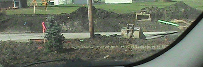
No this was not an alley, but a back road near Pigeon Hill.


Large machinery going to work on replacing sewage pipes


Dirt mound left. Most photos are from East Scottdale and Everson
                                                                 
Road damage with gravel fill.


    Under approval of the chairman of the board, Randy Roadman, last year saw an increase of twenty five percent in sewage bills rates, and yet they also passed that they will charge a hefty sum on the side as well-to some. I read where they were also raised in 2013. Currently this is at $36.00 a billing, and from $1,800 - $2,300 in total extra fees. A piddling sum one would suppose even in a depressed area. By the way, hasn't this type of thing been going on with the electric companies as well? MAWC is apparently not under the supervision of the Public Utility Commission. I'm not informed about NFMA one way, or the other. Ignoring an online petition, Westmoreland County Commissioner, Gina Cerilli,basically says she has no problem with the rate hikes. OK...The word is out that there are suppose to be further increases in 2018 and for sewage bills in Fayette as well. Whoa! MAWC calls this tack, "reinvesting in the infrastructure." A "prudent" thing. Uh-huh. They may not like what some of us might call it. The voice of the people appears to often be muffled, if not muzzled. A sad notice on communities of the state of our welfare mixed with a lack of consideration of a very depressed area.

    Beyond all the above, the North Fayette Municipal Authority located in Dunbar Township at  P. O. Box 368, 1634 University Drive, is claimed by the Upper Tyrone municipal authorities as the main culprit behind this portion of our article. They may even be the main controlling unit as for the sewage of Fayette, it would seem. Phone number for them is 724-626-1211, listed on one website as a Connellsville number. The website doesn't offer much information on this subject at all. For what it's worth, an old explanation of the options and the possible connection with Mawc are in this newspaper article. Apparently, they would either buy the 58 acre property from the Coastal Liumber Company for nearly $29,000,000 or use Mawc for the treated water. In the end, it appears we customers will be paying higher sewage AND water bills.

    In other news, why doesn't the website for the Upper Tyrone Municipal Authority have any updates on any meetings held on the 4th Monday of the month or details of the supervisor meetings held on the fourth Tuesday of the month for the last 9 months? Good question. It is worrying that I haven't received a decent answer when posing it, except something like, that with all that has been going on it's no wonder that is the case... uh-huh. Ah, politics! That's not very satisfactory. There are also those that have been informed that, ultimately, the orders or advice for upgrades, I'm not sure which, come from the DEP. There vehicles have been seen around so that qualifies as being spot on too.  I do know that other departments and organizations are involved. This is only added as a basic rundown and is not really the main point of the post. The whole picture can become overly complicated. Regardless of that situation and the regulations which must make customers flinch, if not on the offensive, at least on the defensive, they are treading near to a region where history is in danger and clearly in need of serious funds for archeological research, especially in key places. (Let's see these fine establishments raise a bunch of money for that urgent purpose). No one will be holding their breath.

   One of these realms of multi-layered need of preservation does indeed lie in small northeastern Upper Tyrone Township. That is not to deny the need in surrounding parts, but they do have associations that cater on a better level. For those that come here frequently, it is no secret that there are fairly recent findings, iwhich encapsulate various types of research and documentation of the meeting of branches of the Turkey Foot and Braddock Roads in Fayette County and parts of Westmoreland County; such circumstances should up the ante at hand. Also, in the post for Westmoreland County, more concerned with East Huntingdon Township, is, almost by accident, where most of these significant links are located on this site to retrace much of this archaic material. At this stage it is doubtful anything can or will be done to alleviate the threat toward a loss to our heritage, if indeed there is a serious threat. That would be a sad state of affairs. The PENN Dot McClure project is not finished, so the eventual extent of the damage can only be a rough estimate at this time. The jury may still be out on that issue. Not that planning couldn't of foreseen these problems and rectified them, or some solution could not be undertaken. This is still a distant possibility, though unlikely. It's partly the idea that history is not always considered when these projects are discussed in the board rooms. This is an irksome truth that sometimes it is the least of the priorities, on the bottom of the list.

                                               
Roack an mound left behind.


   The circumstances are ironic in a real sense as the past has seen the sealing of old mines and a general neglect of the old coke ovens. Progress must continue, yet it pushes the treasures of old industrial history aside, even as that very industry polluted our landscape with mine drainage and helped to bury the former heritage even deeper. Obviously with the digging up around the old roads in Upper Tyrone, some of which at this moment make them almost unusable, just patched up with gravel, especially if they are not even bothering to checking this out with archeological experts, that is surely the case. Needs of that stature could be further addressed in many communities.


Alley work.


     Of course, this is not to claim the upgrades do not need to be done or the company does not hire contractors capable of doing a proper job. The wisdom in commencing the operations in the middle of winter is, nevertheless, up for debate, as are other factors as well.  The stark truth contains the hard kernel that some disruption must take place, even at our  own expense. To a point. As for the Municipal Authority of Westmorleand County, if you take the time to read the basic regulations, they do make this available in a fifty-three page PDF file. Although this is only pertinent to water lines and not sewage, an interesting aside concerns a statement on page 9, No. 37, "The Authority will install and maintain at its own cost all service line connections ...and maintain all service lines from the mains to and including the curb stop and service box which will be placed inside the curb or property line", etc. Apparently this is difficult enough to comprehend and somehow does not include this upgrading work taking place now which supposedly includes some water lines. Don't ask me, ask them!Sifting through the descriptions of the various services and rules is probably not a task for the average consumer to grasp, whatever organization we are examining. Maybe they can make a decent explanation of the whole mess. Maybe somewhere they have and I just haven't seen it.

     In a cursory reading, statements to this effect appear to put the cost on the company, hardly the consumer. That may depend on what is being discussed at a given time and place and under what conditions. Maybe some of the following paragraphs allow for some kind of adjustment of the previous condition. All I can say is, I am not a lawyer and in reading at the website, you might need to be one to comprehend all the ifs, ands, buts and round about language referred to. Being this is more connected to water issues, the argument supplied above may be immaterial and not specifically applicable. So be it. Yet how is it that distribution piping and treatment plants could be a new charge for consumers to bear, if that is the case? One wonders exactly how this comes about.

      Sorry about the quality of many of the pipe work photos. Some were taken on rainy days.                            

Sewage work near Duraloy


Large pipes to install at Dexter Road.


    Is this really overreacting on my part? To arrive closer to the heart of the matter from my own simple perspective, I share the guilt. Since writing about the McClure road construction and being later told it is in early stages, so not to worry. That's another thing. Here, I hadn't realized what was going on, not reacting swiftly enough, and my influence is not all that influential to do what newspapers and local governments, historical societies and PA archeological establishments can. We have tried to make some effort to pass on these concerns.

    I'm not too different than anyone else. I find myself dealing with new medical insurance issues, transportation woes and unusual job decisions of some magnitude and the usual projects in my personal life lately. Evidently there is not the proper oversight needed to tackle and control a situation we find ourselves in agreed upon by county commissioners. For the sake of completeness, the township officials in Upper Tyrone on the fairly new Sewage Authority there are:  Jess Keller, Paul Kendi, Barry Whoric, and Stanely Borek. That's what I have read, anyway. Some of the technicalities are clearly beyond the scope of this article and I am not expert enough to attempt such an explanation to any real satisfaction. That must be addressed by contacting the governing bodies involved.

                                             
Black tarps during last winter.


   Hopefully this lone voice is not the only one making complaints, perhaps there are others. Please inform me if you know of anybody else that is on the periphery. I would be happy to have the knowledge and congratulate those persons or entities standing up to be counted.


   One of the key points of this post concerns not just the noise pollution, the machinery up and down the village roads clanking along, the legacy of layers of dust, the mounds of dirt left in people's yards, sometimes with trees and bushes destroyed. That may some day be rectified. But the sad lack of oversight considering the regions vaunted historical significance is most upsetting. One would assume that along the way this constant digging and drilling has or will come upon structure, ancient items, and occasionally, bones that are not only being misplaced and tampered with, probably ignored as so much junk in the way of...PROGRESS. It could be people were better off in the days of outhouses. Well, then again, maybe not!


    Historical Research in the Process of Possible Destruction

    The danger appeared to be at the brink of calamity as they considered work very near to the old structure on the south bank of Jacobs Creek in Fayette County. That is a personal pet project of mine.  If this was indeed the case, it would be appalling. I have recently noted that they appear to be backing away from significant changes in that narrow locality and one can only hope it remains this way. It can be difficult to ask a direct question and be sure of receiving a straight answer. Maybe that depends on who is asking what organization the question at what time.

   An urgent call needs to be made to citizens and caring residents of these communities to inspect the situation for themselves. Nothing less will do to bring a stop to wanton damage of great and meaningful historical implications. If no one gets involved all I can say at this time is: you have been fairly warned. The Turkey Foot Road beds and the routes of the Braddock Road nearby are perhaps the most noticeable features of our old landscape for attention. They are far from the only ones; they appear to be the most significant. Much of this has been previously covered on other posts with handy links above.

                                             
A case of bumpy road conditions. How long until fixed?


..Unfortunately, except for a few conversations and emails, one with state archeologist, Chris Espenshade on the Penn Dot future road construction, gaining an appreciable interest of the proper authorities has not been achieved in any serious fashion. And that is actually an understatement, folks. Personally, there simply hasn't been much success in the aims and needs of having this region examined archeologically, however briefly, let alone minutely on a professional level. I am not alone in this. Cassandra Vivien, author and holder of many positions, particularly in Mount Pleasant, is one person that comes to mind who has voiced frustration in the recent past.

   To sum up, we are seeing a loss of our heritage under the bulldozer and backhoe. To the auspices of those in power  caution is urged. Instead, this looks like a complicit agreement to overrun the land to a certain extent, regardless of the consequences and circumstances in which it is being performed, as long as the job gets done. I want to show some extra empathy with those visitors grueling it out to the end of the article.

  Many of you are watching and observing, sometimes complaining, as taking place in these digs and improvements is a general disregard for historical implications in these parts. Check the authorities that be and voice your important grievances. The seriousness of the problem demands concern. Personally, I predict the historical worries to eventually be ignored, and worse, forgotten. Not to be too gloomy, but it isn't a case lined with much optimism. Experience echoes the reality. The main decisions to get this project to a conclusion appears to be all that really matter toward the price of our heritage. OH, and the prices of sewage and water continue to climb. I've heard various figures. There is a missing formula in their equation: the rights of the people to be represented better than we are at this time in our very own backyards.

    So, our past will be dug up and then covered back and partly patched back up with the approval of the county and township councilors. Those who are there to support us and look after the best interests need to take a second look at things. Granted, times have certainly changed. Consequently, things are very different in every avenue of our fast paced lives. And as most of us well know, not always to our liking or immediate benefit.


   NOTE:

    If any of this material is technically incorrect, the blog has tried to get most of it straight and I think it goes without saying, this is hardly the easiest subject to convey to the public in meticulous detail by an outside source. I apologize to anybody if there are any inaccuracies. Again, I have attempted to get it across as best as was able to.

  Hopefully, the next upload will focus on a subject more upbeat and to the taste of all the history buffs out there.


    A Personal Word

   I'm really glad many of you have shown enjoyment and interest with the last post uploaded. There is also a nice surprise in receiving contact and page views for old posts, some with the warts of inexperience and spontaneity openly exposed, competing for attention with the dates, facts. and figures

   Thank you for continuing to offer a word of encouragement and occasionally passing on your own heartfelt stories and knowledge from the places where you live!

Tuesday, August 4, 2015

Close Friend's Passing

   DOROTHY  BOYD

   Hello again folks ! At first, I debated a while with myself about publishing this post. This blog does have a heart, and in the long run, I think this is the right decision. I hope this post gives a real impression, however briefly, on the life of this fine woman.

   For many years this half cousin of mine was a close friend, especially with my mother over many years. The two of them went places together, had long talks amid cups of tea on the porch in the summer months; my Mom even sometimes ran errands for her, such as picking up her medications. 'Dot', as she was affectionately known, would continually bring up how much, while my Mom was in decline with Alzheimer's, she was gladdened by seeing and talking to her grand kids, as that meant so much to Dot. Well, with the death of my Mom following my father's demise two years ago this April and July, such a special relationship passed to myself. Of course not of the same brand, yet I am proud of getting to know her better and at this time submit an honorable mention out of an abiding respect of her and who she was.

  Let me briefly explain.

 Dot Boyd was one person that would call us every now and then asking how we were doing, naming all of us, just a very caring person. She might of become even more concerned about us, if that is possible, after my parents passed away.

  Sadly, Dorothy L. Boyd died on the first day of summer, June 21, 2015 in the Harman House Convalescent Center at Mt. Pleasant, Pa. I suppose I knew her all my life. She was born on  Dec. 17, 1925, a daughter of Roy and Irene (Eicher) Miner. Graduating from Scottdale High School, Class of 1943, the El Paso, Texas Business School as well as the General Motors Secretarial school in Pittsburgh. Yes, she was one smart lady. She was married to Harry (Bucky) Boyd, who passed on many years ago. Dot retired from her last job as secretary at Frick Hospital. A member of many organizations, including the Everson Evangelical church, she would sit in her kitchen and tell me lots of stories about local events, the old schools and some of the churches with many little anecdotes thrown in. I, on the other hand was often telling her about the rest of my family and stuff about my parents, work and brothers. One other item: My Blog! She was fascinated to hear about the posts and the regional history, particularly the 'Relatives and Ancestors' entries. No wonder!

   Last winter she had anxiously suggested in the spring, we drive out to Bullskin and check up on our distant relatives and just spend some time asking around. The idea sounded like a good plan that I looked forward to! I may of had a bit if a premonition whether we would really be able to do this together.

   Here's a humorous example of how sharp she still was. After her explaining  to me more stories of  our mutual relationship to the regional Hatfield's, I told her I would look up more historical details and get back with her soon. The next time I visited, she asked about this and I told her about how Amsi Miner was the son of George Hatfield and I am descended from Amsi's first wife, Rebecca Green and Dot from his second wife Minerva Keefer. (The fuller story can be found on the January  'Relatives and Ancestors: Chapter Two' post). So, she looked up at me and said, "Oh I know, I told you we were directly related to the Hatfield's!" She had, and without the shadow of a doubt.

   When I got properly dressed and went over to Ferguson's Funeral Home to convey my respects to her and sympathy to her and for her sons 'Jim Bob', or James Dugger and Freddy Dugger and the extended family; in spite of her advanced age, I felt so sad. We have some idea what Jim and Fred, the grandchildren and great grandchildren, must have gone through. Such a personal and intimate experience grief really is, certainly so when losing a close precious relative. This becomes the most difficult part of living. You need to convey your feelings, but don't necessarily get closer than you should. There is something to be said for showing you really care, yet initially keeping a small respectable distance for people going through so much private inner turmoil, if you know what I mean. Birth, death and marriage are truly sacred moments.

  There are few people I could possibly miss more in my life. Two of those exceptions would be my parents, shown below.

   PHOTO: Dorothy Boyd is seen here at an Army Reunion for the 34th Division, 'Red Bull' 135th Infantry, with close companion, Chuck Etling and my Dad and Mom to the left:

           
My Dad and Mom, with Dot Boyd and Chuck Etling

   She was a very dear acquaintance and became an even better friend, to the extent I, a distant relative, not only miss her dearly, and so sympathize with her warm family. Well, this special lady who once was a secretary at the local hosptial, as was my Mom for a local financier, was also a witty, caring and really charming and wonderful person. If this wasn't the case, I would not state the fact in this manner. Yes, one can feel nostalgia this quickly, if you can call it that.


   Brief Eulogy:


    Passing the doorway, an eternal smile, "oh, won't you come in?"

   Passing the days into layered silver years, moving quickly over the higher hills,
   
   Slowing in darker valleys,

    Passing...to a unique bright glow beyond, though unseen;


   Always a word, concern in those lucid eyes, such a zest, 

   Interaction, a unique camaraderie

   Always a deep love of family and  grand kids

   Always unparallelled common sense

   Always more than what she seemed;


   Sharing tales and remembrances of older, fascinating times

   As a bright crystal glass of aged wine

   Sharing energy and wisdom, mixed in with her constant politeness and concern,

   For You

   Sharing snippets, a knowing look and grin amid talks of mutual ancestry


   Tears are easy and free, with a loss uncounted,

   For those without a glimmer of replacement in this world

   Sorely missed, deeply cherished

   One of a Kind

   So " oh, won't you come in?" 


   One with the Lord 

   
    As her obituary in the Greensburg Tribune truly states, "Love Lasts Forever" †

     I owed this much. * Goodbye Dot! *

    
  I encourage any who were close to Dot, or friends and acquaintances with a story or good anecdote, to feel free and leave some message in the comment section below.

Monday, March 9, 2015

In Like A Lion

 A Foreword On A Published Article


 If there is anything I really love doing, up high on the list, is being able to inform people of our fascinating regional history. A close second is the learning experience acquired through this very research and the people and relatives you get to know along the chosen path. The School of History is an awesome place, have you taken a few courses? The Degree is your own satisfaction of gaining a meaningful understanding of times and locations which may involve some time, but totally worth the endeavor, I promise!

 First, but not necessarily foremost, I want to draw your attention to an article I published for the Bullskin Township Historical Society, Volume 4-Number 1 of the Spring 2015 edition. This is a condensed version with some adjustments of my two in depth posts on the 'TFR', The Forgotten Turkey Foot Road...' and 'Turkey Foot Road Remnants...' I admit to feeling some pride in this accomplishment. In fact, I find it very exciting! Although the material was fairly easy to transfer, narrowing the scope for the most important information into a two page story was a mite more of a challenge and yet a good experience. I thank the Society for allowing me this opportunity for betterment and enlightenment of the regional community. There are GOOD, quality articles in there as well you should find entertaining and intriguing, so for more information you can check this LINK!

 COLD Spell

Although our region experienced much cold this winter with some very frozen nights, the white stuff  came in doses of one or two inches. No, we haven't graduated to weather forecasts on FWFH, rather here are a few picturesque views from the large storm from the early March of this year.

   In the old days, and some of us remember a few of those extremes in weather, people had to dig there way out of their homes the best they could to get to the grocer, the post office, or just over the farm lane to the cow pens after a windy night. We don't have it as bad as all that, but getting to and from work and school can still be a harsh reality for many.

  The day after the storm of March 4 was a sunny day, not too chilling and a ride around Upper Tyrone, Bullskin and East Huntingdon was certainly in the cards. So, take a little diversion and hope along with me this is the last snowfall of this caliber, and soon we will be seeing the grass turn greener and the first timid buds of spring arriving!


    The caption from the above photo gives a description of the area where some of these were snapped.


        Ah, blue skies and...snow, plenty of the stuff.


     Can you guess where this is?


A bend in Valley View Drive at South Everson near the Braddock Road


    Above is the South Everson portion of Valley View Drive just north of the St. Joseph Cemetery. Near this stretch was an old trace that could pertain to the Braddock Road that deviated quite close to where the photo was taken.


    This was not actually from part of a wilderness trek, far from it, just a backyard fir tree!


     A path 'around the bend'. Sometimes our course takes us through some chilling places, though often there is beauty along the way.


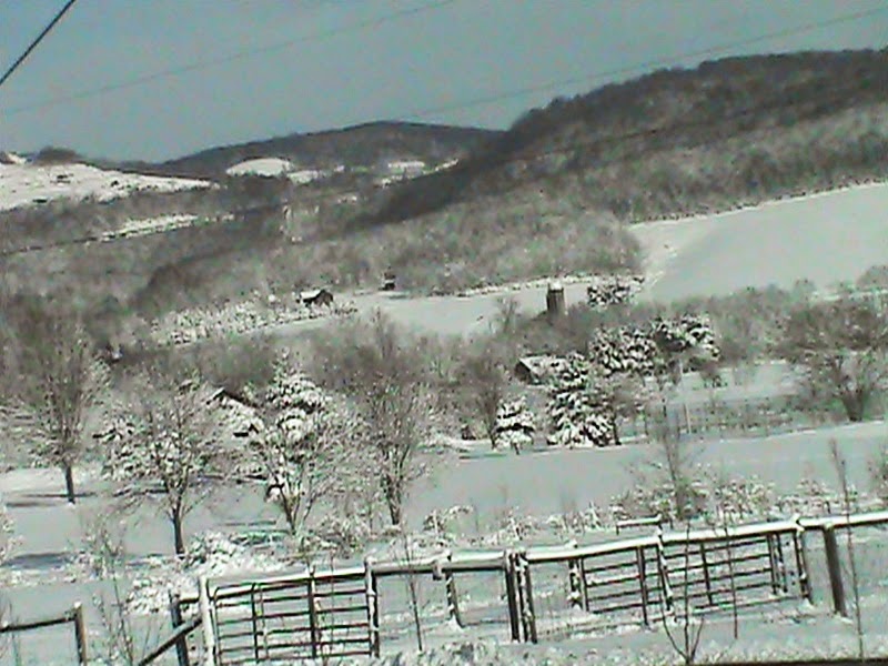
    This photo is looking east toward the lessening heights of the Chestnut Ridge and the Ore Mine Hill region. In the foreground is a rural scene of Woodale.


    There absolutely HAD to be at least one farm scene  ; )
   
A small wooded area covered in snow in Alverton


B'rrr  !


     Like many of you, I sincerely wish this is our last view of ice on the gutters from the freezing winter of 2014/2015. I'm sick of the cold, to be perfectly blunt. Well, let's keep our fingers crossed. Those with snow mobiles and skis can ignore my rant against the cold. Even those hearty ones must admit SUB ZERO numbing weather is not necessary to experience fun in your travels. The snow itself is a beautiful sight, isn't it really?

   Today on Monday, the temperature reached near the balmy high of 50 degrees. Ah, is that a slight whiff of more pleasant climes and the reawakening of warmth around the corner? Nudging of seedlings deep down and the song of a lone robin on the crisp wind? Just maybe...keep your fingers crossed.

   I'll be back soon with a brand new entry as we thaw out. Keep Checking In!

   ~  Histbuffer


Monday, October 20, 2014

The Braddock and Turkey Foot Roads Near Walnut Hill with added Information

  I'm back with you here folks, to present an in depth post on the little known Walnut Hill area of Upper Tyrone and Bullskin townships and the historic connections it has to the Braddock Road and, possible associations to the Turkey Foot Road.

  Please read on for some interesting observations and surprising conclusions.

 School, Church and old Cabin


 Part of the Walnut Hill area is in Pennsville of Bullskin Township, the other part in Upper Tyrone Township, and both are in Fayette County, Pennsylvania. This is above where George's Trading Post is near Crossroads. To help give directions for more distant travelers, from the south is the next one to the left past the Rt. 119 Everson exit. From the north, the second turn off to the right, past the Mt. Pleasant exit.

 As the Pennsville area was settled very early, the only place around the region this ancient is probably the borough of Mount Pleasant. Accordingly, Franklin Ellis' book, "The History Of Fayette County" on page 497, claims the Pennsville settlement once had twenty-one families, (at least as many, and maybe more than now). In May of 1837, it was voted on to build the octagon schoolhouse, so this was, apparently considered as coming into their jurisdiction. I don't know just when this school was replaced by others to the west in Kingview and Kifertown and how this was used in conjunction with the school houses round about Pennsville.

 In what was termed the 'First Half District', was the somewhat mysterious 'octagon' schoolhouse and an old United Brethren church where Isaiah Potter and sometimes, Rev. Powers preached. Dr. John R. King, born in Normalville in 1866, (according to the "History Of The Allegheny Conference of the United Brethren Of Christ", by J. S. Fulton), attended the Mt. Pleasant Institute and was converted at the old Walnut Hill church and was united in service for that church. The Everson Evangelical church was said to be an out growth of the Walnut church in the late 1890's.

  Both the old school and church  have long since vanished.

  Here is a schematic cropped photo to delineate the general location of these two buildings:


   On the same page of Ellis' book about the population, we have "This house was on the Tyrone line, west of Pennsville and was a prominent landmark in its day." Which makes it even more interesting as so very precious little information is known concerning it. Sarah Ullery and Henry Ullery, a family name that has lived nearby, may well of been a teacher there, the same might be said of Elijah Yunkin, and possibly even Lulu Longanecker, as she taught for some time at the hamlet of Kingview. In 1900, as well as South Everson and McClure. Francis Hill was a teacher listed at the school.

  According to the Daily Courier, Sept. 26, 1905 pg. 5, the First Institute of the Upper Tyrone Teachers was to be held in October at the Walnut Hill school house with teachers, patrons, and other friends of education invited to attend. This would allow for some evidence of it's prominence.

   Here is the old cabin down in the woods approximately 40 to 50 yards, (at a posted location), near the top of Walnut just to the northeast of the Kingview Rd. There is still a ruin there, but may not be much left of it nowadays. My family knew the old Rhodes man and woman who use to live here in the 1950's and into the 1960's. My father, Wayne Wilson, wassaid to be personally acquainted with her son, and there was talk of stray Indian and military relics found near there:

Old cabin near the gas line. GPS coordinates are 40.094355, -79.570578


             My research of these places really began with this old map. You can see here evidence of the old church and octagon school house and the residences of a few, very probable, though distant, relatives:


  Here is an old photo of the schoolhouse generously provided by Kim Brown, President of the Bullskin Historical Society that was thoughtfully bought, and therefore salvaged, from the old offices of The Independent Observer by her son, Tom. The contract was voted to build it in 1837:

  
old Octagon school house on Walnut Hill at the border of Upper Tyrone

 The Basic Route of Braddock's Road 


    After the fording of the Youghiogheny River at Stewart's Crossing the Braddock Road headed over the hills through the Narrows along the border of the two township lines through an old road that is broken up for the railroad. It soon travels right past on the west of the Mennonite graveyard, (coordinates, 40.073882, -79.579090), on a branch of the Catawba Path at the intersection of Sherrick and Bradish Roads where once was the Mennonite Meeting house. Here one will have arrived at the location of the old Mennonite Cemetery, a place covered in my last post. From here the Braddock Road segment veered away from Mount East north toward Valley View Drive. You can see on the cropped colored map above, the 'coal lands' might of endangered traces of the BR east of Valley View. What remains is covered as a projected heading for the route to Walnut Hill on what is known as the Kingview Road or the A1035 road, which runs easterly to Pennsville and west to Scottdale.

 Some Orientation

   The Crossroads, to the north of Pennsville, strictly speaking, are to the east of Walnut Hill as well, where the road turns left before turning right, but this relation does not factor into the directional equation because of a more modern origin. The point I'm making here, is the Kingview Road clearly ran unimpeded to the Country Club Road. So, the older road, which I will point out soon, traveled straight down what isWalnut Hill, to where today, is that same road entrance. These beelines can be significant, as when farmland and trees join as a part of a trace linking an old tract. For there, the Braddock Road was plotted by some researchers to turned north, running somewhat close to the Rice School Road and on the northerly part for a way, where there are possible scars still to be observed, but nothing definitive is known. Then it adhered to a rough extent to Rose Road as it traveled more northerly still to Gimlet Hill and the Green Lick Dam. This is my understanding of it. For more information on the 'New Dam', click the underlined link.

 Brief Information on the Turkey Foot Road Route


   Now, what is also interesting, the Turkey Foot Road appears to of followed the Braddock Road from Wooddale in the other direction toward the Rice School Road from the south in an effort to avoid Iron Bridge and the 'Great Swamp' located there. As it may of followed the Braddock Road route, it would then of ascended Walnut Hill and diverting up to the top of the hill where there is an old road trace from a 1939 overhead photo. This is as much as it can be enlarged for the supplied Blog format, so please click on it for a better view.


candidate for a branch of the Turkey Foot Road on Walnut Hill

  Tell me, do you spot the old road trace? Any feedback you can provide will be appreciated! More on this train of thought in a moment.

 As a secondary alternative, I speculate the 'TFR' could of crossed through the small Rankin Creek valley, as it came westerly up what became the Prittstown Road. This would calculate to the advantage of a more direct route, circling on lower ground around the steep elevation of what is locally called Penny Hill, which would necessitate being skirted. For another reason which I will get to in a minute, I favor the plausibility of the Walnut Hill route.

 Here is a schematic that lends a rough estimate of the Braddock Road in blue and the abandoned road, possibly a branch of the Turkey Foot, in green, with a red dotted circle delineating the small area directly across from Valley View Drive to the north with the old United Brethren church and the Octagon schoolhouse. Very little remains:


  I would issue a small word of caution that some of my article is still on the order of estimation, with some proof from map reading, as quite possibly, a part of the Turkey Foot Road used the extension of the Braddock Road. With the route of the Braddock Road near Kingview, we are, admittedly on firmer ground. Consequently, I feel a near surety these two famous routes simply crossed over and through there, navigating around this hill, one down and one up.

  Kingview and Dexter are places I am still looking at and investigating more thoroughly as of this moment, as I find the quality time. I will keep be sure to keep you all posted. Please be patient with research works that are in progress.

  Any discovery of this type is made more difficult as anyone who is familiar with the area knows, with the complications of farming, mining and logging roads that were continually laid in here in their hey day and left their marks and scars to blend with the modern era changes. Even more so, the strip mining that took place from the large Connellsville Coal Bed that under ran the whole region and has done much to deface these historic traces.

  Since the Turkey Foot Road was said to of crossed Jacobs Creek near Dexter and onward toward Mt. Pleasant, possibly using as a part of the old Turkey Path, this needs to be checked out as much as humanly possible in the near future. To further this theory, we have some maps of various ages to help with orientation.

The Backing of an Old Researcher:


  According to my calculations, between the Rice School Road and Walnut Hill, the 'BR' and the 'TFR' would of crossed each other. Though, this statement only holds feasible if the projected research is in the main, correct. This is well within the realm of probability. (As mentioned elsewhere, part of the supposition is not without another, though less likely, alternate route of the Turkey Foot Road, south of McClure).

  Below, you will note what I present as the major factor to favor this route of the Turkey Foot Road.

  I am not privy to the origin of this statement, but, in a dissertation on the main Indian Paths in Fayette County, Pa, a rare distinct claim was made by Rodney D. Mosier, the High School Principal for Uniontown in the 1960's in an article in the Evening Standard for April, 1969. there he is referred to as "one of the district's leading historians":


   Mr. Mosier, a Waynesburg college professor, was a Vice Principal of a Syracuse school in New York and a Supervisor of the schools in the Uniontown area. Also, he was the one time President of the Westmoreland-Fayette Historical Society and his claims should not be taken too lightly.

   Furthermore, if said Turkey Foot Road met with the Braddock Road, a temporary convenience for those that were responsible for it's continuance in Fayette County, as was Providence Mounts, would be to put to good use part of this roadbed already cleared and cut, however the decayed condition years later.  So it stands to reason for them to follow Braddock Road  some distance in the opposite direction around Walnut Hill, steep Penny Hill and Iron Bridge further to the north to the northwest of the old chain bridge. This lends some collaboration toward the Turkey Foot Road in the Kingview and Dexter area. And, again, here appears to be a remnant of the Braddock Road on the 1939 aerial photo as it appears to deviate from roughly one half of the way up Walnut Hill heading east:

Here, from the 1939 photo, is noted the course of the Braddock Road antecedent before modern realignment.

  Above is the old road, probably a part of Braddock's Road, I located from the 1939 black and white photo with locational coordinates where the modern road changes course at 40.090291, -79.560148. Approximately, thirty to forty yards below here is where the newer version of Route 119 bisects the township line north and south. Therefore the new Rt. 119 parallels old 119 of the Pennsville, or Richey Road.

  Again, the only other likelihood to this route or alternative at hand, would be for the TFR heading through an area near Prittstown and subsequently to of entered the hollow of Rankin's Creek just south of Penny Hill and thereby heading to a segment of what would become Dexter Road. This was in the pre-industrial days, before Stauffer's saw and grist mills built on what became their farmland, bought from the original warranty and patent holders. There would still be the required crossing or fording of Jacob's Creek at Dexter which could not be avoided, as pointed out in Veech's book as a mile below the chain bridge, ( at modern Iron Bridge). As Lannie Dietle has calculated, this area is south of West Overton near the Stauffer or Overton Station and saw mill area of the Stauffer coke ovens and part of the Dexter Mine Works near the turn of the last century. Here we find the Jacob Creek Bridge. I would prefer to highlight that place in the future even more clearly.

   Providence Mounts, a captain and major of the militia, was prominent in clearing the TFR in Fayette County, and lived for some years near Connellsville. He was elected a justice of the peace for the area of Westmoreland County, Sept. 15, 1780, per George Dallas Albert, in his book on page 453. This was three years before the separating of Fayette County from Westmoreland after the  Pennsylvania and Virginia land controversy and the resolution of the Mason Dixon Line. He was, of course, a major figurehead here too, along with men like Isaac Meason, the largest landowner around, and George Hogg.

  I could, tentatively speculate toward the inclusion of some relatives of mine, such as Adam Hatfield, John Miner and possibly Adam Flick, (also a Revolutionary War soldier), in capacities as Justice of the Peace, and Overseers of the Poor, and Supervisors of the roads, etc., with the instructions given from General to Colonel, passed on down the chain of command to lay out roads in these areas. This is documented in Washington's journals. I must draw the line right there, having at hand no real evidence of ancestral involvement beyond the efforts of Providence Mounts to sustain such a theory than my conjectures and speculation.

  Thus, in what became Fayette, in the, then, larger township of Bullskin, and once large township of Upper Tyrone and in Dunbar, Isaac Meason, a principal landowner, held offices toward Uniontown, and all these type of men were heavily and directly involved in shaping the region. Much responsibility and territory was associated with his jurisdiction. Notice must be given that Fayette did not become a separate county until 1783.

 Both Old Routes Straddling The Townships

   Finally, to give a clearer understanding of this situation, here is an illustration of what could be the routes taken by the only two ancient roadways near this area:


   For more detailed information of most other regions beyond this, of the Turkey Foot Road route itself, please check with the well documented book, "In Search Of The Turkey Foot Road", by Lannie Dietle and Mike McKenzie, and you will find much detailed research to ponder over and learn of. May I add, the learned gentleman also has expressed a degree of approval, with some added support toward the possibility of these famous roads intersecting each other. It is likely, he will deliver some weight on the issue. As of right now, he may have much on his plate with a letter I forwarded to him of a man with, apparently, convincing evidence of remnants of the Turkey Foot Road near to Quail Road in Bullskin township.

 Summation


   I give this research material out to the public rather tentatively, and in between collecting, photographing, and gathering material for other concentrated posts I am deeply concerned with at this time. I will want to consider including more indirect, though meaningful evidence and/or documentation up 'around the bend'. This will be when I can get a breather!

  So, theoretically, with some fairly substantial documentation, we are confronted with what appear important remnants adjoining the Country Club Road from Walnut Hill, traveling the very area the Braddock Road traversed and quite near to where the Turkey Foot Road of a few years later, would of extended close to. Here I have located an abandoned road on the side of that hill following the contoured incline.This is what I call fascinating stuff, folks. Where am I going with this, you may inquire? Well, we'll see, but I feel as the website gains steam, more perceptive observations ride on it's coattails.

  These signposts of historical relevance need to be noticed and addressed as they light the dim reaches of our forgotten days, finding a serious purpose in your readership to enlighten our path forward and what treasures has been lying right behind us all along.

  In my eagerness to provide some tantalizing clues toward the further discovery of these famous roads of antiquity, I consider this a sister post to the last one on a lost or abandoned road near the Mt. East region of South Everson where Braddock's army crossed through. Please have a look at it too. Coincidentally, this was about an area only a relatively small distance south of the location referred to in this, my most recent post. These articles and their content, literally and figuratively, need to be followed up on soon with more exciting revelations of our past.

  So stay tuned!

Contact Form

Name

Email *

Message *