Saturday, May 31, 2014

Whiskey Mania in Southwest Pennsylvania

                   The Whiskey Insurrection


  Also known as 'the Whiskey Rebellion'. Centered in southwestern Pennsylvania in the early 1790's, specifically 1794 and also with effects reverberating in other states of the new Union. An interesting time in our regional history that almost became a real powder keg. The main objective here is to give an accounting the principal theater and of the more prominent parties involved, along with a description of the basic timeline, as it played itself out.

   Early Factors

  According to A Department of the Interior article, 'Whiskey Rebellion Resources in Western Pennsylvania' for the National Register of Historic Places of 1992-
  "through the 1780's the median cleared acreage per farm was 20 acres for subsistence level. By the 1790's the size of land ownership had dropped off and many settlers were landless. (Isaac Meason owned a whopping 3200 acres and has 17 horses)...roughly 40% of the absentee landlords were from outside the western regions"...John Neville, the Supervisor of Collection of the excise tax, not an envious position, was, oddly enough, also a distiller and had 1000 acres south of Pittsburgh; his house and barns were destroyed by fire in 1794, by the rioters.

  To paraphrase a bit, rye as well as wheat were probably easier to grow than oats and barley; there were a lot of stills, many times referred to as distilleries in the Mon/Yough areas, with nearly 800 in Southwestern PA alone. Roughly stated, one fourth of the rebellious owned one. "For a period of about 6 weeks there many tar and featherings"...further exacerbated by the previous PA, VA rivalries and factions; "The Baptist and Calvinist elements were in the forefront to protecting hard won freedom toward their rights and their beliefs as well"
.
   The colonists and frontiersmen were fresh on the heels of the dreaded crisis of the enacting of the Stamp Act of 1765 and the near uprising caused by that law. Between the support gained by the French Revolution, resentment of depredations perceived as encroachments by the Indians; the lack of good markets and the attitude back east, and in the halls of justice, the fear of Washington, Adams and Jefferson, etc., that the new Constitution would be disobeyed publicly in a real test of the central government, this boiled up a heady mixture indeed.
 
   Much of the early hubris centered in Pittsburgh, Redstone and Hanna's Town, and included the wary constituents of the public officials who supported them with the backing of the regular militia. J. Smilie and W. Findley were two that were honed in on by A. Hamilton as defectors to the Federalist cause. April, 1793 saw the vehement Benjamin Wells have his office seriously attacked and ruined by protesters, and the year before in 1792, he was beaten by a man from Westmoreland County, one Philip Vigol.
  
    (History of Fayette County, Pennsylvania: with biographical sketches of many of its pioneers and prominent men
Author: Ellis, Franklin, 1828-1885
Collection: Historic Pittsburgh General Text Collection)

Disputed Land

  Compunding the tax situation, until 1781, the area of these lands were laid claim to as territory of Virginia.


    An examination about the old Yohogania County of Virginia would be in order.

    Created in a disputed area between Pennsylvania and Virginia in 1776, from the deeds of overlapping land grants long before the days of proper surveying, leading to much conflict between the states. Conflicts with Maryland had taken place and were considered resolved by the Proprietary Governor of the Province of Maryland, in 1767. The similar Yohogania County name was directly related, after all, to the Youghagenia area that now lies in southwestern PA. The two names are spelled and pronounced differently. The Virginia  territory was as far north as to claim Hanna's Town and the Fort Pitt area at the forks of the Ohio. The bounds of both claims included almost the entire southwestern corner of what is now Pennsylvania, west of the Laurel Ridge, (Allegheny Mountains), and south of the rivers of Kiskiminetas, and the Ohio and Allegheny rivers. (Courtesy of Wikipedia, with other sources included).No one actually disputed the claims of Pennsylvania, except at how far west the claim of the 5 degree line west of the Delaware really went. Following closely on the creation of Westmoreland, came the Earl, John Murray and 'Lord Dunmore's War'. In 1773 he appointed John Connolly Captain Commandant of Pittsburgh; nothing less! He was a nephew of George Croghan. Supposedly, with the help of outlaws like Simon Girty mentioned elsewhere, and with Virginian settlers, he took Pittsburgh in 1774, believing the area was part and parcel of West Augusta. Washington himself, once stated concerning him, "Nothing less than depriving him of life or liberty will secure peace for Virginia." It is interesting that Arthur St. Clair promptly had Connolly arrested for this act and jailed at Hanna's Town. By 1774 he was back in force after serving bail. The magistrates quickly wrote to complain to Governor Penn.

   It is claimed many Virginia settlers disliked the Pennsylvanian, especially the Quakers. Adopted resolutions were then sent to be heard at Pittsburgh where more outrages from the south took place also.. People were also ordered out of Redstone and other places. Connolly attempted to sell Pennsylvania land on the cheap and held courts here. Then came the creation of the Yohagania County situation, along with Ohio and Monongahela. Dunmore eventually reached Pittsburgh and stirred up the indians against the settlers and vice versa, complicating a difficult time so much the more.Then, with deliberation, Cornstalk, the chief of the Shawnee attacked Virginia. Later, John Neville took charge of Fort Pitt. Dr.Connolly was finally arrested at Fredericksburg, while Dunmore went to the English side during the Revolutionary War. This behavior ended up stiffening the backs of southwestern Pennsylvanians even more than many others against the British. It can be seen how politics, amid these simmering troubles, relate an undercurrent of distrust and varying loyalties with the attitudes of the colonists.

     We need also to keep in mind, Allegheny, Fayette, Greene and Washington Counties were all carved from the original boundaries of old Westmoreland County, which itself was, (legitimately),  created in the year 1773, to the east of Pittsburgh.

    The dispute was near the time of the capture of the Scotch-Irish "Hanna's Town" in Hempfield Township, founded in 1773. This area on Forbes Trail Road in Westmoreland County, is  maintained by the Westmoreland County Historical Society. A very important place historically and archeologically, near to modern day Greensburg which experienced serious armed conflict in 1774-1775. The tavern here was where the 'Hanna's Town Resolves' were written out a year before the famous 'Declaration of Independence'. Hanna's Town was then replaced, appropriately, by 'Newtown', or Greensburg, toward the south as the county seat on December 10. 1785, and the creation of it's court houses began. The town was ruined during the Revolutionary War by the British, (with the help of some notorious white outlaws of the ilk of Simon Girty, Alexander McKee and Matthew Elliott, according to History of Westmoreland County, Volume 1, Chapter 7). This was effected with their capable ally, the Seneca leader Guyasuta, (1725-1794), of Pontiac's Rebellion in 1782, though later their were attempts at rebuilding. It would be meaningful to go into more detail of the particulars, but that will have to wait until another post. Let's say, for now, there were violent acts experienced by the settlers over these tough issues.

   The Scotch-Irish in the area did have a real propensity toward strong independence from 1775 with the Transylvania colony and the attitude of state rights still paramount, with many of them claiming they deserved and expected recognition as the 14th state of 'Westylvania'. Meanwhile, the Hamilton led, anti-constitutionalists, insisted on lessening state rights in favor of a centralized bureaucracy. To explain all of the cultural, economic and political circumstances of the times would be beyond the scope of this article. What we will try to do here, is to examine the basic situation, strategically and some of the more prominent people and the areas involved, with concentration, chiefly, on Westmoreland and Fayette counties.


More Violence


     In chapter 15, on page 157 of the History of Westmoreland, "The Whiskey Insurrection" is a term which has been usually applied to a series of unusual and unlawful and violent acts committed (principally in 1794, but to some extent in previous years) by inhabitants of the counties of Washington, Allegheny, Westmoreland and Fayette. These illegal and insurrectionary acts embraced an armed resistance on several occasions to the execution of certain State and national laws imposing an excise tax on distilled spirits and stills used from the manufacture of such spirits, a measure that was generally and peculiarly obnoxious to the people of these counties, particularly because they regarded it as calculated to bear with especial and discriminating severity on the industries of this section as compared with other parts of this country'.

   He goes on to state that ' The first excise tax imposed on the province of Pennsylvania was that authorized in an act of Assembly passed March 16, 1684, entitled "Bill of Aid and Assistance of the Government." As it was found to be objectionable to the sense of the people, that part of the bill relating to the collection of excise duties was repealed soon afterwards, and no similar legislation was had for more than half a century.

   In 1738 the provincial Assembly passed "an act for laying an excise on wine, rum, brandy, and other spirits," but this... "was received with such unmistakable disfavor that it remained in force only a few months..." This was attempted again and at other times and places, "upon the inhabitants of the province of his Majesty", with, basically, the same results-outrage and threat of uprising. Eventually, the hard facts of the need for revenue for the Revolutionary War forced the new government to enact a tax that would be enforced as needed, by 1772, this was law.

   "After the close of the close of the Revolution, laws imposing excise duties on distilled spirits, remained on the Pennsylvania-statute books until 1791, but they were not generally enforced, and they were exceedingly unpopular, especially in the western and southwestern portions of the State'...Some of the grains were so much easier to transport east through conversion to whiskey that the tax was that much more heinous to those in the western regions than the east. This area had more distilleries than anywhere else and many of the populace was of Scotch-Irish descent and strongly supported the resistance to the earlier Stamp and Tea acts".

   It was widely known the adverse effects experienced by collecting officers when they attempted to collect. For example one excise officer experienced, "His Pistols, which he carried before him, taken and broken to pieces in his presence, his Commission and all his papers relating to his office torn and thrown in the mud, and he forced or made to stamp on them, and Imprecate curses on himself, ... they then cut off one half his hair, cued the other half on one side of his head, cut off the Cock of his Hat, ...this with many other marks of Ignominy they Imposed on him, and to which he was obliged to submit; and in the above plight they marched him amidst a Crowd from the frontiers of this County to Westmoreland County, calling at all the Still Houses in their way," etc.

  At one point, Bradford, of the Washington County area, pushed the idea for going as far as to attacking the homes of those that supported the tax in Pittsburgh. Brackenridge's views prevailed, in that the rebels only marched through the city and later, disbanded without any real violence.

Brief Explanation of the Political Situation

  If, by chance, this subject comes across as 'too stuffy' to some, please feel free to skip down a few paragraphs.

  This was just the beginning of troubles for the state, partly thanks to the persistence of the Secretary of the Treasury, Alexander Hamilton against 'Tom the Tinker'. This was also complicated  by the British favored politics of the Federalists and the French favoring Democratic-Republicans of the Jeffersonians. It should be remembered, Hamilton, along with John Jay and John Adams, wrote many of the 85 essays, (under aliases), of the "Federalist Papers". They can be read here ,(feder16.txt), a part of Project Gutenberg. These were mainly written in response to the "Anti-Federalist Papers", with writings by Patrick Henry, 'Cato' and 'Brutus', with James Madison and Thomas Jefferson. Much of the friction took hold beginning with the Jay Treaty, which Washington himself supported. Yet, the early formation of the two party system was disagreeable to our first President, who tried hard to appear neutral at all costs, believing, perhaps wisely, seen in hind sight, this would bring favoritism and too much influence to bear on republicanism in many ways.

 Canonsburg. in Washington County, became a major area of foment, many supposedly meeting at the Black Horse Tavern of Henry Westbay. The area had lots of skirmishes and minor battles with the Indians and the British, being so long a part of Virginia and close to eastern Ohio. Colonel John Canon, was known to become upset when, along with others like, James Marshall, David Bradford and Thomas Speer, they diverted the Pittsburgh mail and found letters between Morgan, Neville, Governor Mifflin, and Thomas Butler discussing strategies and the military implications of the radicals.


Black Horse Tavern, courtesy of Wikimedia Commons


  Gallatin


   William Findely, John Smilie, his son Robert, and Albert Gallatin, no less, closely involved in Westmoreland and Fayette counties, were strongly opposed to the new laws and had said so. Washington made it known that he very much resented this as a 'daring and unwarrantable spirit', in his words. Gallatin, himself did become more moderate in his feelings over time, along with Jefferson and Madison. He became outspoken, famously, in a meeting at 'Whiskey Point', near the Monongahela River not far from Bower Hill. Though his political career began with election in 1790 by his peers as clearly sympathetic to there views, his oratory was firm in denouncing outright violence in the cause, yet was in a minority opinion in this stand. He still had an important influence, after all, he was very influential and held much more land and financial wealth than others.

   Firmly ensconced at Friendship Hill, he helped raise funds for the government to pursue the development of the National Road becoming a reality. From the 1780's to 1825 he lived here in the region and his force and wisdom held sway. Hamilton was particularly suspicious of him as to his Swiss-French ancestry and pushed to disallow his legitimate election on grounds that he wasn't naturalized for nine years and should not sit in the legislature. Being a major opponent in some circles of congress, he may well of held a special dislike toward his position, and maybe vice versa, as well.

    With the more moderate views of Jefferson, he became his Secretary of the Treasury, no less. There was much friction between them and eventually Jefferson did resign before being dismissed, it was that heated. Washington felt strongly that Jefferson had betrayed his allegiance to his office.
     ( http://explorepahistory.com/citation.php?citeId=1-3-68A)

   "This rebellious sentiment was so wide-spread, so unmistakable in its character, and indicated by such open threats of violence to any officers that might be hardy enough to attempt the collection of the excise duty, that it became difficult to find any proper person willing to take the risk of accepting the office of chief inspector of the Western District."

  Looming Troubles

   Yes, there was the spectre of blackened faces, tar and featherings, liberty poles with militia dressed like Indians, and effigies burnt, reminding officials of Bostonian confrontations not so many years ago, and this must of influenced them in an unusual way, so that Washington introduced legislation to ban any extra-legal meetings that would be controversial to the national government and what they felt was the public good. Though Albert Gallatin pressed for less violence and more reason at a meeting in Uniontown, by the summer of 1794 the protest was in full force with U. S. Marshall David Lennox entering the fray from Philadelphia to serve papers for court trials on prominent rebellious distillers. Neville was allowed to retreat to Pittsburgh, the only city with any real eastern elite sympathies. This saw the creation of John McDonald's 'Mingo Creek Democratic Society' of Washington County. Exciser John Lynn was famously tarred and feathered and then his house attacked in Canonsburg, Greene County.

    In Allegheny County, Neville, who had fought in Lord Dunmore's War in 1774, and in various campaigns in the Revolution, opened fire on a group of 100 at Bower Hill, Scott Township, now off of Interstate 79. They proceeded to burn down his house for such force shown in opposition. James McFarlane returned to find Neville with about 600 rebels to attack them, but he, himself was shot on offer of a parley, or so it was said. Oliver Miller and James McFarlane were both killed.

   Washington and Hamilton together had eventually come as far west as the Espy House in Bedford to meet the troops and thus, made it his temporary headquarters.

   Deputy Attorney General of Washington County, David Bradford, fueled the flames as leader of the rebels, urging succession from the Union, eventually having to flee his house and most possessions for the south and Louisiana to hide out. He was never pardoned. He was also the leader in the meeting at Bonnet Tavern in Bedford, (Raystown).

   Benjamin Wells House In Connellsville

   The burning of the house of Benjamin Wells in Connellsville, at the intersection of North 7th and 8th Street, which sits at Rt. 119, is worthy of a photo:

  
courtesy of www.waymark.com


    This happened in April of 1793. His house was ..."visited in the night by these rioters, who, having forced an entrance and finding that Wells was absent, contented themselves with terrifying and abusing his family...On the night of November 22, 1793, a second attack was made on the house of Wells. The insurrectionists again entered the house by force, and demanded a surrender of the officer's commission and official books, and upon his refusal they threatened him, with pistols pointed at his head, and swore that if he did not comply they would instantly put him to death... He did not resign however, and, about July 1, 1794, the rioter burned his house in his absence, captured him on his return, and again demanded that he resign his commission as collector and promise to accept no office under the excise laws in the future.

   These demands were made as the conditions on which his life and safety depended. He accepted them, submitted to all their requirements, upon which they desisted from all further ill treatment of him. He afterward removed to the Connellsville side of the river and established his residence there."
      (History of Bedford,Somerset and Fulton Counties, Pennsylvania, of 1884).

   Well's son John was attacked in East Huntington. Also, as the situation grew more and more out of control, Captain John Webster was ran out of town and humiliated near Stony Creek in Somerset, old Bedford county, by residents of Westmoreland, while at least 5,000 militia gathered at Braddock's Field to protest in earnest in August. While Hamilton fomented the trouble by writing cloaked letters stating it was tantamount to trying to overthrow the government, Hugh Brackenridge of Allegheny County tried to mediate, partial as he was with the 'Whiskey boys'. He found it a hard time doing so effectively, as did PA Governor Thomas Mifflin trying to reduce the urge for retaliation by the regular troops.

In Maryland, when they attempted to force a draft for military duty, the young men revolted and raised the red striped flag of Liberty or Death!

   Washington's Arrival and March


    The 'peace commissioner's' from Washington made the decision the army should be called out to rectify the rebellion without meeting with any PA representatives involved with the counties, considered by some factions as a knee jerk reaction. The PA Commissioner did meet with them at Brownsville to basically wave the white flag. PA eventually voted 34 to 23 for a reluctant submission. That was not thought good enough. So the troops came...as many as 12,000 men were raised from Maryland, PA, New Jersey and Virginia as George Washington, first President of the United States of America slowly marched to the west. temporarily deviating to Ft. Cumberland and then to Ft. Bedford before he personally made a return to Philadelphia, perhaps hesitant to risk the sight of possible heavy bloodshed.Meetings were held at many key places in the four counties to strongly reconsider their former radical stance. This they did, when the sixty township delegates, represented by Findley and Reddick returned from meeting with Washington in Carlisle. One example would be when they met in Greensburg with signatures of 420 fellow citizens, to "discountenance all illegal acts of violence from whatever motive."

   General Henry Lee, (the 3rd, known as  'Light-Horse Harry', father of Robert E. Lee), who personally held opinion against the tax, under orders had arrived at Pittsburgh and at Uniontown in early November. This almost immediately led to, what was after called, the 'Dreadful Night' of the 12th, rounding up 150 insurgents in the bargain. Daniel Morgan's men wintered at Harper's Ferry in case of more unrest. In the face of this major force, the delegates then carried the resolution to General Lee in Uniontown, the seat of Fayette County. 'Oaths of Allegiance' were soon reaffirmed at offices of the local Justices of the Peace. The rebellion had clearly taken a different and more peaceful course. With this turn of events, and the charge of treason had turned things completely around, the main opposition had ended. Most of the troops were then recalled from the area. On their way east they marched near Greensburg and were said to of camped within a few miles of Fort Ligonier, then crossing over Laurel Hill.


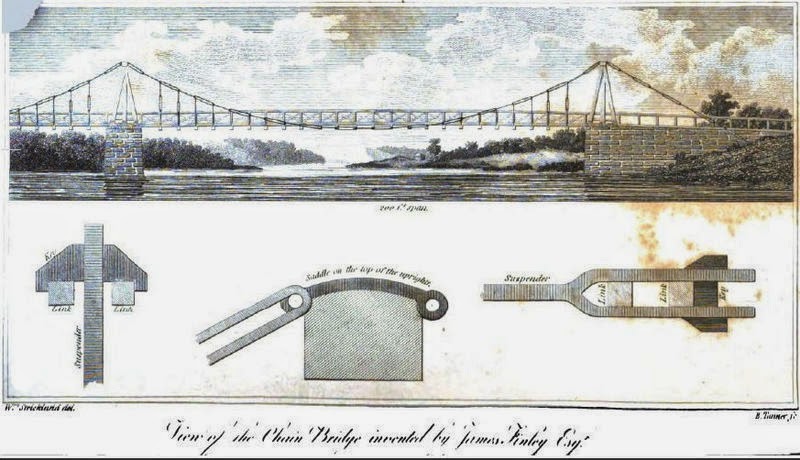
   Meanwhile, with a reference provided to me by Lannie Dietle, Alexander Hamilton wrote a letter to George Washington on November 3, 1794 from 'Cherry's Mill',(now Laurelville, straddling Bullskin and Mt. Pleasant townships at the bottom of the three mile hill), which states, "I have returned to this place from Union Town. A letter from Governor Lee which goes with this probably informs you of the plan of future operations-but lest it should not I shall briefly state it. The right wing is to take a position with its left towards Budds ferry & its right toward Greensburgh. The left wing is to be posted between the Youghagani & Monongalia." Hamilton's letter to Washington of September third indicates that one Caleb Mounts, son of Providence Mounts, (the man Mounts Creek is said to be named after), was clearly embroiled in this situation. This paragraph cited is very revealing as to the context, which states, "Caleb Mounts then a Captain since a Major of Militia stands charged before Isaac Meason and James Finley, Assistant Judges, by information upon Oath of Benjamin Wells, Collector of the Revenue and his Wife, with being of a party that broke into the House of the Said Collector sometime in April, 1793." We also discover Mounts was taken to Philadelphia and imprisoned for a time before the great pardon given by Washington to the rebels. It doesn't appear the infractions were held against him by most of the local people since he was promoted to a Major.

   The Federal troops also billeted, or quartered for a time in Youngstown, named after Alexander Young in 1815, at the Barrett Hotel, further up Rt. 982. As a curious aside, nearby Sugerbush Ridge carries the curious legend of a payroll cache of the Revolutionary-era that has, to this day, never been found. So, maybe we should go treasure hunting!


   It is fascinating to see the course taken by the units of the Army so near our region, and with the knowledge of the famous Secretary of State for the United States, Alexander Hamilton spending time embedded with the troops at Laurelville, basically between southeastern Westmoreland and northeast Fayette.
   Something must be said in Washington's favor, who should be considered a cautious man, he made certain he had received congressional approval in all things, quite unlike these modern times of Presidential 'Executive Orders'. He genuinely felt the need to make a display of mercy, that the new Republic was not an oppressor in the sense of a dictator or a King and did not enforce suppression of the citizens. Regardless, in upcoming trials the convicted, if they could be located, were referred to as 'malicious', 'wicked', and 'seditious' in what could be thought of as a taste of yellow journalism. Two were under death sentence, but were later pardoned as well. This had some effect on the local political power. Right or wrong, good or bad, the scene was engrained in the fabric of the towns and cities of southwestern Pennsylvania and thus the definition of treason was officially set for the congress and judiciary for the future of the country.

    You can read more of George Washington's thought's toward this time in history, as well as other important documents concerning him at this site of the University of Virginia here.

     It is probably surprising for most of us to read of the heavy turmoil the region was deeply involved in during the early years of it's riveting history. And no wonder.

     As material from the above monograph of the Dept. of the Interior clearly points out,

"The Federalist revolutionaries of 1776, now acting as conservatives, had taken the same position their British predecessors had, while the western rebels voiced the identical ideology and claims of self-interest that had been advanced by all segments of America in 1776."
 
    A very good point made.

   The Result:


   The dreaded excise tax, the subject of all this controversy and turmoil, was repealed in the next year.

   (some of the sources are The Philisophical Society and The Life of Albert Gallatin, 1943, and parts of History of Greene County, Pennsylvania. And also,  H.H. Brackenridge, 'Incidents of the Insurrection in the Western Parts of Pennsylvania in the Year 1794',John M'Culloch, Philadelphia; material also taken from, Libby, O. G. "Political Factions in Washington's Admninistration," NDQ: North Dakota Quarterly (1913)


   (Please let me know, if any errors are to found, I do make apologies and thank you for your patience. The material quoted is from sources believed by the writers to be genuine and factual. I take no other responsibility. Any mistakes should be incidental and will be glady and promptly corrected, if cited with proper reference as to authenticity). Thank you.
  

Thursday, May 22, 2014

Quick Note on Mt. Pleasant Historical Society:


 An Acknowledgement


    Without much thought, I simply, was planning to add this to the post on Mt. Pleasant. Was that from February, I believe?

   That is just what I did recently about a 'pleasant ' incident concerning the town with an experience I had:

 ' Late Note:

  In early May, I had the pleasure of meeting the Mt. Pleasant Mayor, Jerry Lucia, in his role as Fire Chief. I enjoyed the occasion and was honored to have a talk with him for about an hour. We discussed a lot of old local historical subjects. As an added bonus, I had the opportunity to explain to him of my regional website, thank you very much. I must say, he is a very well informed, and likeable man. It was a real highlight for me'.

    And that was the truth, too, of course.


    BUT, on second thought, I wished them and everyone, that in any way visits my blog, to know I so appreciate the recent acknowledgement from such a quality organization as this, that I am writing to you now. Things aren't always recognized in this way. The response was given on their Facebook Site, and yes, I felt it deserved a special corner. I actually went online there to see all the old stories and photos they have uploaded and the comment left with the added link was done before leaving as an afterthought.

    I had originally included the link on March 20. A response came on May 17 that my Mt. Pleasant Post was "interesting and informative." Well, I would openly admit it wasn't exactly expected at that late a date, though it probably took a while for the dots to be connected. Is this an example of the saying, some 'good things come to those that wait' ? That is two compliments, ladies and gents, if anyone is bothering to count !

    It's right here, for those that want to see it themselves. You may of just stumbled across it, but, hey, I'm glad that you did. They have my gratitude, my * thanks.*

     ( Update- 5-26-14: Apparently, the comment left about my blog has been removed. Sorry about that, if it isn't available now. Still, I do want to mention that Rick Meason, descendent of Isaac Meason, will be speaking at the next Bullskin Historical Society Meeting next month- Ed.)

    Not to make too big a deal out of this, you know, I only wanted it understood, it does mean a lot, coming from the source. Call me kind of old fashioned, I hardly think of myself in that way, still, in a larger context I care about the towns and townships here, and I'm certainly not alone. To an extent, I like to think I have some effect relecting my commitment through the articles I write, sometimes late into the night, that are published here. This has developed into my own niche and I do like to see 'Fayette/Westmoreland Forgotten History' get some attention when it deserves it. We gain if we can do something, anything, to bolster each other in some fashion, no matter how insignificant it may look to others. This kind of thing isn't likely to be taken for granted here! I would hate to be accused of that.

   Keeping Perspective


   Our hearts go out to other people with their problems and worries, and to envision the realities facing our illustrious ancestors, as well. What were their expectations for the future? Their fears and way of life, their past times, personal grievances, and achievements. Things were never perfect, then or now, near or far from home, Concerns for the underprivileged and under appreciated, and maybe the lesser known, and our military personnel, are all too real. Nurturing our old towns, cities and rural places, enjoying the grand scenery of the seasons, (yes, in winter, too), and wonderful, though often lost and disused places, and the 'found' ones also!

   Though, it's just my perspective, now and then I find myself perplexed and dismayed, as many are, by the problems and challenges we all face. Inflation, taxes, interest rates, politics; this stuff can pile up on people and seem overwhelming without an anchor to hold onto. We know there is nothing really new about it, yet in this age it is more complicated. In the midst of better preserving our freedoms, cultures and American heritage and following the direction the country is going and how to survive in today's world, are things we deal with a lot every year and every day. Our jobs, marriage's, children and relationships. We simply must do as best we can, with what we have and our chins held high, come what may. This is what are ancestors were faced with too. The blog does get my adrenaline going, just to be able to relate something positive and, hopefully, something meaningful, to as many as is possible. Corny as it sounds, we love this place in our own way. That also makes you 'quality' in my humble little book. And, God bless that attitude. And try to sympathize a bit with those that don't have it, or don't get it. I realize that might sound like an old episode of 'Green Acres', with Oliver giving his patriotic speech and no one could figure out where the music was coming from, remember that? Ha. Well, I do feel this way in my bones and no apologies are forthcoming folks.

    Your input is the only guarantee that I stay on track and don't neglect a post on your area, OK? So please, keep that in mind.

    As you could probably guess, I do check out the Historical Societies and their websites, from time to time. Well, it would be amiss, if I didn't. Along with some other great PA sites to be favored and savored, these organization's are the life blood of an historic community.

    So I thought it just meaningful enough to relate a little more closely.

    I think it's about high time to finally add a 'gadget' for a list of good historical places for readers to search for more in depth information about their favorite local areas, as well as statewide. So, it may take a while. Still, I'll start adding that some time soon.

    Alright, don't fret, let me get back into writing one of my next posts which will probably be on the infamous 'Whiskey Insurrection' of the late 1700's and how it affected the local populace and the surrounding counties of southwestern Pennsylvania, so...please stay tuned. With your support and encouragement we all win. And someone like 'Nancy', (you know who you are), is proof that a little help is a big thing.

    THANKS


Monday, May 19, 2014

The Meeting of The Townships

  With Introduction and Supplemental Research

                                  by Lannie Dietle
                                  
   All paragraphs formatted in italics are research written exclusively by Lannie Dietle, author of 'In Search of The Turkey Foot Road' and are not, necessarily directly related to other sections of this post. All other paragraphs written in regular typeface are by 'Histbuffer', Alan Wilson, and are separate research and commentary. A combination of both are here presented as seamlessly as thought possible for your edification.


                                  IRON BRIDGE


    The populated place known as Iron Bridge where 'Old 119' crosses Jacob's Creek, at Latitude 40.1126 degrees Longitude -79.553186 degrees. In the earliest contemporaneous reference to the place named Iron Bridge that I have seen is on page 243 of the 1878 book "Annual Report of the Secretary of Internal Affairs". The name may be a reference to an Iron bridge that was built across Jacobs Creek in 1863, and was still in service in 1904. Iron Bridge is also famous for being the site of the first iron suspension bridge in the United States. This innovative bridge was built in 1801 near the early residence of the well known iron maker Isaac Meason, on what was then called "the great road leading from Uniontown to Greensburg".

   In regard to Isaac Meason, page 488 of Ellis' 1882 book "History of Fayette County, Pennsylvania" states "The latter first lived near the chain bridge, in Tyrone township, removing to Mt. Braddock at an early day." Meason's circa 1801 Mount Vernon iron furnace is located 3.6 miles away on modern roads, at Latitude 40.095833 degrees, Longitude - 79.510556 degrees. This may be where the iron for the chain bridge came from.


chain bridge at falls of Schuylkill, courtesy of Wiki Commons

     *I realize holding people's attention in a blog format is a unique form of challenge. Please hang in there and follow along with us here. I think you will be a more satisfied fan of local and regional history and become better informed if you do.*

Bridging the Townships and the Counties


    Though there are no known pictures of the bridges of this area, as stated elsewhere, and there are no known remnants of the old bridges, this was an historic place. A meeting takes place of the townships of Bullskin, Upper Tyrone, and close to Mount Pleasant township; furthermore, the Counties of Westmoreland and Fayette come together and are separated here. By all means, the hamlet held the position as having an important bridge and area of roadway. Near the turn of the nineteenth century, it experienced the comings and goings of the trolley, or street cars, and the whistling echoes of the bustling locomotives, in their heyday.

   Ii is known there were also prosperous saw mills near here. The Pershing's had, at least one, while George Hogg and a relative of his, one 'A. Hogg', kept a saw and grist mill, nearby. Hoggs eventually found residence further into Bullskin, as did the influential Pershing's, who eventually moved further into Hammondville and to Bridgeport, (referenced in "History of Fayette County, Pennsylvania"of Franklin Ellis). The residence near Iron Bridge that George Hogg kept a small ways northeast, near Jacob's Creek, was aptly named 'Hoggs' on some old maps. It is very thick with brush and marshy swampland, being very difficult to traverse. That having been said, traces of the old saw mill would be hard to locate now. Apparently, as stated in Ellis' "The History of Fayette County, Pennsylvania" pg. 496, George Hogg acquired Mt. Vernon Furnace off of Isaac Meason as well, though, to my knowledge, the information on this transaction hasn't all been successfully tracked down thoroughly.


1918 topographical map

  A Few Memories


    To add some local flavor to this post, when we were kids we would walk down the railroad tracks, a half mile west of here, on the Pennsylvania Railroad side, toward the old "Y Pond" and fish for bass and blue gills and the occasional sturgeon, or catfish. There were some large turtles that drifted around us, which we watched rather warily. It is doubtful if fishing is allowed here anymore.

    When you are sure of "No Trespassing"areas, they must need be respected, though they sure weren't nearly as prevalent in the old days. The pond looks somehow smaller now, for some reason, with the bicyclers zipping past the trail; the activity is still rather new to me, and getting use to the removal of the PA Railroad tracks. Just to make mention, there was muskrat and coon trapping to be had around here, too.


 My late uncle Harold, who was an avid woodsman, known all around as 'Hack', (like the baseball player from the early part of the 20th Century), lived for years right up a hundred yards or so to the east at the little hamlet, with his last wife, Dorothy who survives him and has since moved near the Senior Center.

 He could probably tell me a few good anecdotes and stories, which he had many of, and could likely of filled me in about the place, but, sadly, this is no longer an option. There is a little pull off spot on the south side of Jacob's Creek by the street car tracks that was used as a kind of "make out" place, among other things, twenty five to forty years ago. Maybe that is still true and I hope revealing this doesn't ruin it for anyone. Alright, enough said there.


 A Road By Any Other Name

   
   Lannie Dietle brought up a valid point in an e-mail containing his main research, which would of gone unnoticed. Whether or not locals are aware of this or not, he heard said there were issues with the road name here of  "Old 119".

  The term "old 119" has long been in general circulation on some street addresses and most road maps. Where did the use originate? Since many of us near here were children, it was, and is, also known, simply, as the 'Mt. Pleasant Road', sometimes referred to as the 'Connellsville, Mt. Pleasant Road'. Also, locally the route is commonly referred to as 'the Pennsville Road'. From what is still in use of the southern part, from Greenridge Cemetery, it is signed as "Richey Road". Northward, on modern maps, it is listed as "1027". Recently, the only signs I, myself noticed, starting from where the road joins Rt. 819 on to Mt. Pleasant back to the Richey Road area, were the signs for Prittstown, (where Braddock's army crossed through there); the small village of Crossroads, and further south, the village of Pennsville. To quote Ellis' 1882 book, "The History of Fayette County, Pennsylvania" again on page 496, we have "the Mt. Pleasant Road", and a few pages back, it has the outdated moniker of the "old State road".

  Not to be overly weighed down in details, but interestingly enough, it is documented as the route from Scottdale through the Everson Valley, twice marked as "119" on a 1958 Road Map. It crossed over and travelled on into, and inversely, from Connellsville on various maps. Checking into this more in a few locations on the internet, the "old 119" route went from Everson to Scottdale, then through Water Street, to Alverton, and further north to Old Bethany thereby, on to Rt. 31 and then beyond to New Stanton. The road past the old Sony, now RIDC Westmoreland complex, is  known locally as "old 119".

Rt. 119 itself was created in 1926. In 1966, (according to research included here on Wikipedia), the Rt. 119 'four lane', or expressway, was completed between Pennsville and Rt. 819.

  To be exact, this old route traversed this area of Upper Tyrone and East Huntingdon, quoting, from the website http://www.pahighways.com/us/US119.html, which states the following:

 "For the most part, the designation followed the current path with some exceptions. In Pennsville, the route changed to Brown Street to enter Scottdale. North of that borough it followed Water Street to Alverton and then Old Bethany Road to Ruffs Dale. From there it followed Buttermore Avenue to Hunker and New Stanton where it picked up the current alignment".

Here's part of the map showing 119 in Upper Tyrone and Bullskin Townships:


old 119 on this 1958 road map


   Another issue would be, did West, East, and/or South Pennsville Street's continue on into what is today, Richey Road? It is again, indeed apparent, something to this effect was the case, as on other maps, the western end of "Longanecker Road" did connect here before the coming of the 119 expressway.

  Well, it certainly appears that the "Mt. Pleasant Road", the "old state road" and "1027" would all be acceptable as proper names in the past. The term, "Old 119" seems unusual. Any other information that can be provided, especially from those familiar with living here, would be appreciated.

   Hopefully, this still goes a fair way toward clearing the matter up.

    The 1941 Pennsylvania's Department of Highways "General Highway Map" of Fayette County identifies a different road as "old 119" as Route '1027'. Whatever the name we call the road today, back when Finley built his chain bridge in 1801, it served as the "great road leading from Uniontown to Greensburg."

  The old trolley

    Here are a few photos taken earlier this year.

   As you can see, there isn't much to differentiate the bridge now as if it were ever anything very unique, but hardly more than 25 years ago, the structure was quite different. The trains and trolleys passed here regularly in the past. The Coal and Coke Trail has replaced the old PA Railroad tracks and the B & O tracks are on the southern side. There had been speculation the late 1880's bridge might of still been in place until recently, about the late 70's or so, though this is unconfirmed. It use to be possible to see a few pylons in the water 20-30 feet west of the bridge before gathering a lot of debris and brush, becoming well hidden. Some people use to assume they were from the old truss bridge, though, it is probable they were from the trestle where the street car once crossed the creek. To give more perspective, I have a photo of where the trolley crossed back over Jacob's Creek and bridged the two counties again, a few hundred yards further west toward the Overton Way area.


Coal and Coke Trail looking west

old trolley bridge abutment on the Westmoreland side
    We walked from here early in the morning in late April this year, passed by various bikers and hikers, capturing another photo of the old street car track itself:

old street car track east toward Iron Bridge


                         The modern 'Iron' Bridge


'old 119', or the Mt. Pleasant Road, looking north

     Below are the B&O railroad tracks over Jacob's Creek as it wends its way from the south near McClure on toward the northeast:

railroad tracks heading toward Bridgeport

                  
street car track east toward Dexter under the 119 overpass


 The "Great Swamp", "Braddock's Road" and "Turkey Foot Road"


   Iron Bridge was the basic origin of the northwestern area once known as "The Great Swamp" in Bullskin, famously bivouacked by Braddock and his men further down Greenlick Run, a tributary emptying into Jacob's creek after running through at the "New" Dam, Jacob's Creek Project, a few miles from the east. This was immediately after the army marched here from Stewart's Crossing in Connellsville, using the Narrow's Road and generally holding to the township line between Upper Tyrone and Bullskin before veering to the east in Prittstown and from there to Hammonsville and on toward Mount Pleasant.

   We should also briefly mention the "Turkey Foot Road", a subject that Lannie Dietle has written about in an excellent book with a new edition coming out soon. In early February he penned a detailed guest article here on this blog where you will find more information and links.

    Very briefly, this was a particular ancient road, following older Indian trails.  Providence Mount's led the way in turning it into a pack road in the late 1700's, bypassing the swampy terrain of the Iron Bridge/Jacob's Creek area which we are noting, when there was no known bridge there. Instead, those intrepid men guided the clearing of it approximately a mile to the southwest over Walnut Hill, and then to the north down the Dexter Road near Kingview and on northeast to Mt. Pleasant, consequently joining the basic route of the Braddock Road. I hope to have more information on the Dexter area and a forthcoming West Overton post, fairly soon.

   There is a local tradition in the past that Captain Jacob's, the Delaware Chief who met his death at Kittanning, maintained a log cabin hereabouts.

   When we were children, there were ruins of old buildings near the creek on the Bullskin side, possibly of an old feed, or, flour mill. Any remnants would seem to be long gone now. The Bullskin Historical Society might have something in their archives about it. I may be able to upload a photo soon, courtesy of the Society's President, Kim Brown.

     Here it is, thanks to Gilbert and Kim:


   Further Research

  
   Now, getting back to Lannie Dietle's research with a good description of the way the oldest bridge here was set up:

 The May 22, 1802 issue of Greensburg's "The Farmer's Register" includes an article titled "Iron Bridge" which states:
   The Bridge which Judge Finely (near this place) had undertaken to erect across Jacob's creek, at the expense of Fayette and Westmoreland counties, near Judge Mason's * on the great road leading from Uniontown to Greensburg, is now completed. Its construction is on principles entirely new, and is perhaps the only one of the kind in the world. It is soley supported by two iron chains, extended over four piers, 14 feet higher than the bridge, fastened in the ground at the ends, describing a curve line, touching the level of the bridge in the center. The first tier of joists are hung to the chains by iron pendants or stirrups of different lengths, so as to form a level of the whole. The bridge is of 70 feet span and 13 feet wide; the chains are of an inch square bar, in links from five to ten feet long; but so that there is a joint where each pendant must bear. The projector has made many experiments to ascertain the real strength of iron, and asserts that an inch square bar of tolerable iron in this position will bear between 30 and 40 tons; and, of course, less than one-eighth part of the iron employed in this bridge would be sufficient to bear the net weight thereof, being about 12 or 13 tons.

This passage shows that Finley had engineering experience. He performed tensile tests on the iron to determine its tensile strength, and then performed engineering calculations to determine that the bridge design had an adequate safety factor.

Page 415 of George Dallas Albert's 1882 book "History of the count of Westmoreland County, Pennsylvania" quoted 1801 Uniontown records about coordinating construction of the chain bridge with Westmoreland County, and states "This bridge over Jacobs Creek, on the turnpike ran between Connellsville and Mount Pleasant, was the first suspension bridge erected in the state of Pennsylvania."
  
     Although no image of Finely's bridge across Jacob's Creek is known to exist, there are surviving images of other bridges that were based on Finley's design. One such bridge is illustrated in the circa 1820 drawing of Cumberland that is included with this article.


    Some more history of Judge James Finely and the Jacob's Creek Bridge:


   According to Ryan Gordon of Penn State University, referenced on Wikipedia, James Finley was born in Ireland in 1756 to Scotch Irish parents who had immigrated to the United States...In the years prior to 1784, Finley moved to Fayette County near to Uniontown, to farm. It is also stated that "In 1784, Finley was elected justice of the peace. Five years later, Finley was elected as county commissioner, and served two years in the state House of Representatives, starting in 1790. 1793 saw the now successful Finley named to the Pennsylvania State Senate. Amid Finley’s multiple elections, he was also named the associate judge for Fayette County—a position he held for the rest of his life".  Finely went on to describe the design in 1810 in the political magazine of Oliver Oldschool,  in "The Port Folio" :
'The bridge is solely supported by two iron chains, one on each side, the ends being well secured in the ground, and the chains raised over piers of a sufficient height erected on the abutments at each side, extended so slack as to describe a curve, so that the two middle joists of the lower tier may rest on the chains'.
   The reasons for its demolition in 1833 remain somewhat perplexing unless there was fairly severe damage done to it, for it's construction, by all accounts, was superb. It is also known that he patented the bridge design in 1808, though, it was later said to of been lost in a fire. And, as Lannie Dietle shows, his bridge design was certainly used in many places, though there was said to be a possible flaw in the cables stabilizing the joists to it. So, between the damage and the design, that should surely have something to do with explaining why it was dismantled for a more mundane wooden bridge before the construction of an iron truss bridge. This is then debatable whether his actual design was properly adhered to or not, leaving the argument undecided. As stated, it was also said to of been damaged and rebuilt in 1825, so there could be speculation as to whether the rebuilding had adhered exactly to his original plans.

 Finley is also credited with designing and constructing a chain suspension bridge across Dunlap's Creek in Brownsville, Pennsylvania, in 1809. In 1820, however, the bridge collapsed under a heavy snow combined with the loads from a six-horse wagon team.

  More about the history of the chain suspension bridges in "Progressive Pennsylvania", by James Moore Swank, at Google Books.


   Finley describes his bridge

 The June 1810 issue of "The Port Folio" contains Finley's detailed technical description of his bridge design, in the article, Finely also states:

  In the year 1801 I erected the first bridge on this construction over Jacob's Creek, on a contract with Fayette and Westmoreland counties, to build a bridge of seventy feet span, twelve and a half feet wide, and warrant it for fifty years (all but the flooring) for the consideration of six hundred dollars. Nothing further of this kind was attempted for six years. The exclusive right secured in the year 1808. There are eight of these bridges erected now; the largest of which is that at the Falls of Schuylkill, 306 feet span, aided by an intermediate pier; the passage eighteen feet wide, supported by two chains of inch and a half square bar. There is also one at Cumberland (Maryland) supported by two chains of inch and a quarter bar, span 130, width 15 feet.

Replacement Bridges

 The November 10, 1902 issue of Philadelphia's "The Bulletin" has an article titled "A Chain Bridge a Hundred Years Ago in Western Pennsylvania" that quotes the above 1802 article, and then states that "The Jacob's creek chain bridge was torn down several years ago and an iron truss bridge was erected in its stead." The April 10, 1904 issue of "The Bulletin of the American Iron and Steel Association" clarifies the date the chain bridge was torn down, stating:
  "It... was in use until 1833, and in August of that year the Commissioners agreed to build a wooden bridge in place of the old suspension bridge, and thus ended the life of the first chain suspension bridge in the country, and it outlived as far as known all the bridges later built on the patent. At or near the site to-day is an iron truss bridge, built in 1863."

 This is harmonious with page 250 of Ellis's 1882 book, which reports that the Fayette County commissioners' records indicate that the chain bridge was initially replaced by a wooden bridge.

Aug. 5, 1833-Commissioners agreed with George Marietta to build a new wooden bridge over Jacob's Creek, in place of the old Finley chain suspension bridge, for $267. The iron of the old bridge sold to Nathaniel Mitchel for $90.

Identifying the location of the chain bridge

  The location of the "Chain Bridge" on the 1817 Melish Whiteside map of Fayette County is an excellent match to the location of "Iron Bridge" on a 1902 topographical map. By comparing an 1872 map to satellite imagery, it is possible to determine that the path of "Old 119" was much the same as is today. This means that the chain bridge and the iron truss bridge were located about where the modern bridge is situated on "Old 119" at the place known as Iron Bridge.

 (Sayenga, Donald. “James Finley.” Structure. Nov. 2008. NCSEA. 21 June 2011 www. structurmag.org, Strickland, William. “View of the Chain Bridge Invented by James Finley. Port Folio. June 1810).


 Postscript


    I would like to finish this post appropriately enough, by commending Lannie Dietle for the time spent on his input, basic framework and encouragement. Without his correspondence, it is most unlikely the article would of been undertaken by me.

    In passing, his particular family background is to be noted, and the research they have accomplished, is really unsurpassed. Though, he may not completely realize just how much influence he has garnered with this blog, I am proud of, and have been able to enjoy, what collaboration we have had together. Toward the area of his involvement, and the times he has helped to steer me in the right direction, for example, with my genealogy, it is sincerely appreciated, and would be that much poorer without his influence.
  
    Now, remember folks - any ideas, stories, or comments are welcomed!

Sunday, May 11, 2014

Relatives and Ancestors Link

  There has been a recent problem with the link to that post.

  This link should work fine in the mean time:

  Relatives and Ancestors

Tuesday, May 6, 2014

Dunbar City

  DUNBAR

  Looking almost like something out of the Wild West with the unusual shaped architectural buildings, Dunbar, in Fayette County, PA, has seen a good share of excitement in its own way. It may see more once again; so please read on down.

 Once called 'Frogtown', an interesting name, and yet later known as Dunbar City.

                            
courtesy of Google Maps


    The town, and borough, began out of early settlers movements from the south, many from Maryland and the eastern parts of Pennsylvania in the late 1700's, although it didn't officially become a town, until almost 100 years later in 1883 when it was incorporated.
  This is the town and borough after which it received its name from Colonel Thomas Dunbar, of the 48th Irish Regiment who was in charge of the support column for Braddock's failed campaign in 1755 during the French and Indian War. His camp was at Jumonville nearby. He retreated back to Ft. Cumberland on July 22. Dunbar Creek flows through to the west of the town crossed by the Dunbar Bridge, appropriately enough.


coming into Dunbar
   
     The Union Furnace was started up by Isaac Meason, about three hundred yards above where the Dunbar Furnace stood. The ironmaster, as he should be called, accomplished this in 1791. He had other forges here and a rolling mill. In what is Bullskin Township, today he also was busy early on with the Mt. Vernon iron ore furnace which you can see more about here. He died n 1819 and his son Isaac, carried on the business. This was defintely difficult work to of taken part in.

    The first Justices of he Peace had jurisdiction over Bullskin and Tyrone. The earliest of record is Jacob Stewart in 1787.  Connellsville Street has been the Main Street for a very long time. In 1844 Jones and Miller permanently changed the name to Dunbar Furnace. A few more times, it changed hands too, as Mr. Edmund Pechin became the head of the works. The enormous amount of manufacturing here is hard to imagine, as this was a very bustling borough. The 'Dunbar Community Fest' which is held the last Saturday in September, continues the tradition of pride in it's 131st year of official acknowledgement as a borough of Fayette County. With the Knights of Pythias and The Knights of the Golden Eagle, there were some interesting organizations. This was all part of what is named the Connellsville Coke Region and the rich quality of material inherent here led to the unprecedented manufacture of nearly 20,000 coke ovens in Fayette County alone. There were still some to be seen out on Ranch Road according to the Fay-West Discussion Boards, but the story is they are reclaimed, in other words, destroyed. Have they all been gotten rid off?

   Train service here began in the mid 1800's. There was even a funeral held for, can you even guess? The last trolley that served here! That is called taking the loss of an important element of your community very seriously, and you can bet that it was a real change in the way of living in those times. In after times, most owned at least one car or truck to get to where they needed to go. They also weathered some bad floods here, mainly in the early twentieth century, but also as late as 1972.


   There has been various businesses here over the years, including brick works, a sand plant, woolen mills, glass works, quarries, the coke works and, of course, the Dunbar Furnace which was working with a prodigious amount of iron when in it's heyday, and the Company itself dealt in coal and bluestone. The Dunbar Fire Brick and United Fire Brick companies started in 1890 and 1907, respectively. with the Uniondale, Watt and Ferguson ovens in operation. There is also the 'Irishtown' section where many of the citizens worked in the local ore and coal mines. There are those sites that can still be seen if you look closely in the corners of the borough and town. Some of the ovens were said to be of a unique byproduct variety which were first in production. At the time this post began being written, not too long ago, I was looking out the window at the snow flakes and it was not too inviting, but I did want to finally get some photos to upload now that it is looking like spring! If you click on other posts on the blog you might notice the snows of last winter will show themselves. Here, for example.

   But, not here:


old First National Bank

      The 1716 trolley ran through Connellsville Street here and to the left of the old bank was where the B&O Railroad Station use to be by the tracks.


Settlers and Indians

  
   Some of the prominent people that settled here, though long passed away would include:
  John Rodgers, John Christy, Jacob Leet, Thomas Jones, and John Sherrard. If there are any descendants that read this, be sure to put in a comment. Everyone would be interested to hear some of your ancestry.

    There are traditions of Indian burial mounds, as at Fort Hill, (Farm), which use to have the Coke Works of that name when it was the A. J. Hill farm. I'll be honest with you, one of the hardest things to research is in finding concrete facts concerning the Indian presence in local areas. Still, curious relics were said to of been found here. According to one Alexander Martin, there was also a crude graveyard with unmarked stones at the yard of Meason's Union Furnace where they simply buried people when they died of whatever was terminal. There was said to be a Liberty Pole at this furnace during the Whiskey Insurrection that read 'Liberty and No Excise'.

    A man called "Captain Cook", a recluse who lived and died in a cave by Cow Rocks, was said to of came from England enchanted by the stories of Braddock's campaign and spent much of his time lingering around the areas he was known to of visited or marched through.


   Inquiries about all the buildings and bygone attractions can be made to the Dunbar Historical Society, started in 1995. I freely would admit, they are more informed than I, while being very cooperative, possessing many old photos and articles of interest. It is open on Saturdays, too. Ask about the Sheepskin Trail, two miles long which connects up from the Greater Allegheny Passage not far from the Borough as the first part is there of the remaining 32 mile length. It is near adjacent to it. They have the nice mural done by Gerald Metzger also. You can discover from these conscientious locals much about the area's history, such as, the Dunbar House, (torn down), from 1897-1917; the Post Office which began in 1889 on Church Street used by the Historical Society, and the Wesley Methodist and Presbyterian churches. The old B&O is not but, the PA R x R Station, and some buildings may still be extant; and the Bryson home with coke oven is very much here. Look for them on Facebook!


  Though the PA Railroad Station is long gone, there is the Coke Oven Park, a unique, rebuilt beehive oven on display from new material of the old Shamrock & Shoaf Works, on New Salem Road. The Society has some excellent graphics and this piece of work has received over 25,000 visits! There is a good You Tube video of the construction of the coke oven above, courtesy of "Stuff That's Gone". And maybe, last, but not least, a person traveling around the olden town is never far from the East and the West, Railroad Streets.
   By the way, Shady Grove was the old West Penn Railway's Trolley Park here.

    A good Fayette County site with a lot of varied info is here and worth having a cup of coffee or tea and checking out. Locally there is the Dunbar Historical Society, as stated previously.

   Note:

   I may need to make mention, I was very excited to of received a very kind e-mail from Donna Myers of the Dunbar Historical Society, acknowledging the article here and that they approve of the quality. It means a lot to me. Very nice of her and I just want to give a special  *Thank You for that!*

    I still aim to get a photo to upload of the derelict restaurant by the creek that was built from the old bluestone quarry. I heard there was once a mill here. That'll have to be on the next trip over there. The name was the 'Rippling Waters' and it closed about 1970.

    There is an interesting anecdote I have here. One of my relatives was trout fishing years ago, and observed an old man that was fishing near the big boulder behind the restaurant and a copperhead slunk out from under it and struck at the ankle of his hip boot and went back under the rock. Well, he was so intent on his purpose that he never noticed the attempt by the snake to bite him! He just went on fishing...

    UPDATE: I got a photo, here it is


bluestone of the Rippling Waters restaurant


the old abandoned gun powder mill


   There's 'No Trespassing' signs all around here, so this was
     the best I could do


the powder mill from the disused tracks

    The town has the old Swearingen building, the Grocer and dry goods store, built in 1901 or 1902. Also, nearby, to the southwest, the Hill Farm and Coke Works, Tr. 703, there are a few ovens still remaining here. I'm not sure of the condition. This began in 1872 , some say, as early as 1865. There were many coal companies served by a private railroad associated with the Dunbar Iron Co. and mostly the Dunbar Furnace Co. There was a teriffic explosion here in 1890 on June 16, that killed 31 workers. Apparently, they were tragically suffocated, according to the 'Warren Ledger'.


   The Speers Mill was here from back in 1815 on Dunbar Creek, and was once said to have had a distillery there. The Eureka Brick Works were a few miles southwest of the town. Originally named 'Mount Braddock', this was a large operation. 

   On the positive side of things, there are some new job opportunities to open up for this area real soon, by way of the Fay-Penn Economic Development Council. Here's an article from the Tribune about it. It would be good news to another place in Fayette and Westmoreland that has seen better days.

   Cleaner waters


   There have been issues between the fly and bait fishermen and modern mining over the years. I have relatives who work along with the PA Game Commission as they help stocking trout, especially on Laurel Hill Creek, so there is a kernel of wisdom of which I write.

   Chestnut Ridge Trout Unlimited's Eugene Gordon's website for further info. Their involved in fighting hydraulic 'fracking' of open pit mining and some damage also from mountaintop mining. Especially, longwall mining operations by Consol, Atlas and Cabot Energy, for methane gas production, supposed offending parties. This compounded with the burning, or flaring of coal 'fly ash' said to be improperly regulated by the EPA, (considered reusable by some), with toxins from diesel fuel used, including known carcinogens.To be fair, though the EPA has been known to reach settlements from lawsuits dictated by the public concern. I mention this subject as we would hardly want to see the local areas decay as they did since the mining days when the place was described in terms of many red fiery lights and gray smoke across the bleak horizon, an after effect of the pollution some of the industry brought with it. Let's keep our trout fishing from being a forgotten thing of the past. This has been said to be a danger to the ecology of fish, their diet, and the drinking water, with possible neurological, dermatological and gastrointestinal symptoms experienced as health problems. This is claimed by those that live close to these wells and mines, as reported by Reuters news agency toward complaints filed by the PA. Fish and Boating Commission, also. This is through the processes sometimes overlooked, maybe too conveniently, of diverting the water flow according to the 'Center For Public Integrity'. This took place in another way, with the dredging of streams like Mount's Creek passing north through Bullskin Township, causing much damage to the habitat of the fish population there. Caution surely should be the keyword when it comes to the health of animals and our fellow citizens, do you agree?

  There were at least four of these dams functioning here:

remnant of old Dunbar dam

    The Dunbar Creek Project, run by Gary Sherwin, are doing what they can along with help by the Dunbar Sportsman's Club, headed by John Maddas, President, (724-277-4258). about the pollution of many streams in the area, especially from higher places like Glade Run. You see, the acid run-off is an ongoing problem from the coal and coke days and the strip mining done here. So, the Trout Unlimited Chapter of the CRTU, has made inroads in efforts to try to deal with radioactivity as well, with the work of Eugene Gordon. This involves the controversial 'Endangered Species Act.' Many feel this is to be commended, though there are some complaints with coal mining, especially the Marcellus Shale in a larger context. According to them, the Yough is not immune to run off by any polluted tributaries. Well, we all want to keep the waters clean and healthy.
  
 Local directions to Dunbar, located southwest of Connellsville, from Rt. 119 to State route 1053, and with the Arch Bridge Road from West Crawford Avenue. Also, Furnace Hill Road from the south will get you here.

 Remember the 'Pechin's' restaurant and grocery store formed from an old train depot? The place sure was popular when we use to shop there every two weeks as a kid, with my mother and grandmother in the 60's and 70's. You could get a little of everything there without paying too much. It has been transferred to the old Laurel Mall location and still has a beer distributor and sporting goods.

  Will be back soon with another article on our lost and forgotten history!
  

Contact Form

Name

Email *

Message *